Sonar boat Apache 4

TitleApache 4
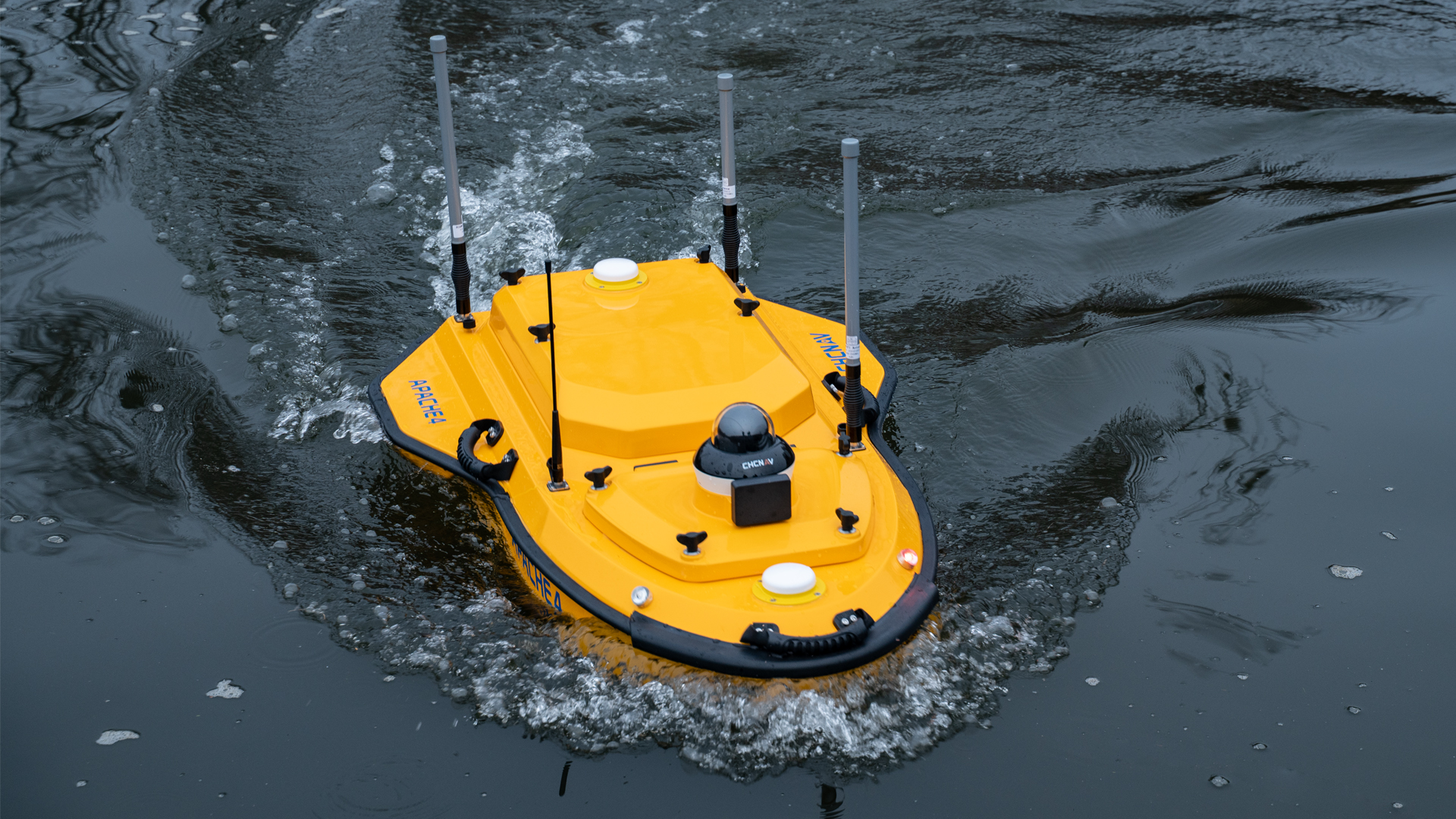
The Apache 4 sonar boat from CHCNAV is a state-of-the-art unmanned surface vehicle (USV) for precise hydrological and hydrographic measurements in rivers, lakes, or coastal areas. With its sophisticated sensor technology and reliable autonomous navigation, the system simplifies the recording of currents, water depth, and discharge, even under difficult environmental conditions.
TitleWhat makes Apache 4 so special?
The Apache 4 combines robust technology with versatile measurement capabilities on a compact, transportable platform.
It features precise navigation, integrated sensors, and broad connectivity to hydrological measurement systems. The system remains stable and reliable even in varying currents and turbulent conditions.
TitlePrecise positioning via GNSS and IMU
For precise positioning and location determination, Apache 4 combines a GNSS receiver system with an inertial measurement unit (IMU). This sensor fusion provides reliable position data even during temporary GNSS disruptions (e.g. under bridges). In addition, vehicle movement is compensated for, which increases the accuracy of the measurement data.
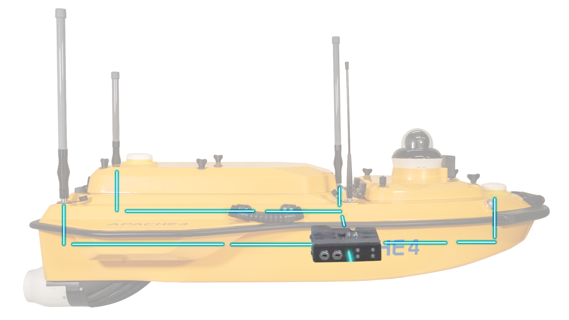
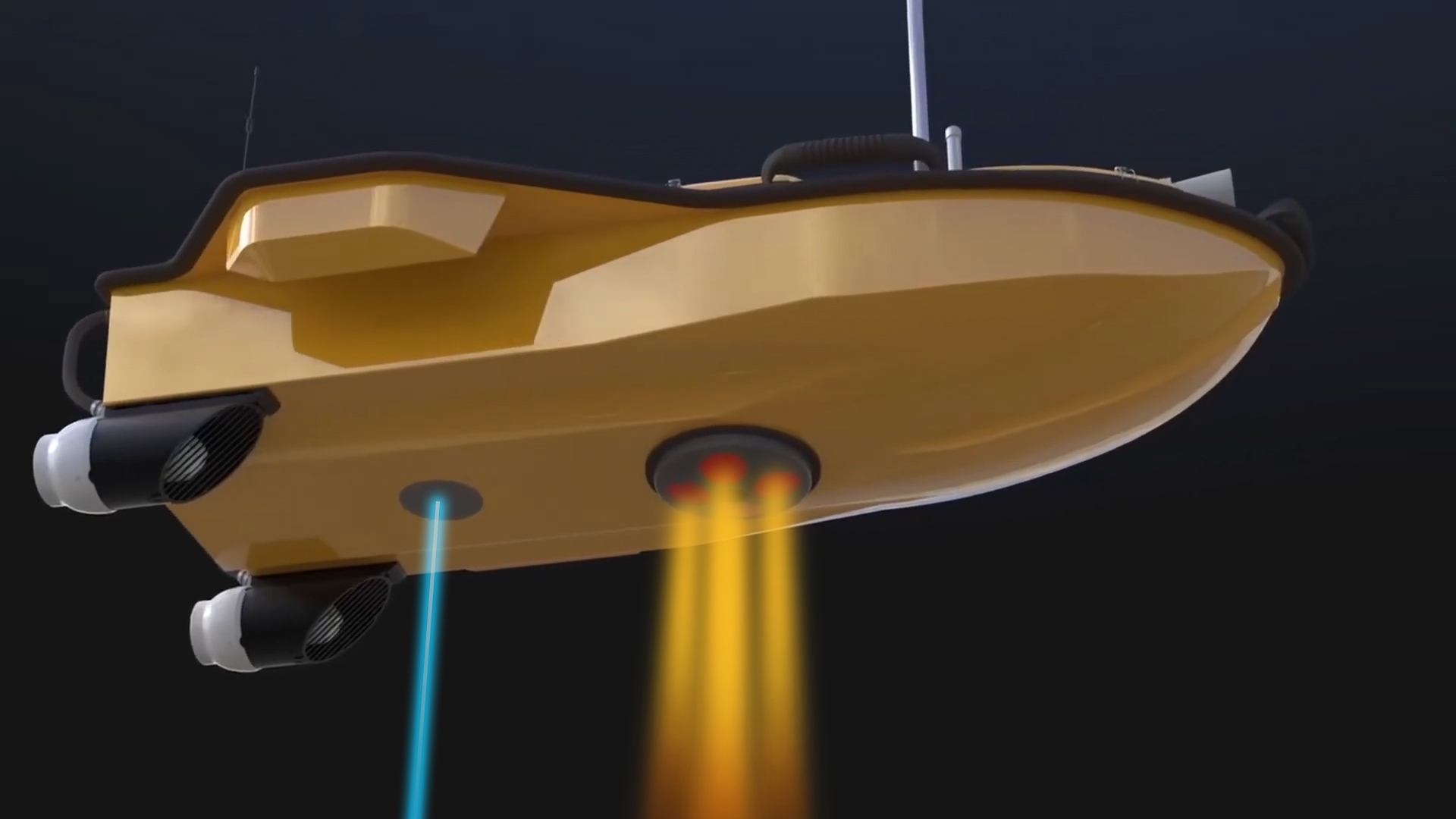
TitleBuilt-in single beam echo sounder & compatibility with common ADCP systems
The Apache 4 has an integrated single-beam echo sounder that records depth profiles of the water and supplements ADCP measurements, resulting in complete hydrometric cross-section data. In addition, the UPS is compatible with common ADCP sensors (e.g., M9, RTDP 1200, RiverPro, RiverRay); power supply, data interfaces, and communication are fully designed for sensor integration.
TitleHow does the sonar boat work?
The Apache 4 is typically programmed in advance with mission parameters (e.g., profile lines, measurement speed). The vehicle then autonomously follows the planned routes while collecting flow and depth data, which is either transmitted in real time or stored.
Adaptive navigation ensures that the measurement track is kept stable and that disturbances caused by currents or waves are compensated for.
TitleAreas of application
Flood risk assessment and hydrological models
Recording of flow and discharge parameters for risk assessment.
Sediment and morphology studies
Documentation of bed changes and sediment transport.
Monitoring measurements
Dams and reservoirs.
Flow analyses in port, coastal, and river areas
Support with infrastructure planning and operation.
River discharge measurements for monitoring and management
Continuous data collection for long-term studies.
Better advice as a user
If you are interested in our offer or would like to learn more about the CHCNAV Apache 4, then call us today and arrange a free and non-binding consultation appointment for you. We will answer all your questions. As a dealer and at the same time a user, we are well positioned to assist you even after the purchase.