Mosaic
TitlePrecision. Mobility. Diversity.
Mosaic stands for innovative 360° and mobile mapping technologies that support professional users in the fields of surveying, mapping, infrastructure inspection, asset management and VFX. With a clear focus on precision, user-friendliness and versatility, Mosaic offers solutions that combine state-of-the-art technology with practical applications.
TitleTechnology by Mosaic
Mosaic was founded by industry pioneer and veteran Jeffrey Martin and is led by a team of experts committed to pushing the boundaries of what is possible. Mosaic offers a broad portfolio of high-performance camera systems:
- Mosaic 51 36° panoramic camera – ideal for high-quality 360° imaging in a wide variety of environments.
- Mosaic X mobile mapping camera – powerful mapping system for professional infrastructure projects and large areas.
- Mosaic Xplor backpack camera – portable system for mobile mapping and rapid data capture in complex environments.
TitleSpecial features of mosaic technology
Mosaic devices are characterised by their high precision, fast and uncomplicated data acquisition, and the integration of state-of-the-art sensor technology.
Whether 360° panoramic images, mobile mapping or 3D data acquisition – Mosaic systems deliver reliable, detailed results and enable efficient further processing.
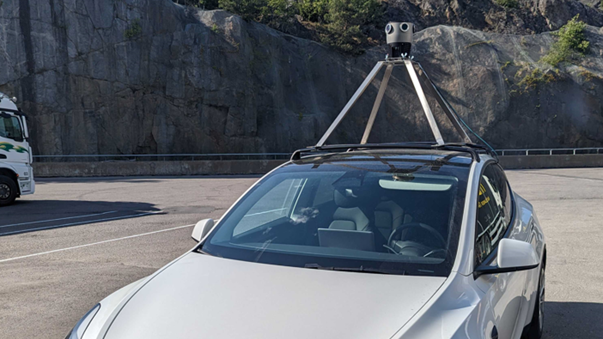
TitleVehicle assembly & mobile mapping
To ensure efficient and flexible mobile mapping, Mosaic offers suitable mounts that allow the Mosaic X mobile mapping camera or Meridian systems, for example, to be securely installed on vehicles. This vehicle mounting enables:
- Stable and vibration-damped attachment – even when driving on uneven roads
- Quick installation – the mount is easy to install, so the system is ready for use in no time
- Continuous data collection on the move – ideal for road and infrastructure mapping, traffic monitoring or route recording

TitleWide range of applications for high-resolution Street View images
Mosaic's mobile mapping systems combine high-resolution 360° imaging with precise georeferencing. Whether mounted on a vehicle or used as a portable solution, they deliver detailed images that are ideal for analysing, documenting and digitally mapping roads, railways and complex infrastructure. Thanks to their robust design and integrated sensor technology, Mosaic cameras are designed for demanding environments and deliver reliable results in a wide variety of projects.
TitleRoad infrastructure & inventory
Mosaic's mobile mapping cameras can be used to capture roads, road markings, traffic signs and other elements of road infrastructure in high resolution – quickly, accurately and over large areas.
This enables authorities and service providers to obtain up-to-date condition data, document damage and plan maintenance measures in a targeted manner.
The combination of 360° imaging and integrated positioning makes inventorying not only more efficient, but also significantly more accurate than with conventional methods.
TitleRailway inspection
Mobile mapping enables reliable recording of tracks and facilities. This improves maintenance measures and at the same time opens up new opportunities for automation in the railway sector.
TitleInfrastructure surveying
Whether roads, bridges, tunnels, electricity or water networks – precise geodata supports authorities and operators in monitoring, maintaining and modernising important infrastructure systems.
TitleTraining autonomous vehicles
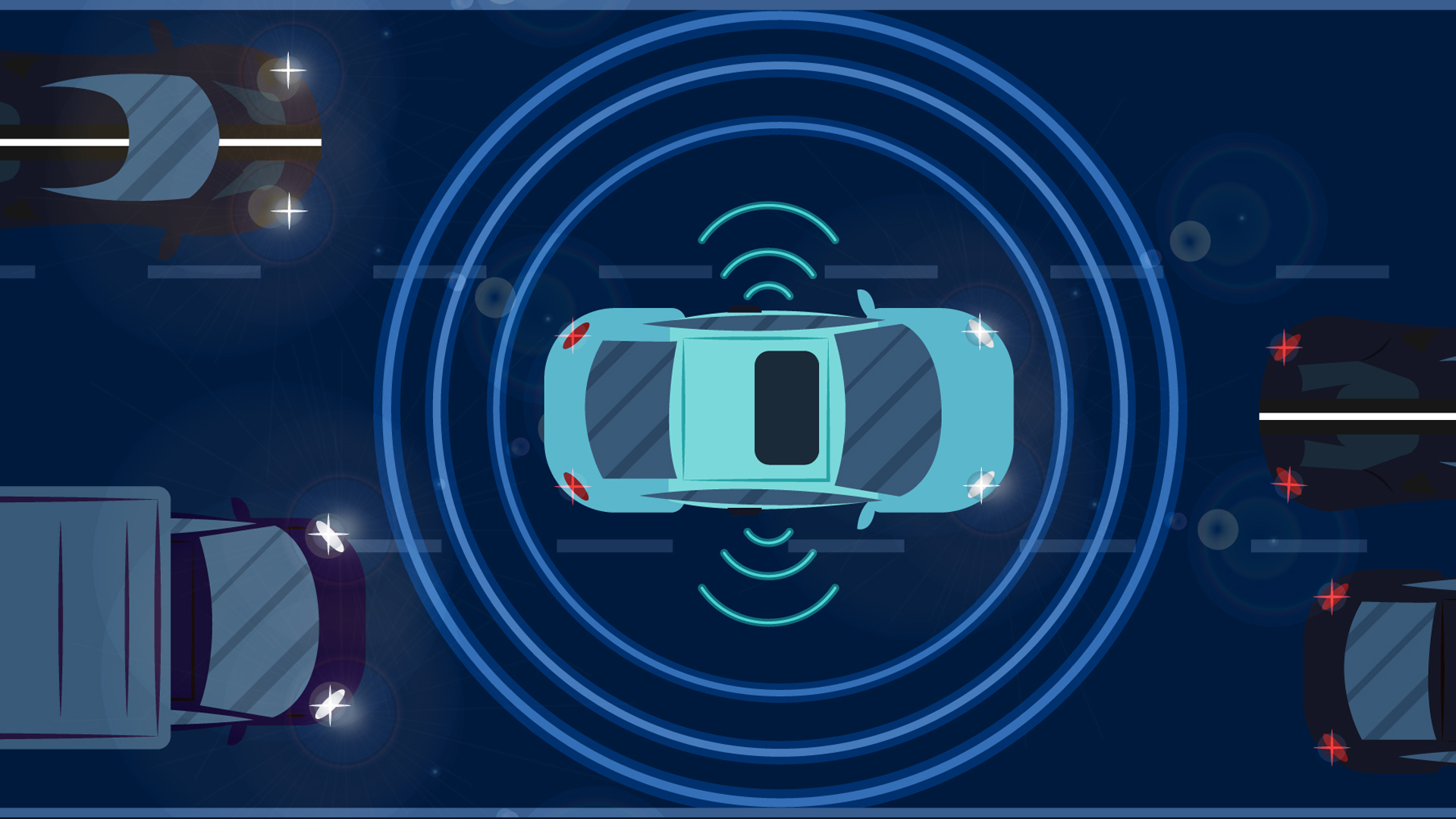
The high-resolution image and geodata from Mosaic cameras provide the basis for reliable AI and ML training data.
Roads, obstacles and environments can thus be captured realistically – a crucial prerequisite for the further development of autonomous vehicle systems.

TitleAn overview of how it works
Mosaic cameras have been specially developed to efficiently capture high-resolution 360° images and precise geodata.
Their functionality combines state-of-the-art sensor technology with user-friendly design, enabling professional users to reliably capture data in the shortest possible time – whether on foot, off-road or from a vehicle.
TitleThe technology behind Mosaic
The camera systems work with multiple high-resolution image sensors that combine to produce a complete 360° panoramic image. Supplemented by integrated GNSS and IMU sensors, the images are precisely georeferenced and tagged with position data. This allows image and geodata to be seamlessly processed into detailed maps and digital twins.
Thanks to powerful onboard storage and robust construction, Mosaic cameras can be used for both stationary applications and mobile mapping on vehicles or in backpacks.
TitleMosaic 51 360° panoramic camera for mobile mapping
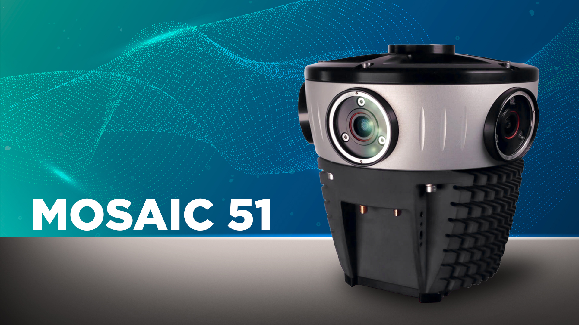
The Mosaic 51 is a specially developed 360° panocameric with an impressive resolution of 12.3K – perfect for high-precision HD surveying, GIS applications and infrastructure inspections. The compact, stand-alone device can be easily operated by just one person and requires minimal training.
Thanks to its rugged housing and industrial-grade connectors, the Mosaic 51 360° panocameric is equipped for tough outdoor use, whether in cold, hot, dusty or wet conditions or on poor road surfaces. An integrated GNSS receiver, a powerful computer and generous internal memory ensure that you can record all day long – without additional workstations.
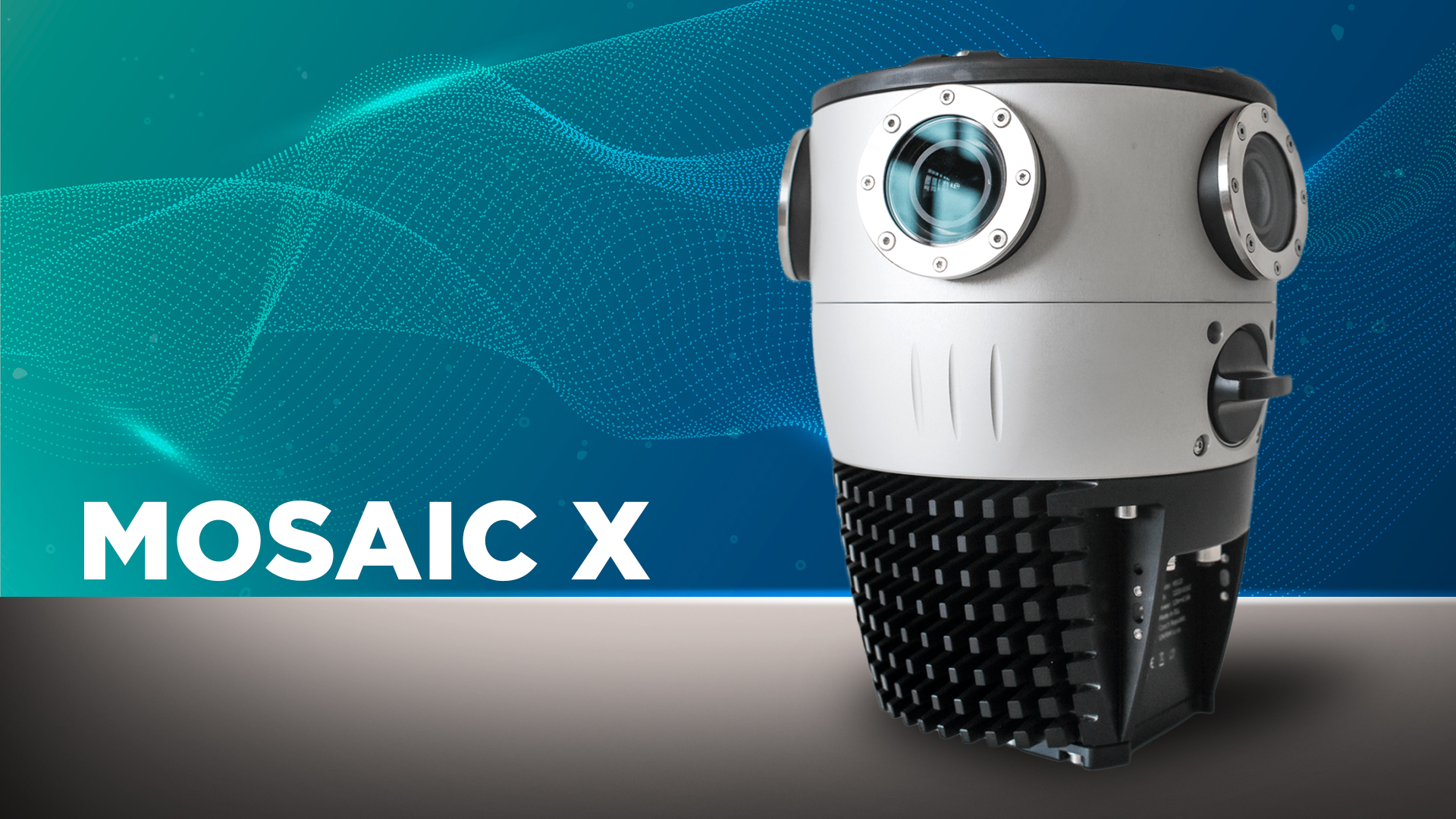
TitleMosaic X - Mobile mapping camera
The Mosaic X combines robustness with state-of-the-art imaging technology. With its global shutter, it captures high-quality street view images completely distortion-free – even at high speeds. The system is completely self-contained and comes with everything you need: GNSS receiver, memory and an intuitive user interface for control during recording.
Optimised performance in low light allows for longer operations – even at dusk, in bad weather or in tunnels.
Seamless stitching ensures detailed image documentation in post-processing. In addition, the camera is future-proof and can be expanded with additional devices such as LiDAR, GNSS or IMU if desired.
TitleMosaic Xplor backpack camera
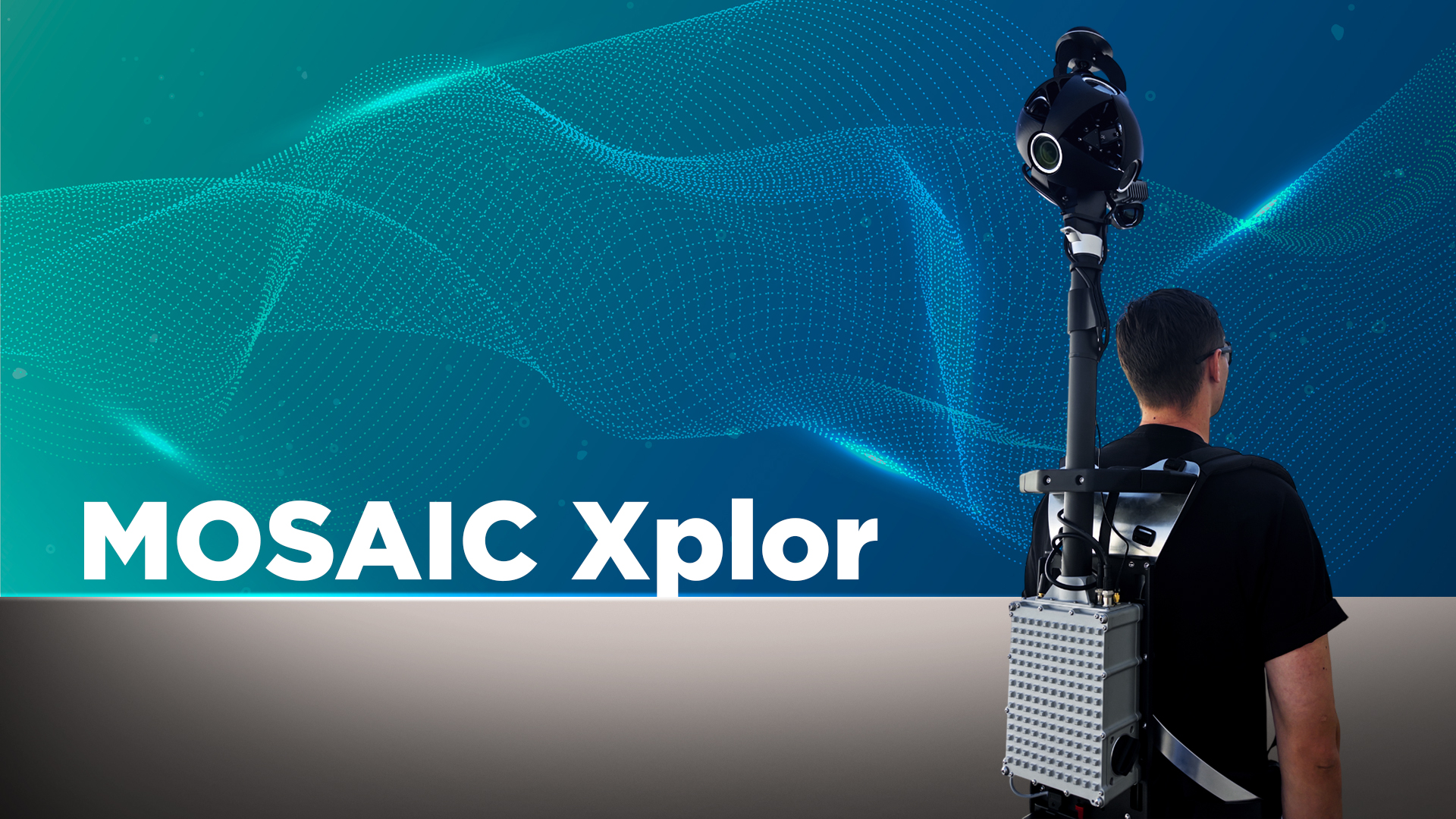
The Mosaic Xplor makes mobile mapping more flexible than ever before: whether on foot or by bike, the camera brings state-of-the-art technology in a portable backpack format. With its revolutionary 13.5K resolution, it sets new standards in image sharpness and detail accuracy for geodata and 3D scanning. The system delivers complete 360° panoramas with no blind spots and combines image data with state-of-the-art 360° x 120° LiDAR capture – all in one lightweight, portable device. This allows even locations that are inaccessible to larger vehicles or systems to be documented with precision.
The Mosaic Xplor is ideal for applications in architecture, engineering and construction (AEC), VFX, urban planning and surveying, as well as in hard-to-reach areas such as nature and forest areas, parks or complex industrial environments.
TitleExample data of Mosaic 51 and Mosaic X
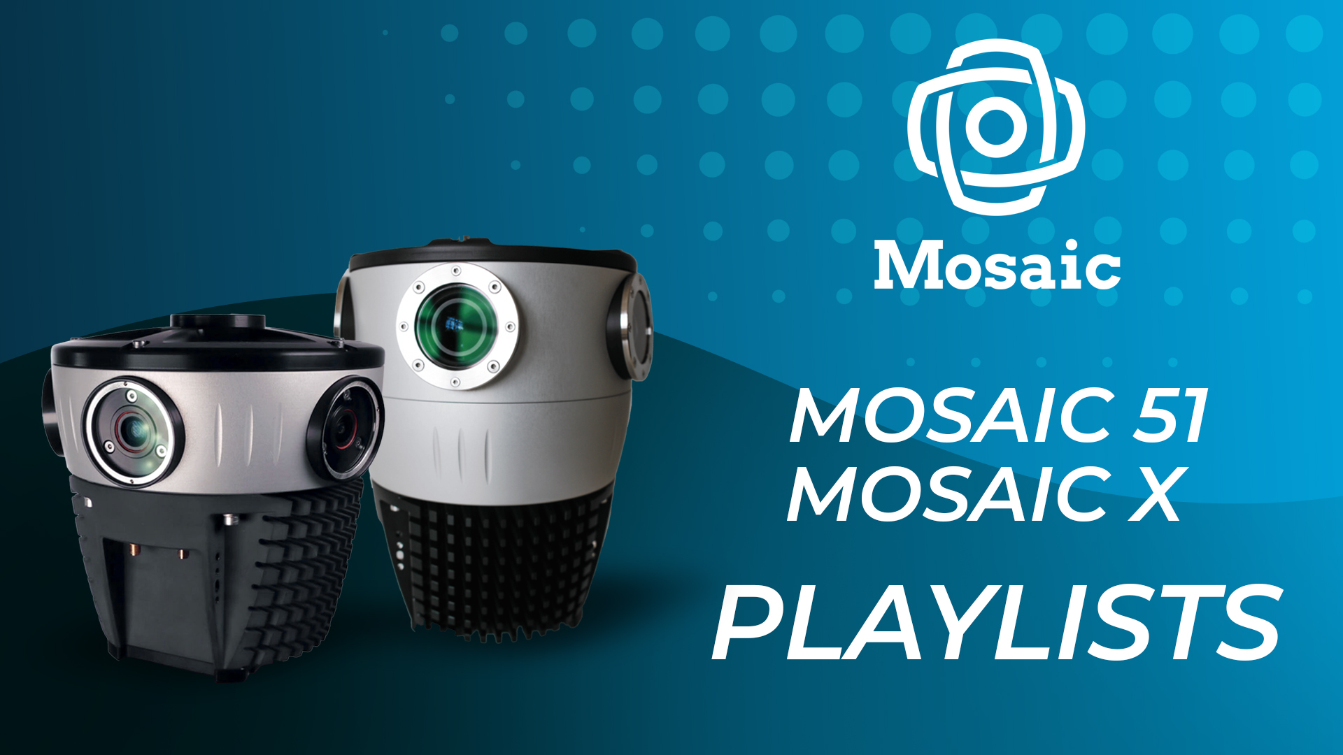
Mosaic presents the results using sample data from its products – the Mosaic 51 360° panoramic camera and the Mosaic X – in special YouTube playlists. This allows you to experience the impressive images first-hand.

Title360° cameras and mapping systems compared
Choosing the right 360° camera or mobile mapping system is crucial for achieving high-quality images, streamlining workflows and ensuring accurate data capture. Compare our products and find the optimal solution for your requirements – whether in surveying, mapping, infrastructure inspection, asset management, inventory, VFX projects or AI/ML training.
TitleCommon features of all Mosaic camera systems
| Features | |
|---|---|
Low-noise sensors and lenses | Robust construction and connectors |
8-bit h.264 compressed images | Designed and built for mobile mapping |
Open-standard data format | Open to 3rd party integration via REST API |
| Mosaic 51 | Mosaic X | Xplor | |
|---|---|---|---|
| Sensor type | Rolling shutter | Global shutter | Global shutter |
| Weight | 4.6kg / 10 lbs | 7kg / 15 lbs | 7kg / 15 lbs |
| Equidirectional resolution | 75.5 MP | 91.2 MP | 91.2 MP |
| Pixel size | 1.55 microns | 2.74 microns | 2.74 microns |
| Operating temperature range | 0º to 45 °C | 0º tot 45 °C | 0º to 45 °C |
| IP rating | IP67 | IP67 | IP67 |
| Storage | Onboard 1TB SSD | Onboard 1TB SSD | Onboard 1TB SSD |
| LiDAR enabled | Custom Integration | Part of Meridian | Yes |
| Data stored onboard |
| Timestamp Log (CSV), | Timestamp Log (CSV), |
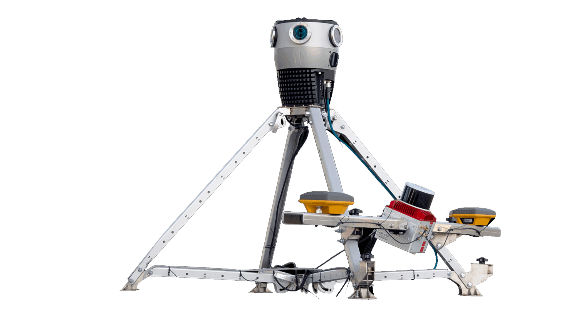
TitleMosaic Meridian
- Integrated 360° mobile mapping technology with LiDAR precision – efficient, versatile and cost-effective. Best suited for: surveying, infrastructure monitoring, autonomous navigation
- 91.2 MP images
- LiDAR accuracy: 2–3cm / Precision: 2–4cm / Range: 120m
- Integrated INS: Positioning accuracy: 1cm + 1ppm (RTK); 0.5cm (PPK)
- 83x120x81cm, 15kg (including mount)
- Fits on standard roof racks
Better advice as a user
If you are interested in our offer or would like to learn more about Mosaic cameras, call us today to arrange a free, no-obligation consultation. We will be happy to answer all your questions. As both a dealer and a user, we are ideally positioned to support you even after your purchase.