Apache 3
TitleApache 3
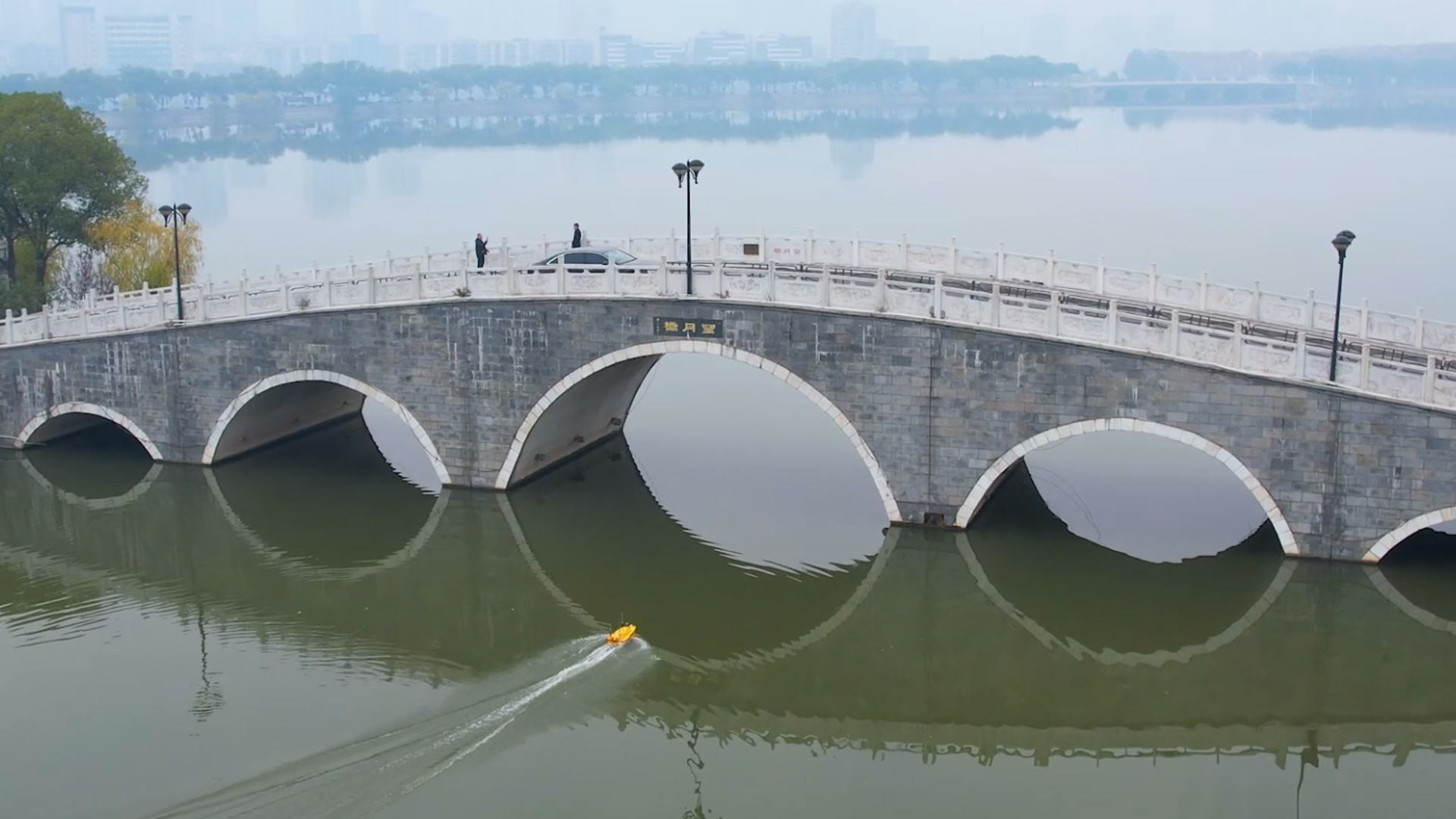
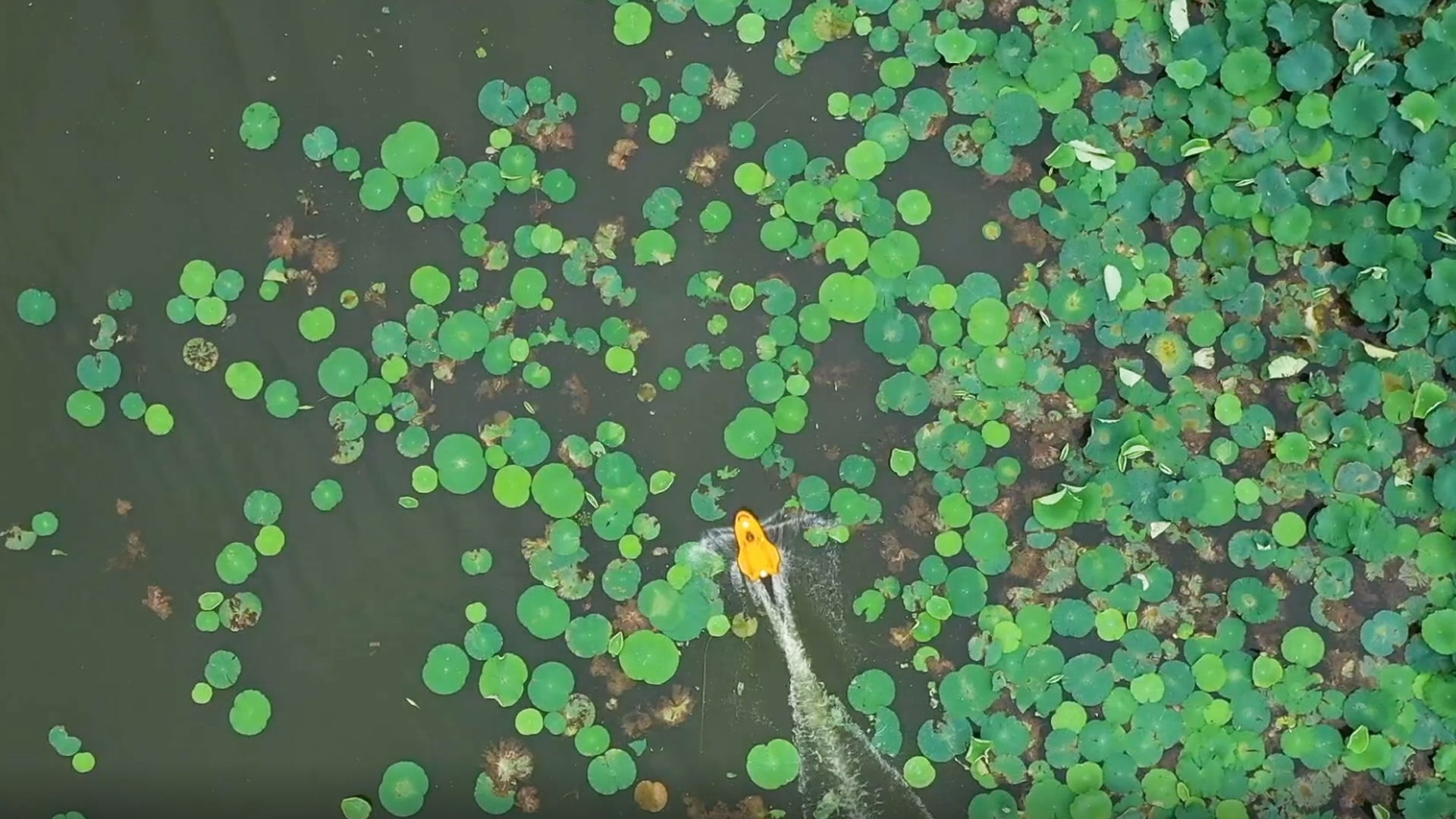
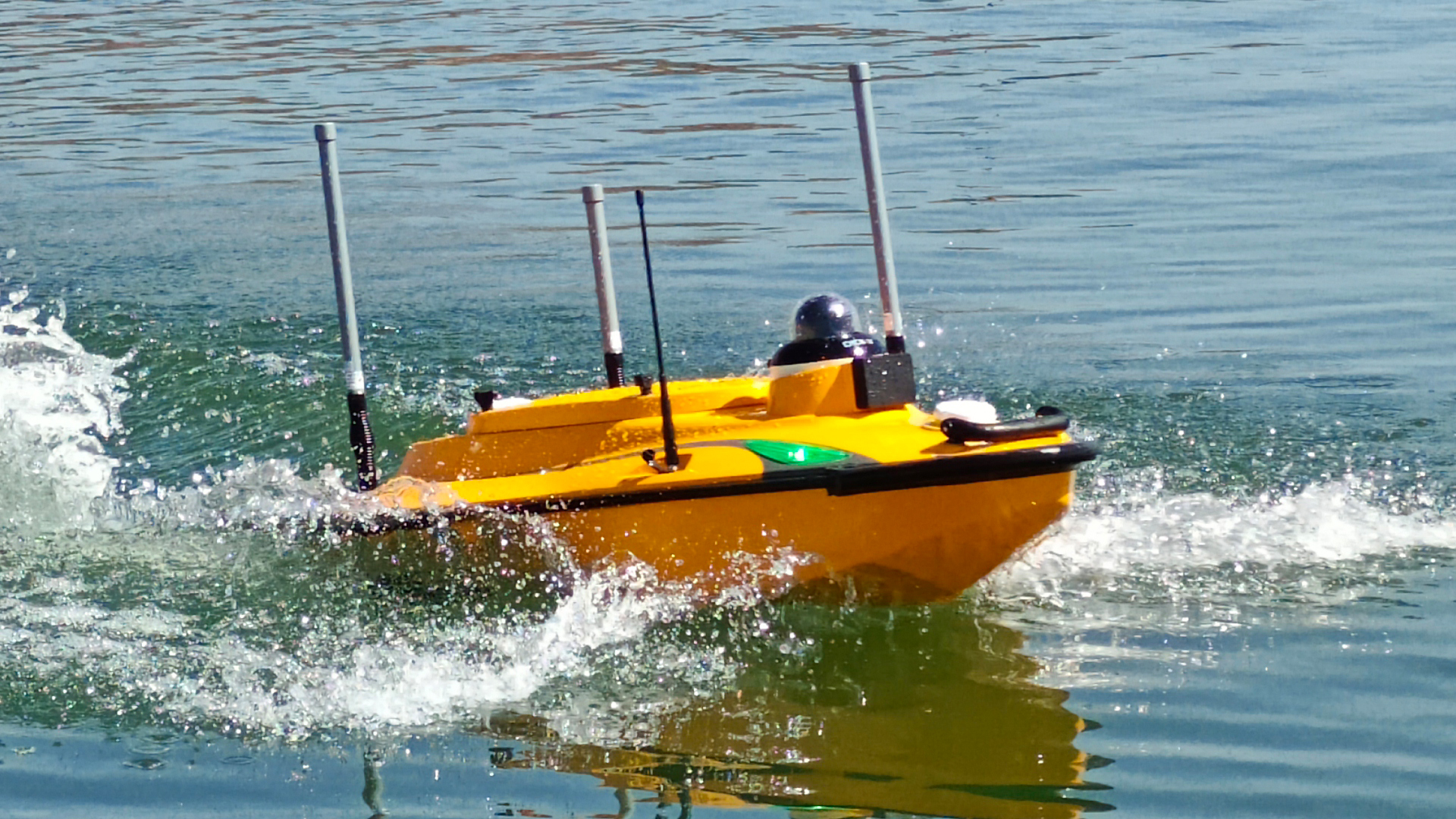
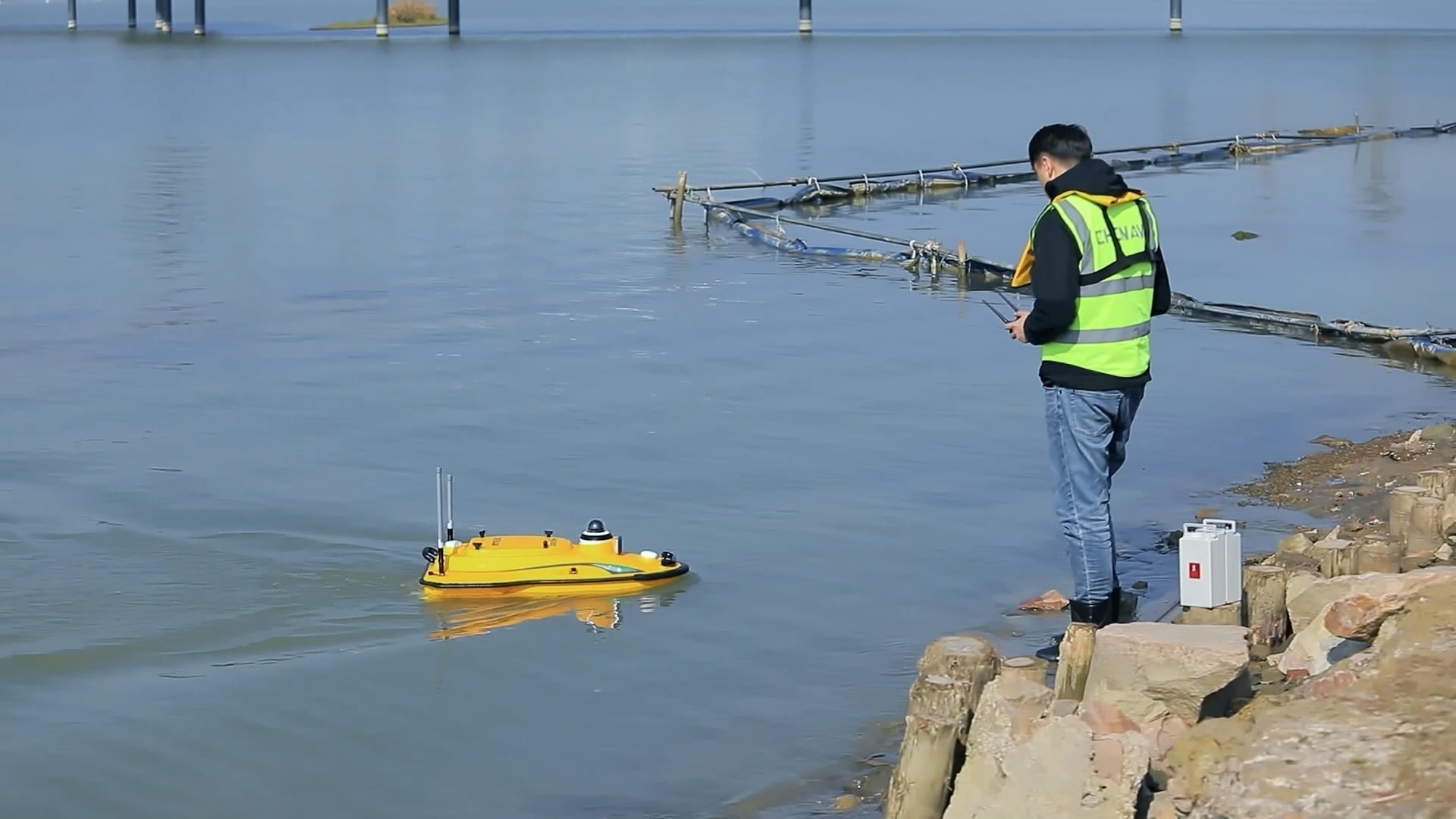
The APACHE 3 is a compact, easily transportable, shallow-draft unmanned surface vehicle (USV) designed specifically for bathymetric surveys in lakes, rivers, and coastal waters. Equipped with a single-beam echo sounder, it enables precise depth measurements. Thanks to its reliable 4G data connection, a dual GNSS system for position and course determination, an integrated IMU sensor, and powerful propulsion units, the APACHE 3 can navigate autonomously along defined routes even under challenging current conditions, ensuring accurate and efficient data collection.
TitleOptimized design and durability
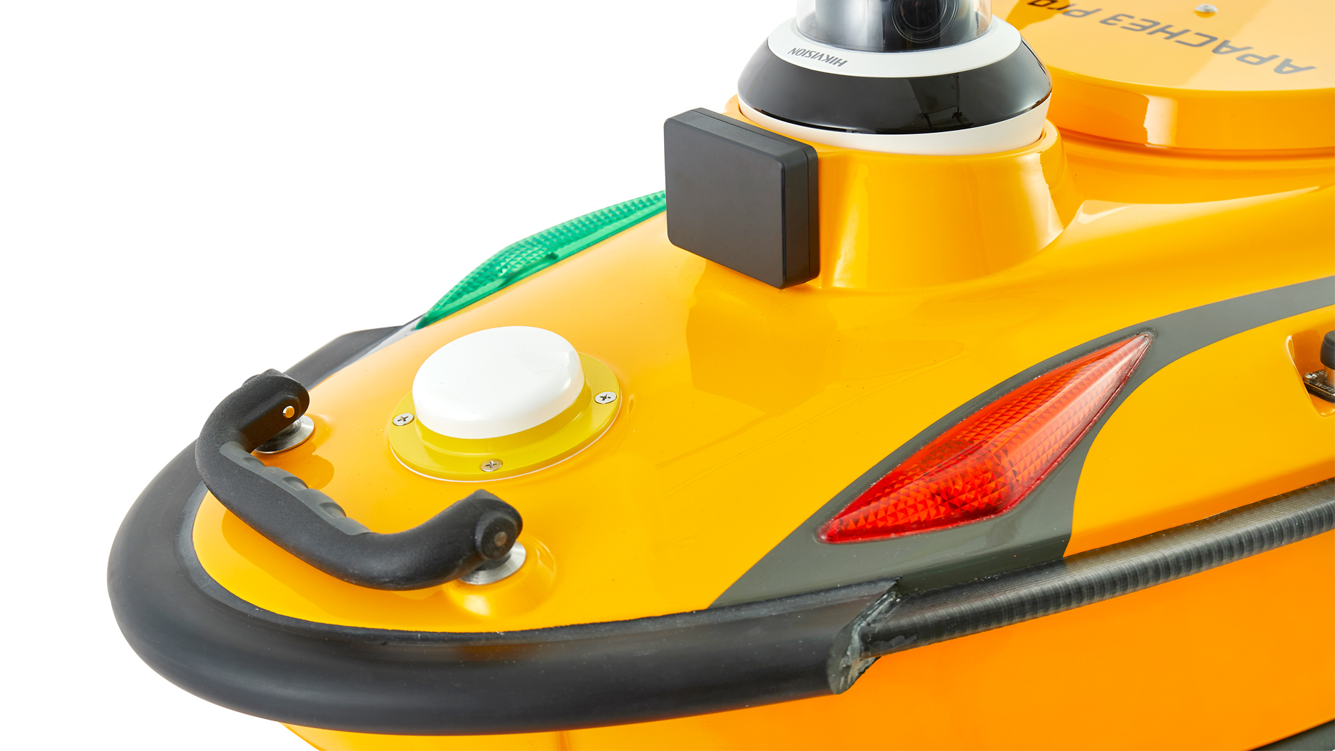
The APACHE 3’s hull is made of carbon fiber and molded in a single piece, achieving a strength of up to 10 MPa and significantly increasing its resistance to collisions. An additional aluminum cover reinforces the structure and reduces potential deformation under mechanical stress. The APACHE 3 Pro features an advanced twin-hull design made from a high-quality combination of carbon fiber and Kevlar, offering even greater durability and longevity. Thanks to its optimized construction, the APACHE 3 is also lighter than previous models, allowing it to be easily transported and deployed by a single person.
TitleHigh accuracy under bridges and around obstacles
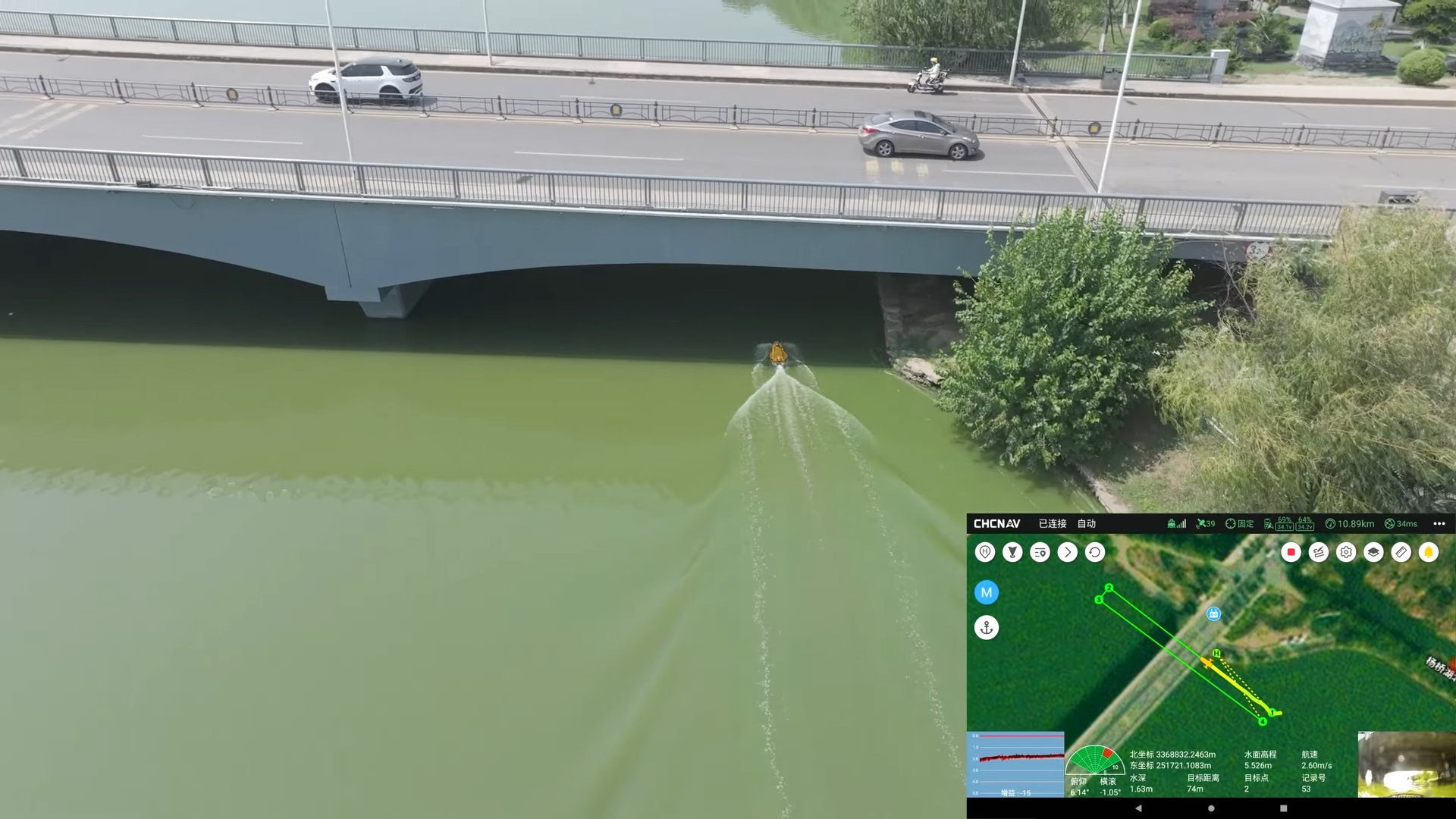
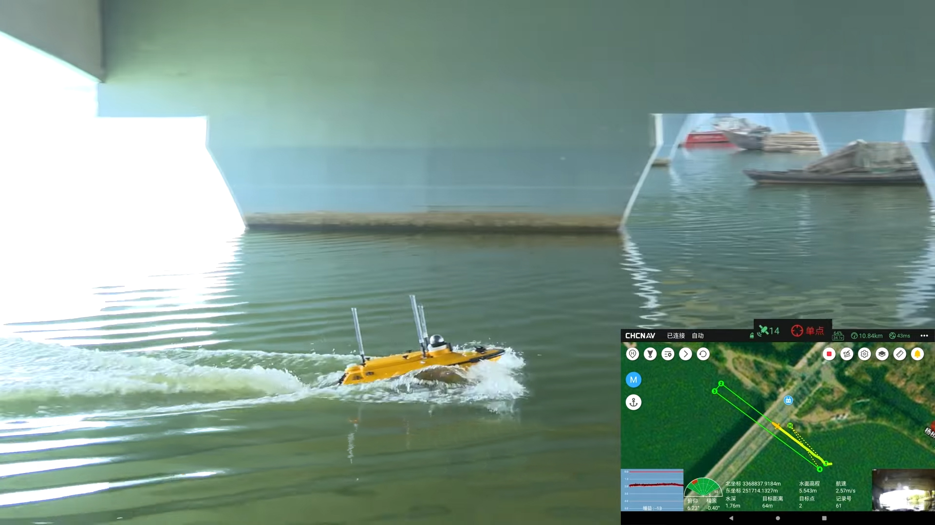
An integrated IMU sensor enables the system to compensate for brief GNSS signal outages. The combination of GNSS and IMU data ensures precise position and orientation information and reliably compensates for boat movements in the measurement results. As a result, the APACHE 3 continuously provides accurate position data even when passing under bridges or in areas with limited GNSS reception. The close integration of GNSS and INS technology minimizes measurement deviations and prevents outliers. Both models use GNSS RTK, while the Pro version additionally features an advanced INS integration that ensures even more stable positioning, particularly in shaded or obstacle-rich environments.
TitleSurveying in difficult water conditions
The APACHE 3 features a performance-optimized propulsion system. The semi-submerged motor design effectively protects the propulsion units and reduces the risk of damage, particularly in shallow waters. Advanced bathymetric algorithms enable automatic adjustment of relevant parameters, ensuring reliable measurement results even in changing riverbeds and under varying environmental conditions.
TitleSingle-beam echo sounder for bathymetric surveys
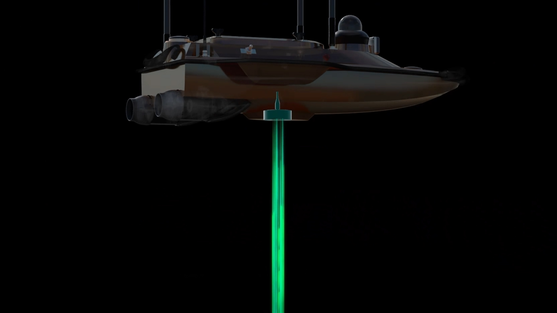
The APACHE 3 comes standard with the D230 single-beam echo sounder, while the APACHE 3 Pro is equipped with the more powerful D270. The D270 features a more compact design and also includes an integrated sensor for measuring water temperature. This allows for real-time compensation of temperature-induced changes in sound velocity, further improving the accuracy of depth measurements and providing reliable bathymetric data even under varying environmental conditions.

TitleTypical applications for Apache 3
The APACHE 3 is used for a wide range of hydrological and hydraulic engineering tasks. Thanks to its combination of autonomous navigation, integrated sensors, and stable handling, the system is suitable for both routine surveys and complex analyses in dynamic water environments.
The following application areas illustrate typical uses of the vehicle.
Bathymetric surveys
The APACHE 3 was specifically designed for precise bathymetric surveys in a wide variety of water bodies. With its integrated single-beam echo sounder, it enables reliable measurement of depth profiles in lakes, rivers, and coastal areas. Thanks to its autonomous navigation along predefined survey lines, even large areas can be surveyed efficiently and systematically. The combination of GNSS positioning and IMU support ensures consistent and accurate measurement results – even under challenging operating conditions.
Surveying of navigation channels
For the inspection and maintenance of navigation channels, the APACHE 3 provides an efficient solution for regular depth monitoring. Siltation, sedimentation, or changes in the riverbed can be detected and documented at an early stage. Thanks to its precise tracking and reliable data capturing, the system is ideally suited for recurring inspection measurements that ensure the safe navigability of waterways. The compact, unmanned system really comes into its own in sensitive or hard-to-reach areas.
Mapping of riverbeds
The APACHE 3 supports detailed mapping of riverbeds and enables the analysis of morphological changes over time. Thanks to its highly accurate depth data collection, erosion, sediment deposition, and structural changes can be reliably documented. This is particularly important for water management issues, construction projects, or ecological assessments. Even in dynamic watercourses, the robust sensor integration ensures stable and traceable results.
Monitoring measurements at dams and water control structures
The APACHE 3 is also suitable for the regular monitoring of dams and reservoirs as part of bathymetric surveys. Changes to the riverbed, such as sediment deposition or scouring, can be systematically recorded and documented over extended periods of time. This data provides an important basis for assessing operational safety and planning maintenance measures. Due to the lack of ADCP technology, the focus here is on depth measurement rather than on the analysis of flow conditions or discharge rates.

TitleHow Apache 3 Works
The APACHE 3 is an autonomous survey boat specifically designed for bathymetric data collection in waterways. By combining precise GNSS positioning, inertial sensors, and an integrated echo sounder, the system enables reliable depth data collection along defined survey profiles. Autonomous navigation and continuous data transmission ensure an efficient and safe surveying process – even under challenging conditions.
TitleGeneral Operation
The APACHE 3 automatically follows predefined survey lines while continuously capturing depth and position data. It is controlled via planning software in which the survey routes are defined in advance. During operation, the system combines GNSS and IMU data to ensure stable navigation and accurate positioning – even during brief signal outages. At the same time, the integrated single-beam echo sounder provides precise depth information, which is stored with direct georeferencing.
TitleThe Process of a Surveying Project
1. Project planning & mission preparation
First, the survey parameters are set and the survey area is defined in the planning software. The tracklines are then created according to the desired resolution and accuracy. Next, APACHE 3 is prepared for operation, including a system check, calibration, and setup of the GNSS connection.
2. System deployment & autonomous navigation
Once deployed, the APACHE 3 automatically follows the planned survey lines. Thanks to its integrated GNSS and IMU technology, the system remains stable and on course even in the presence of currents, wind, or brief GNSS signal loss. Unlike systems equipped with ADCPs, the focus here is entirely on precise line tracking for extensive depth mapping – not on cross-section surveys for current measurement.
3. Data collection & quality assurance
During the voyage, depth data from the echo sounder, as well as position and orientation information, are continuously captured. Data is transmitted in real time, allowing the operator to monitor progress and make adjustments as needed. The robust sensor integration ensures that measurement errors are minimized and consistent data sets are generated – even in dynamic waters.
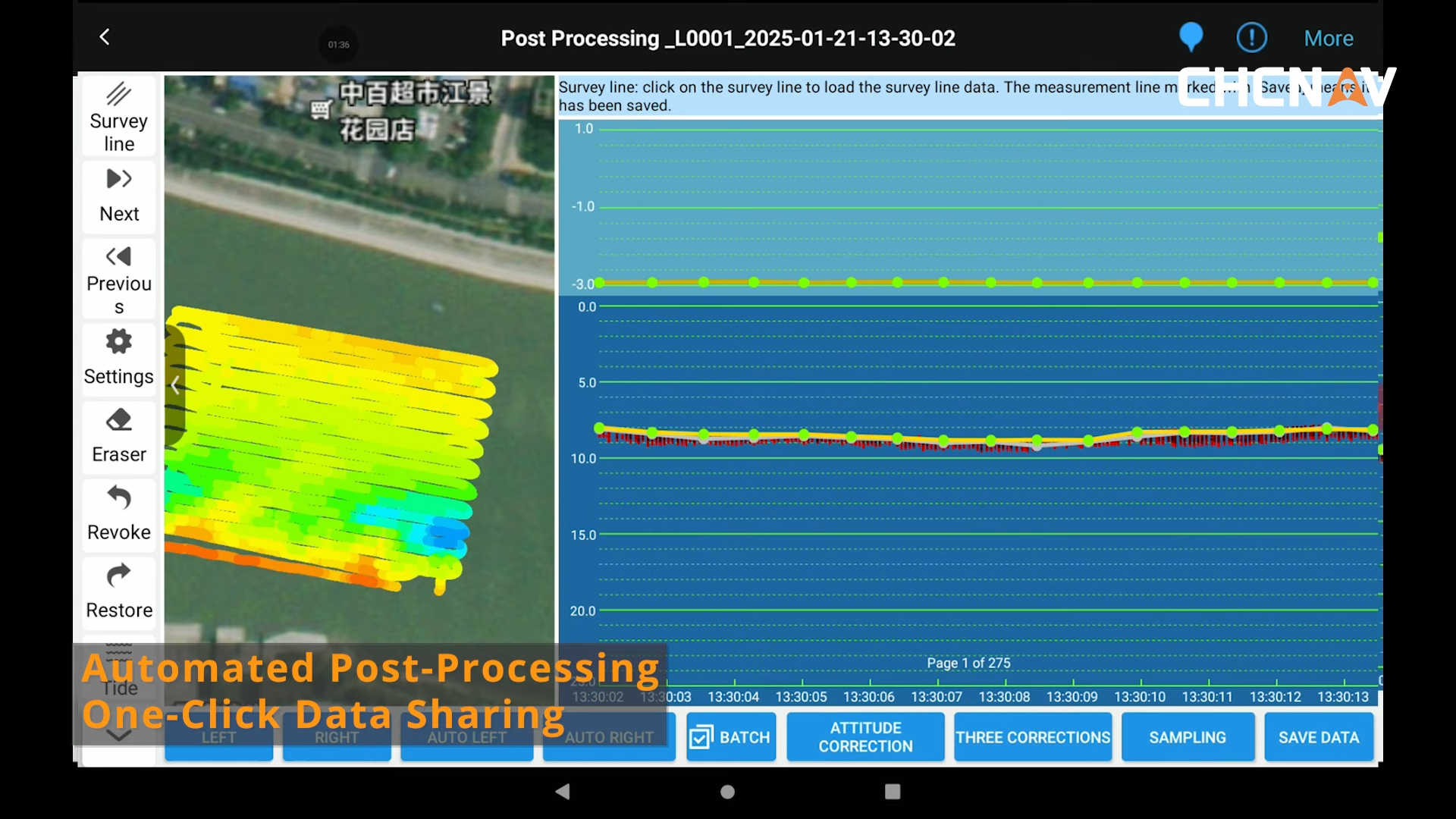
4. Data processing & analysis
Once the measurement is complete, the collected data is processed and analyzed. This results in detailed depth models, cross-sections, or volume calculations. These results serve as the basis for water management analyses, monitoring tasks, or planning processes. Unlike ADCP-based systems, the APACHE 3 focuses its analysis on bathymetry rather than on flow or discharge parameters.
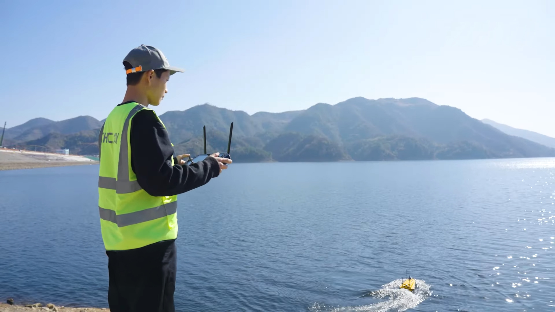
TitleFlexible control: Can be combined manually and autonomously
In addition to autonomous operation, the APACHE 3 can also be controlled manually at any time. This feature is particularly useful during deployment, in hard-to-reach areas, or for supplementing measurement data as needed. The operator can navigate the system flexibly, for example, to avoid obstacles or navigate to specific measurement points. In practice, manual control is often combined with autonomous mode: While the main survey is performed automatically along planned lines, manual control allows for additional flexibility and maximum efficiency in the field.

TitleSpecifications of the Apache 3
Discover the key technical features of the APACHE 3: This compact and powerful UPS system delivers precise positioning, reliable sensor integration, and stable measurement performance for bathymetric applications in a wide variety of water bodies.
The following specifications provide a structured overview of the system’s design, features, and key technical performance data.
Product characteristics
| Features | Apache 3 Pro | Apache 3 |
|---|---|---|
| Size (L x W x H) | 1050mm x 550mm x 390mm | |
| Material | High modulus carbon fibre + Kevlar composite | High modulus carbon fibre |
| Weight | 7kg | |
| Maximum payload | 35kg | |
| Anti-wave & wind | 3rd wind level and 2nd wave level | |
| Hull design | Triple-hull vessel | |
| Protection | Equipped with anti-collision strips | - |
| Water proof | IP67 | |
| Static draft | 10cm (unloaded) | |
| Indicator light | Two-color (positioning and differential signal) | |
| Camera | 360° omnidirectional video | |
| Obstacle avoidance distance & range | 0.2 – 40m (H: 112°, V: 14°) | |
Technical Specifications
| Features | Apache 3 Pro | Apache 3 |
|---|---|---|
| Propeller type | Brushless DC | |
| Direction control | Veering without steering engine | |
| Rated motor power | 800 W | |
| Maximum motor speed | 7200 ± 5% RPM | |
| Motor installation | Pluggable | |
| Li-Ionen battery capacity | 32.4 V; 23.1 Ah | |
| Battery endurance | 10h at 1.5 m/s (1 battery set, expandable) | 7h at 1.5 m/s (1 battery set, expandable) |
| Power supply | Single/dual balanced battery support | |
| Battery charging time | 3h | |
| Maximum speed | 7m/s | 6m/s |
Communication
| Features | Apache 3 Pro & Apache 3 |
|---|---|
| Data communication | Standard 4G a Remote control |
| Remote Control Range | 1km (Remote); Unlimited (4G) |
| SIM card slot | Nano SIM |
| Reserved interface | 2x RS232 serial ports |
| Navigation mode | Manual or Auto-pilot |
| Data storage | Local (multi channel) & Remote |
| Software | Easysail |
Positioning
| Features | Apache 3 Pro & Apache 3 |
|---|---|
| Satellite system | BDS B1I/B2I /B3I; GPS L1C/A/L2P(Y)/L2C/L5; Galileo E1/E5a/E5b; GLONASS L1/L2; QZSS L1/L2/L5 |
| Single point position (RMS) | Horizontal: 1.5m; Vertical: 2.5m |
| DGNSS position accuracy | Horizontal: 0.4m + 1ppm; Vertical: 0 – 8m + 1ppm |
| RTK Position accuracy | Horizontal: ±8mm + 1ppm; Vertical: ±15mm + 1ppm |
| Radio protocols | Satel 3AS, CHC, TT450, Transparent |
| Heading accuracy | 0,1 ⁰ @1m baseline |
| Inertial navigation stability | 6 ⁰/ h (accuracy attentuation 1m after 20 s) |
| IMU update rate | 200 Hz |
Note on navigation & accuracy: While both models use GNSS RTK, the Pro version offers more advanced INS (Inertial Navigation System) integration. This ensures more stable positioning, especially under bridges or in areas with obstacles (shadowed areas).
D230 & D270 Single beam Echo Sounder
| Features | |
|---|---|
| Data type | CHCGD, NMEA SDDPT/SDDBT, Original wave form |
| Sounding range | 0.1m until 200m |
| Sounding accuracy | ±0.01m + 0.1% x D (D is depth of water) |
| Resolution | 0.01m |
| Maximum sampling rate | 30 Hz |
| Frequency | 200 kHz |
| Beam angle | 6.2° ± 1° |
| Sound velocity adjustment range | 1400 – 1700 m/s |
| Integrated water temperature sensor | -55 °C bis +100 °C, real-time correction of the sound speed |
Difference between D230 and D270 Echo Sounder
The APACHE 3 is equipped with the D230 single-beam echo sounder, while the APACHE 3 Pro is equipped with the upgraded D270.
The D230 is a proven, reliable entry-level echo sounder for classic bathymetric applications.
The D270 is the advanced version featuring:
- integrated environmental compensation (temperature)
- modern system architecture
- greater workflow efficiency
Better advice as a user
If you are interested in our offer or would like to learn more about the APACHE 3 USV, then call us today and arrange a free and non-binding consultation appointment for you. We will answer all your questions. As a dealer and at the same time a user, we are well positioned to assist you even after the purchase.