PointCab Geospatial Weeks
PointCab Geospatial Weeks
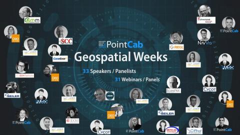
3 months. 31 webinars. 33 speakers.
Our cooperation partner PointCab has put together a great free webinar series called "PointCab Geospatial Weeks". The aim of the comprehensive webinar series is to provide you with the best possible support despite this year's pandemic and to offer a wide range of interesting topics that will help you in your work. You can look forward to a wide range of different webinars with experts from the most diverse fields of geodesy. We are proud to support this webinar series with many competent speakers from our area of expertise.
See webinar overview Registration for the first panel
What you can expect to see
The scope of the webinar series is impressive. Over the course of 3 months 33 speakers will share their knowledge and experience in 31 webinars or panels. Topics include laser scanning, point cloud processing, BIM modeling, and much more.
The series will be kicked off by an all-female expert panel with the title “From Scan to BIM – How do we improve collaboration between different systems and industries?” on International Women's Day, the 8th of March, with experts from GeoSLAM, Seiler and Laserscanning Europe.
Between March and June, more experts from companies like FARO, Riegl, NavVis, ClearEdge3D, Scantra and many more are participating in panels or are holding webinars themselves. You can register for the free webinars on the PointCab website. As not all webinars can be held in English, we also offer alternative webinars in German. If you also feel comfortable with the German language, it is worth taking a look at the German dates.
Great interest and positive feedback from the industry
PointCab's CEO Dr. Richard Steffen, is delighted by the huge interest and support the webinar series received: “When initially coming up with the idea for free helpful content webinars, we weren’t sure how many experts and companies would be willing to participate in our endeavour. The only thing we are offering is a free independent platform and the vision to create a cross-industry online event to give back to the geospatial community during the Covid19 pandemic. We’ve invited hardware and software manufacturers, researchers, freelancers, service providers, you name it. We thought we would get a few responses and could put up a mini series. Well, we were wrong. Almost everyone joined instantly and was happy to participate making this a diverse couple of months with interesting subjects. Up until now, we are still receiving more responses from additional speakers, so we may even add a few more webinars along the way. It’s amazing to see how smaller and larger companies are willing to come together for the community.”