
CHCNAV AU20 Mobile Mapping System

TitleTechnology for precise mobile mapping
The CHCNAV AU20 Mobile Mapping System is a powerful mobile mapping system designed for the precise collection of georeferenced 3D data while in motion. By combining state-of-the-art LiDAR technology, intelligent AI algorithms, and flexible sensor integration, the system enables efficient and highly accurate data collection for a wide range of surveying and infrastructure projects. Whether for road surveying, asset management, structural documentation, or quality control – the AU20 delivers reliable results and optimizes workflows from data collection to analysis.
TitleHighest accuracy for demanding surveying tasks
The AU20 sets new standards in mobile data collection. Thanks to its fourth-generation real-time waveform processing, the system processes up to 2 million data points per second at a scan rate of up to 200 revolutions per second.
With an accuracy of 5mm and a precision of 3mm, even the smallest details – such as lane markings, manhole covers, or road surfaces – are reliably captured.
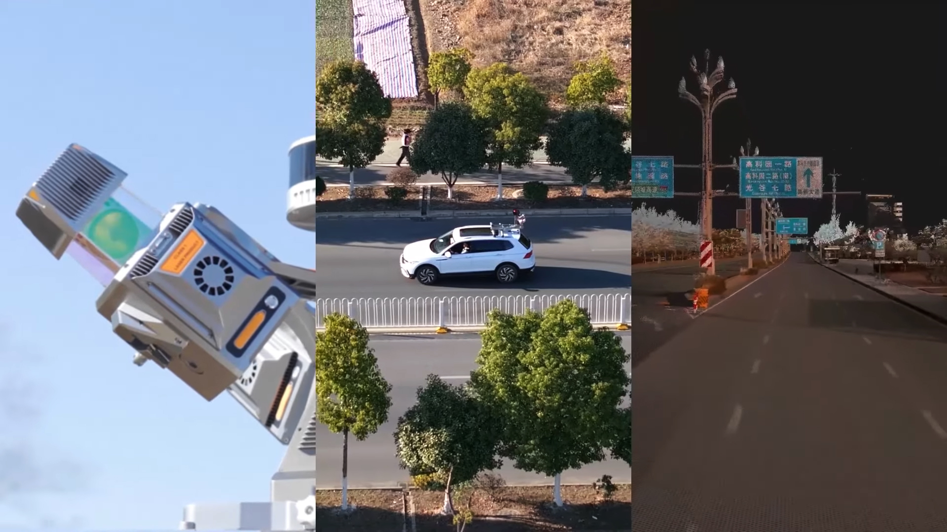
TitleFlexible multi-sensor platform
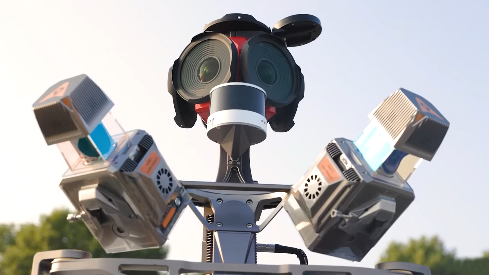
The powerful AP7 processor supports the integration of up to eight external sensors, significantly expanding the AU20's range of applications.
In addition to LiDAR data, systems such as cameras for road condition monitoring or other sensor systems can be integrated. Seamless compatibility with panoramic cameras like the Ladybug5+ and Ladybug6 offers maximum flexibility for specific project requirements.
TitleAI-powered colorization of point clouds
Using intelligent algorithms to detect vehicles, people, and environmental objects, the AU20 generates color-accurate panoramic images with over 95 percent color fidelity. Automatic optimization ensures high-quality, noise-free, and realistic color point clouds – quickly and efficiently with a single click.
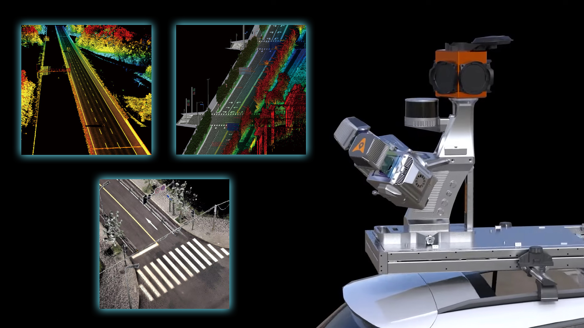
TitleHigh-resolution data capture with maximum detail
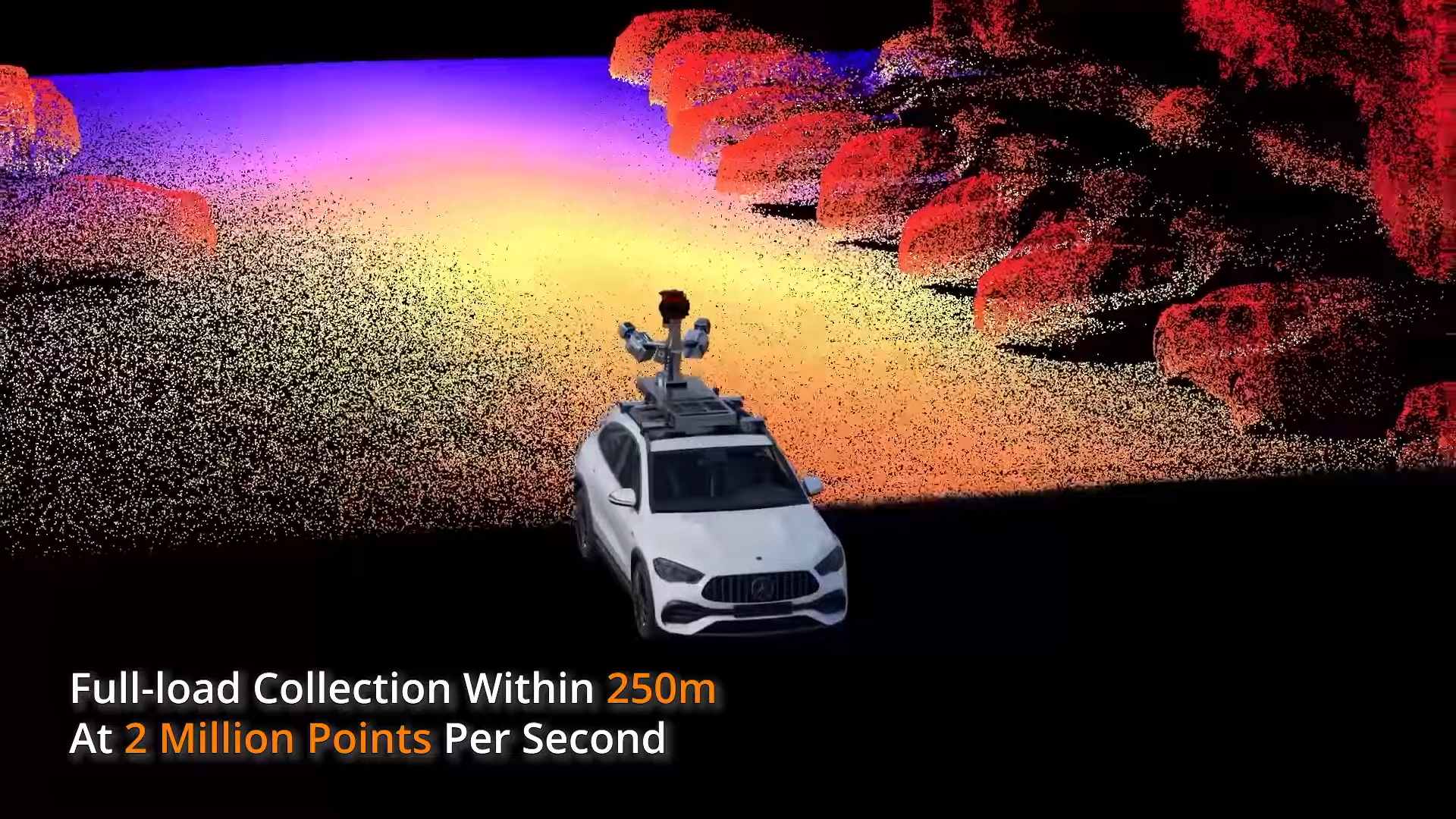
This innovative multi-cycle laser technology enables the capture of up to 2 million points per second at ranges of up to 250 meters. Thanks to the significantly increased point density, even fine structures along road edges, roadways, and infrastructure objects are captured in detail and analyzed.
TitleDual-scanner technology for maximum coverage
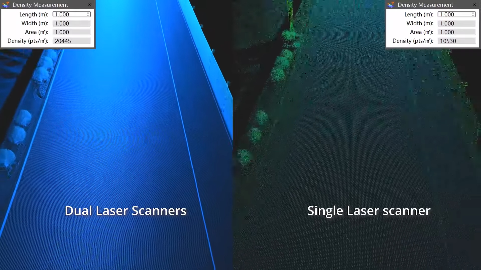
The AP7 platform can operate with two laser scanners simultaneously, thereby doubling the data density. The 45-degree scanning angle enables capture from different perspectives, reduces shading, and minimizes blind spots. This particularly improves the detection of traffic signs, road objects, and complex infrastructure.
TitleIntelligent VMA correction using artificial intelligence
The AI-based VMA adjustment uses automatic control point detection and intelligent calculation methods to efficiently correct point cloud errors. This achieves an accuracy of up to two centimeters, even in challenging surveying environments. The result is reliable data that meets the high standards of modern infrastructure and road construction projects.

TitleAccurate geographic data for planning, construction, and infrastructure management
The CHCNAV AU20 Mobile Mapping System helps surveyors, design firms, and public sector clients quickly and accurately capture data for complex road and infrastructure projects.
High-resolution point clouds, AI-powered data analysis, and flexible sensor configurations enable efficient use throughout the entire project lifecycle.
TitleApplications
- Highway surveying
- Road administration
- Road reconstruction and expansion
- As-built documentation of transportation infrastructure
- Construction progress monitoring
- As-built surveying
- Infrastructure and asset management
- Digital Twins of transportation and road networks
TitleEfficient data collection & intelligent processing
The CHCNAV AU20 MMS combines state-of-the-art LiDAR technology, intelligent sensor integration, and AI-powered data processing into a powerful mobile mapping system. While in motion, millions of measurement points, image data, and sensor data are simultaneously captured, processed, and merged into precise, georeferenced 3D models. The result is detailed point clouds and digital twins that serve as the foundation for surveying, planning, and infrastructure management.
At the heart of the AU20 is fourth-generation LiDAR technology with real-time waveform processing (RWP). While driving, the system continuously captures up to 2 million data points per second and generates highly accurate spatial information.
The captured laser data is compiled into detailed 3D point clouds. Thanks to multi-cycle LiDAR technology and a range of up to 250 meters, a particularly high point density is achieved, enabling a precise representation of roadways, infrastructure objects, and complex environments.
For even more comprehensive data capture, the AP7 platform supports the simultaneous use of two laser scanners. By capturing data from different angles, shadows are reduced and blind spots are minimized.
After data collection, intelligent algorithms are used for image and data processing. The AI detects vehicles, people, and other moving objects, reduces noise, and improves the quality of color assignment in the point clouds.
To ensure consistently high data accuracy, built-in AI algorithms continuously analyze the captured information. By automatically detecting control points and intelligently correcting alignment errors, deviations are minimized and point clouds are optimized.
TitleOperating Procedures for the CHCNAV AU20 MMS
- Data collection
LiDAR sensors and cameras continuously capture highly accurate 3D data of the surrounding environment while the vehicle is in motion.
- Georeferencing
GNSS and INS systems determine the vehicle’s position and orientation in real time and link the measurement data to precise coordinates.
. - Sensor fusion
All captured LiDAR, camera, and sensor data is synchronized and merged on the AP7 platform.
- AI-powered processing
Intelligent algorithms detect objects, filter out noise, and optimize the colorization of the point clouds.
- Quality control and correction
Automatic control point detection and VMA correction improve accuracy and minimize deviations.
- Output of the 3D point cloud
The processed data is available as high-resolution, georeferenced point clouds for surveying, planning, and infrastructure management.

TitleTechnical specifications at a glance
The CHCNAV AU20 MMS combines powerful LiDAR technology, precise navigation sensors, and flexible expansion options in a compact mobile mapping system. The following specifications provide a detailed overview of the platform’s technical features, performance metrics, and system components.
TitleSpecifications
| General system performance | |
|---|---|
| Multi-platform | Support vehicle-mounted, airborne, backpack and other carriers; supports LD5+, LD6, Basler, and other cameras,enable data capture from up to 8 cameras simultaneously |
| Data storage | 512GB, optional for 1T (airborne) 2TB external hard drive (vehicle-mounted) |
| Positioning & orientation system | |
|---|---|
| GNSS system | GPS: L1,L2,L5 GLONASS: L1,L2 BEIDOU: B1,B2,B3 GALILEO: E1,E5a,E5b |
| IMU update rate | 600 Hz |
| Attitude accuracy after post-processing | 0.005° RMS pitch/roll 0.010° RMS heading |
| Position accuracy after post-processing | 0.010 m RMS horizontal 0.020 m RMS vertical |
| Laser scanner | |
|---|---|
| Laser product classification | Class 1 according to IEC 60825-1:2014 |
| Dimensions of instrument | 262.3mm × 141.5mm × 161mm |
| Weight | 2.82kg |
| Range | 1.5~250m (vehicle-mounted) 1.5~1450m (airborne) |
| Accuracy | 5mm (1σ,at 50m range) |
| Precision | 3mm (1σ,at 50m range) |
| multi-period | Up to 7 zones |
| Field of view | 360°, selectable |
| Scanning mechanism | Rotating mirror |
| Max. effective measurement rate | 2,000,000 meas./sec. |
| Scan speed (selectable) | 10~200 scans/sec |
| Max. number of return pulses | Up to 16 |
| Waveform | Full waveform |
| AP7 vehicle platform | ||
|---|---|---|
| Type | AP7 single-head | AP7 dual-head |
| Dimensions | 528*301*638mm (with installed AU20) | 505*604*609mm (with installed AU20) |
| Weight | 7.5kg (without laser and camera) | 8.3kg (without laser and camera) |
| Imaging system | ||
|---|---|---|
| Camera type | Ladybug5+ | Ladybug6 |
| Resolution | 30 MP (5 MP × 6 sensors), 10 FPS | 72 MP (12 MP × 6 sensors), 15 FPS |
| FOV | 360° Spherical camera | |
| Lens | 2.5mm | 6.94mm |
| Dimensions | 160mm (height) x 197mm (diameter) | 198mm (height) x 269mm (diameter) |
| Weight | 2.9kg | 5.2kg |
| CCD size | 2048 × 2448 | 12,288 × 6144 |
| Coverage | 90% of full sphere | |
| High Dynamic Range (HDR) | Cycle 4 gain and exposure presets | |
| SLAM laser scanner | |
|---|---|
| Measuring range | 0.05 to 120m |
| Data points generated | Single return, 320,000 points/sec |
| Environmental | |
|---|---|
| Operating temperature | -20 °C to +50 °C |
| IP rating | IP64 |
| Humidity (operating) | 80%, non-condensing |
| Electrical | |
|---|---|
| Input voltage | DC 24V(20 ~ 27V) |
| Power consumption | 150W (dual head) |
| Optional software | |
|---|---|
| CoPre Intelligent Processing SW | Data copy, POS solve, point cloud and images creation, strip adjustment & GCP refine, noise optimization, Airborne DOM and 3D model generation |
| CoProcess Efficient Feature Extraction SW | Terrain module, Road module, Volume module, Road Extractions module, Building Extractions module |
TitleLaser scanner range
| Laserscanner | |||||||||
|---|---|---|---|---|---|---|---|---|---|
| Laser Pulse Repetition Rate PRR | 100kHz | 200kHz | 300kHz | 400kHz | 500kHz | 800kHz | 1000kHz | 1500kHz | 2000kHz |
| Max. range, at ρ>80% | 1450m | 1320m | 1220m | 1120m | 1000m | 790m | 706m | 576m | 500m |
| Max. range, at ρ>20% | 750m | 660m | 610m | 560m | 500m | 395m | 353m | 288m | 250m |
| Max. Operating Flight Altitude AGL, at ρ>20% | 530m | 467m | 431m | 396m | 354m | 279m | 250m | 204m | 177m |
| Max. Number of return pulses up to | 16 | 16 | 16 | 16 | 16 | 16 | 16 | 10 | 8 |
Better advice as a user
If you are interested in our offer or would like to learn more about the CHCNAV AU20 Mobile Mapping System, then call us today and arrange a free and non-binding consultation appointment for you. We will answer all your questions. As a dealer and at the same time a user, we are well positioned to assist you even after the purchase.