Emlid Reach RS4, RS4 Pro and RX2

TitleThe new generation of EMLID GNSS receivers
With its new product line, EMLID is once again setting new standards in GNSS surveying. The proven technology of the previous models has been further developed and enhanced with state-of-the-art hardware. The result: even faster, more stable and more precise measurement results – even under the most demanding conditions. Whether in dense forest, in the city or in open fields: the new receivers reliably deliver RTK positions with the highest accuracy.
TitleNeue EMLID GNSS-Empfänger im Überblick
In diesem Video stellen wir Ihnen die neuen GNSS-Empfänger Reach RS4, RS4 Pro und den neuen Reach RX2 von EMLID vor. Sie erhalten einen kompakten Überblick über die technischen Highlights und Einsatzmöglichkeiten der Geräte. Zusätzlich zeigen wir Ihnen das neue, speziell für den professionellen Vermessungseinsatz entwickelte EMLID-Zubehör. Erfahren Sie in wenigen Minuten, welches System am besten zu Ihren Anforderungen passt.
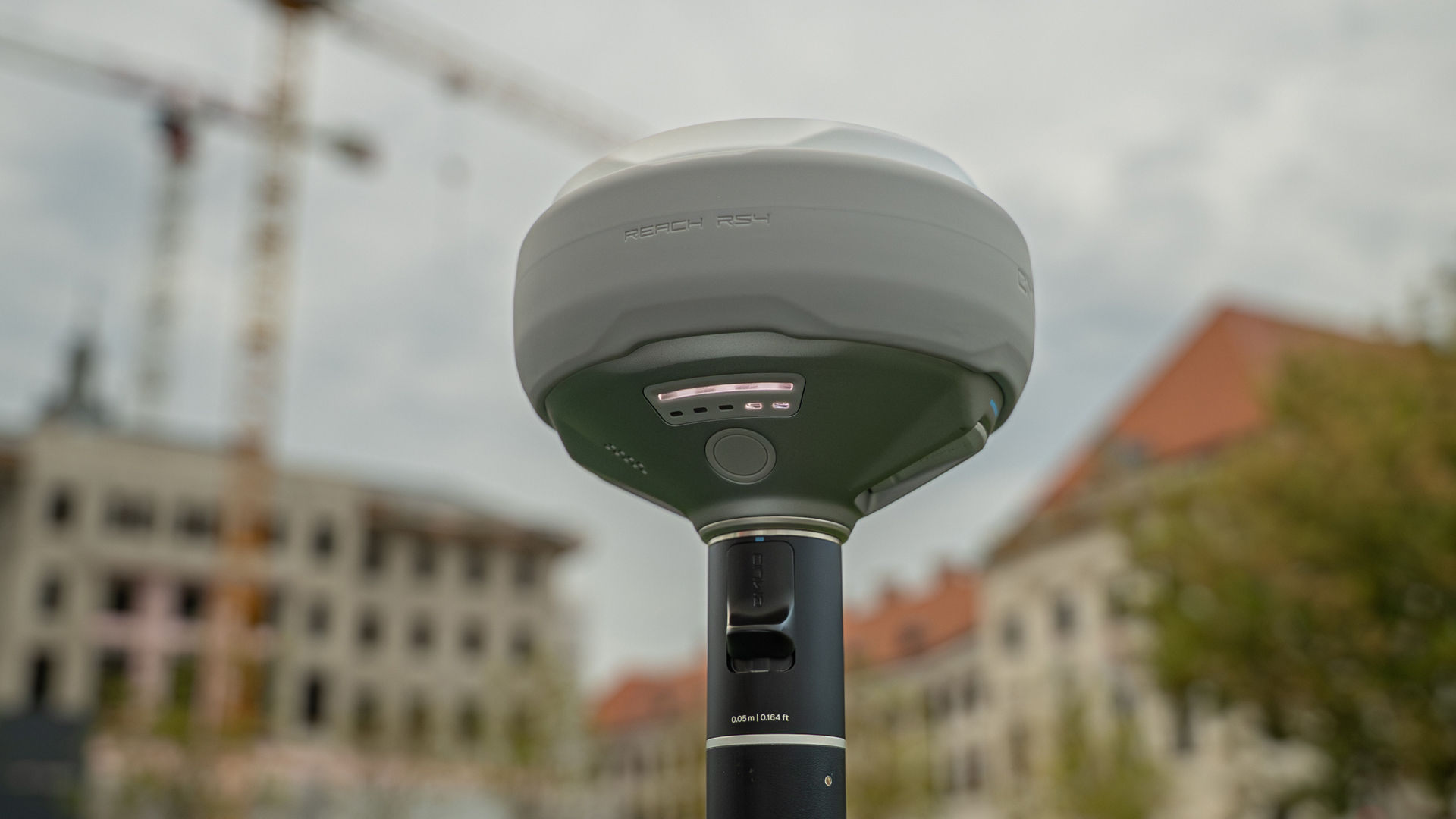
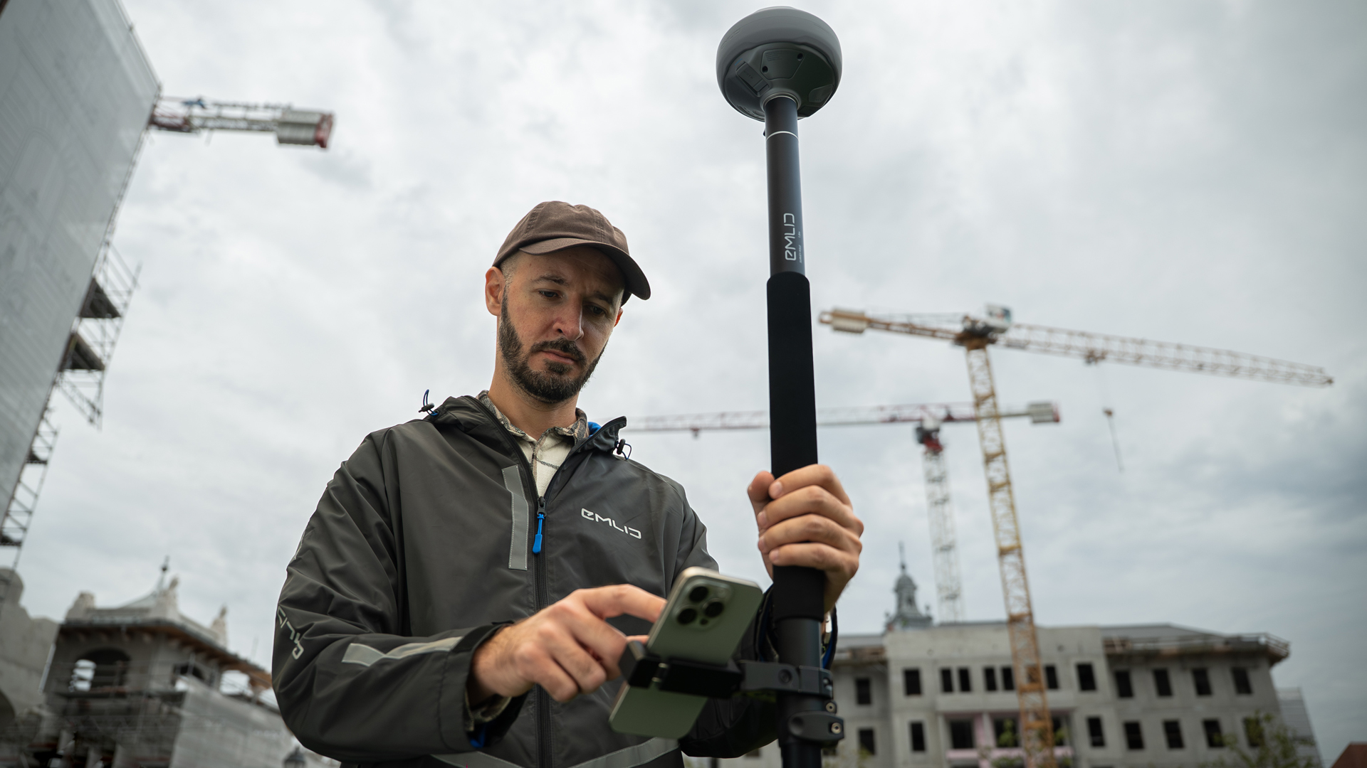
TitleEMLID Reach RS4 - Powerful in any environment
The Reach RS4 is the successor to the successful RS3 and offers numerous technical innovations. A newly developed GNSS chip allows all available frequency bands to be used for RTK. This enables an even faster FIX solution and stable signal processing even in difficult environments such as cities or wooded areas.
Thanks to the new dual-band radio module with up to 2 watts of transmission power, the range and reliability of correction data transmission between base and rover is significantly improved. The integrated latest-generation IMU works five times faster than before and delivers leading accuracy in position and attitude determination thanks to a high-precision 6-axis MEMS sensor. Like its predecessor, the RS4 also has a tilt sensor with tilt compensation up to 60°.
A special highlight: the new magnesium housing not only makes the RS4 extremely robust, but also enables better signal processing in the event of reflections, for example when the receiver is located near a wall. In addition, there is an optimised device layout for easier maintenance and a newly designed carrying case that combines functionality and elegant design.
TitleEMLID Reach RS4 Pro – Precision meets augmented reality
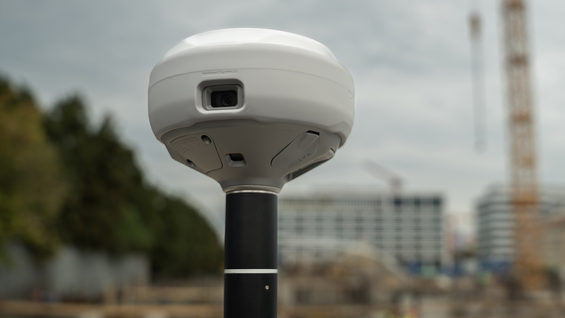
With the Reach RS4 Pro, EMLID takes surveying to a whole new level. In addition to the features of the RS4, the Pro model has two integrated cameras that can be used directly via the EMLID Flow app. This opens up completely new possibilities in the field: stakeout points can not only be displayed using coordinates, but also tracked visually as a walking route using augmented reality.
Furthermore, measurement points can be captured directly on photos – a decisive advantage when direct access to the measurement point is not possible. This combination of state-of-the-art GNSS technology and image data processing makes the RS4 Pro an innovative tool for the highest demands in surveying.
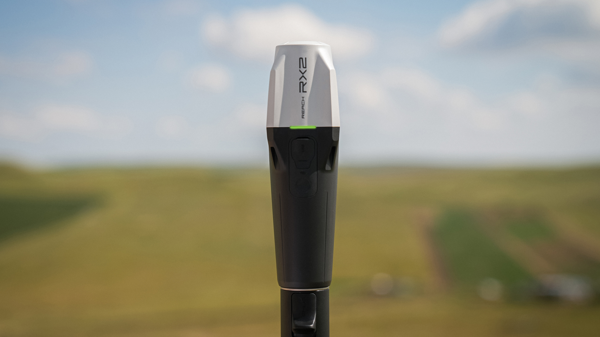
TitleEMLID RX2 – Compact, reliable, precise
The new Reach RX2 is the portable alternative in the new series. Technically, it is based on the RS4 platform, but does not feature the integrated dual-band radio module. Unlike its predecessor, however, the RX2 is equipped with an IMU. This makes the RX2 ideal for users who want maximum compactness and flexibility while still benefiting from improved signal processing capabilities, fast RTK-FIX solution and robust construction. Like its predecessor, the RX, the RX2 uses Bluetooth Low Energy (BLE) to connect to a smartphone.
Further information on GNSS receivers from EMLID and the EMLID Flow app can be found on this page:
TitleConclusion
The new generation of EMLID – RS4, RS4 Pro and RX2 – brings state-of-the-art GNSS technology into practice. With even faster signal processing, innovative sensor technology and a robust magnesium housing, the devices are perfectly equipped for demanding surveying tasks.

TitleYour solution for precise geodata
Emlid's new GNSS receivers combine high accuracy with ease of use. Whether used as a compact rover solution or a robust base station, they deliver reliable positioning data for a wide range of applications in surveying, mapping and construction projects. Thanks to modern technology, intuitive operation and rugged construction, Emlid devices are suitable for daily use in the field and support precise results even under demanding conditions.
Precise satellite-based surveying with GNSS receivers opens up numerous applications in geodesy and topography. Typical applications include:
- Staking out and measuring construction projects
- Georeferencing of 3D laser scans
- Locating and checking boundary markers
- Integration into tracking and guidance systems (e.g. in agriculture or motor sports)
- Creation of original terrain measurements
- Support for UAV/drone mapping
- and many other scenarios in surveying practice

TitleHow it works
Emlid's new GNSS solutions build on the proven technology of Reach RX and Reach RS3 – and go one step further. Designed for precise positioning, fast data acquisition and maximum reliability, they combine state-of-the-art GNSS technology with a user-friendly concept.
Whether used in surveying, construction and infrastructure projects or mapping, the upcoming Emlid devices are designed to simplify field workflows and significantly increase efficiency.
The Emlid Reach RS4 and RS4 Pro are GNSS RTK receivers that receive signals from various satellite systems (GPS, GLONASS, Galileo, BeiDou) and achieve centimetre accuracy through multi-frequency processing and correction data. The new GNSS chip enables particularly fast FIX solutions and stable results even in difficult environments. This is supported by a powerful dual-band radio module for long ranges, a high-precision IMU unit and a robust magnesium housing that also makes reflected signals usable. The RS4 Pro extends these functions with integrated cameras that can be used to visually capture measurement points and display them in the field using augmented reality.
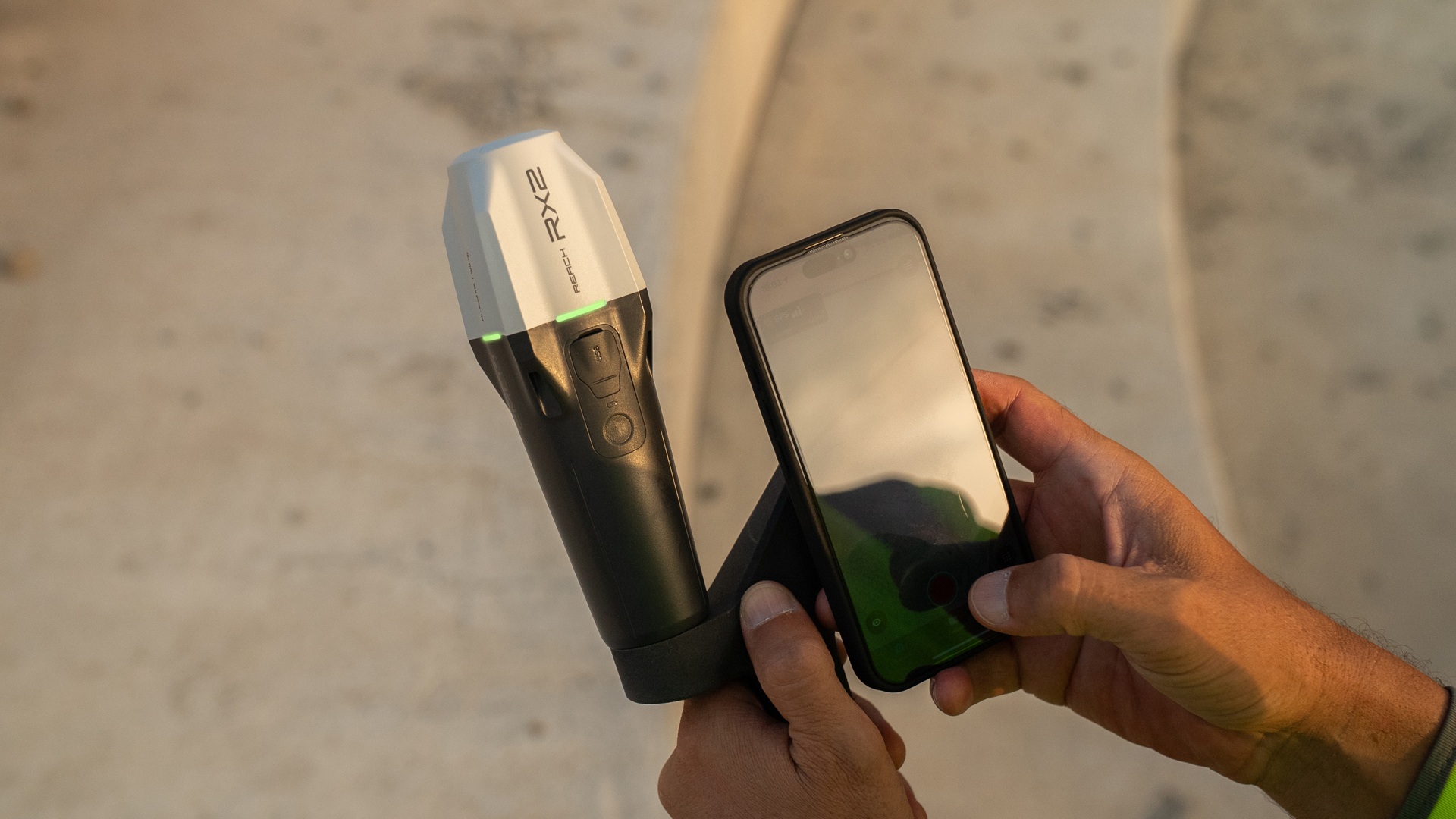
The Emlid Reach RX2 is a compact GNSS RTK receiver based on the same technology platform as the RS4, which also delivers a fast and stable FIX solution and precise measurement results. Thanks to the new GNSS chip, the RX2 can process signals from all common satellite systems on multiple frequencies and reliably determine positions even under difficult conditions. Unlike the RS4, the RX2 does not have an integrated radio module, making it particularly light, handy and flexible. This makes it ideal for users who are looking for a mobile and uncomplicated solution for accurate surveying – for example, in combination with Internet-based correction services (NTRIP).
TitleEmlid Flow app for GPS surveying
The Emlid Flow app is a software solution designed specifically for use with Emlid GNSS receivers such as the Reach RS3 and Reach RX. It is used to control these devices, collect data and process the collected GPS data. The app can be downloaded from Android and Apple and is available both free of charge and by subscription.
Here you can purchase an annual subscription for the Emlid Flow Survey App:

TitleEmlid Flow versions
Emlid Flow – free version
- Collecting and staking out points
- Coordinate systems, geoids and grid shifts
- Base shifts
- Export and import in CSV, DXF and SHP
- Built-in NTRIP client
- Full control over Reach receivers
Emlid Flow360 Cloud
- Project management and automatic synchronisation
- Export and import of survey data
The free Emlid Flow app is for simple projects that only require points or post-processing.
Emlid Flow Survey
- Collect and stake out lines
- Add survey codes on the go
- Use WMS/WMTS layers
- Satellite map
- Localisation
- Inverse and traverse
- Stakeout reports
Emlid Flow 360 Cloud
- Uploading code libraries
- Satellite map
- Using WMS/WMTS layers
- Inverse and traverse
- Reports on stakeouts
Emlid Flow Survey is for advanced surveying work. It includes all the benefits of the free version.
A single subscription for Emlid Flow and Emlid Flow 360.
The following video presents the differences between the free version of the Emlid Flo app and Emlid Flow Survey in more detail. We are sorry, but this video is only available in german languages.

TitleThe devices in comparison
Choosing the right GNSS receiver is crucial for achieving accurate results, streamlining workflows and ensuring reliable data collection.
Compare Emlid devices and find the optimal solution for your needs – whether in surveying, mapping, construction and infrastructure projects, asset management, inspections or inventory.
TitleSpecifications Reach RS4
| Positionierung | ||
|---|---|---|
| Precision | Static | H: 4mm + 0.5ppm V: 8mm + 1ppm |
| PPK | H: 5mm + 0.5ppm V: 10mm + 1ppm | |
| RTK | H: 7mm + 1ppm V: 14mm + 1ppm | |
| Convergence time | ~ 5s typically | |
| Tilt compensation | RTK + 2mm + 0.3mm/° | |
| Signal tracked | GPS: L1C/A, L2C, L5 GLONASS: L1OF, L2OF Galileo: E1-B/C, E5a, E6 BeiDou: B1I, B1C, B2a, B3I QZSS: L1C/A, L1C/B11, L2C, L5 NavIC: L1-SPS Data, L5- SPS | |
| Number of channels | 672 | |
| Update rates | Up to 10Hz |
| Connectivity | ||
|---|---|---|
| Emlid radio* | ||
| LoRA radio | Frequency range | 868/915 MHz |
| Power | 0.1 W | |
| Distance | Up to 8km | |
| UHF Funk | Frequency range | 410 - 470 MHz |
| Protocols | TRIMTALK 450S** | |
| Modulation type | GMSK | |
| LTE modem | Regions | Global |
| Bands | FDD-LTE: 1, 2, 3, 4, 5, 7, 8,12, 13, 18, 19, 20, 26, 28 TD-LTE: 38, 39, 40, 41 UMTS (UHPS/FDD): 1, 2, 5,8 Quad-band, 850/1900, 900/1800 MHz | |
| SIM card | Nano-SIM | |
| WiFi | 802.11a/b/g/n | |
| Bluetooth | Bluetooth 5.1 (BR/EDR + LE) | |
| Ports | RS-232, USB Type-C | |
| Data protocols | Corrections | NTRIP, RTCM3 |
| Position output | NMEA, LLH/XYZ | |
| Data logging | RINEX, NMEA, LLH/XYZ, UBX | |
| Internal storage | 16 GB |
*Use the correct antenna, LoRa or UHF, for your configuration.
**TRIMTALK is a trademark of Trimble Inc.
| Mechanical | |
|---|---|
| Dimensions | 128,6 x 128,6 x 99,3mm |
| Weight | 920g |
| Operation temperature | -40 to +65 °C |
| Ingress protection | IP68 |
| Electrical | |
|---|---|
| Autonomy | 16 hrs as RTK rover with tilt, 22 hrs of logging |
| Battery | Li-Ion 5000 mAh, 7.2 V, 36Wh |
| Charging | USB Type-C (PD): 5V—3A,9V—3A, 12V—3A, 15V—3A |
TitleSpecifications Reach RS4 Pro
| Positioning | ||
|---|---|---|
| Precision | Static | H: 4mm + 0.5ppm V: 8mm + 1ppm |
| PPK | H: 5mm + 0.5ppm V: 10mm + 1ppm | |
| RTK | H: 7mm + 1ppm V: 14mm + 1ppm | |
| Convergence time | ~ 5s typically | |
| Tilt compensation | RTK + 2mm + 0.3mm/° | |
| Signal tracked | GPS: L1C/A, L2C, L5 GLONASS: L1OF, L2OF Galileo: E1-B/C, E5a, E6 BeiDou: B1I, B1C, B2a, B3I QZSS: L1C/A, L1C/B11, L2C, L5 NavIC: L1-SPS Data, L5- SPS | |
| Number of channels | 672 | |
| Update rates | Up to 10 Hz |
| Connectivity | ||
|---|---|---|
| Emlid radio* | ||
| LoRA radio | Frequency range | 868/915MHz |
| Power | 0.1W | |
| Distance | Up to 8km | |
| UHF Funk | Frequency range | 410 - 470MHz |
| Protocols | TRIMTALK 450S** | |
| Modulation type | GMSK | |
| LTE modem | Regions | Global |
| Bands | FDD-LTE: 1, 2, 3, 4, 5, 7, 8,12, 13, 18, 19, 20, 26, 28 TD-LTE: 38, 39, 40, 41 UMTS (UHPS/FDD): 1, 2, 5,8 Quad-band, 850/1900, 900/1800 MHz | |
| SIM card | Nano SIM | |
| WiFi | 802.11a/b/g/n | |
| Bluetooth | Bluetooth 5.1 (BR/EDR + LE) | |
| Ports | RS-232, USB Type-C | |
| Data protocols | Corrections | NTRIP, RTCM3 |
| Position output | NMEA, LLH/XYZ | |
| Data logging | RINEX, NMEA, LLH/XYZ, UBX | |
| Internal storage | 16 GB |
*Use the correct antenna, LoRa or UHF, for your configuration.
**TRIMTALK is a trademark of Trimble Inc.
| Imaging | |
|---|---|
| Image sensors | 1/2.6 in, CMOS, globalshutter, Full HD |
| Field of view | Front camera: Bottom camera: |
| Video frame rate | 25 fps |
| Geräteeigenschaften | |
|---|---|
| Dimensions | 128,6 x 128,6 x 99,3mm |
| Weight | 920g |
| Operation temperature | -40 to +65 °C |
| Ingress protection | IP68 |
| Electrical | |
|---|---|
| Autonomy | 16 hrs as RTK rover with tilt, 22 hrs of logging |
| Battery | Li-Ion 5000 mAh, 7.2 V, 36Wh |
| Charging | USB Type-C (PD): 5V—3A,9V—3A, 12V—3A, 15V—3A |
TitleSpecifications Reach RX2
| Positioning | ||
|---|---|---|
| Precision | RTK | H: 7mm + 1ppm V: 14mm + 1ppm |
| Tilt | RTK + 2mm + 0.3mm/° | |
| Convergence time | ~ 5 s typically | |
| Signal tracking | GPS: L1C/A, L2C, L5 GLONASS: L1OF, L2OF Galileo: E1-B/C, E5a, E6 BeiDou: B1I, B1C, B2a, B3I QZSS: L1C/A, L1C/B11, L2C, L5 NavIC: L1-SPS Data, L5-SPS | |
| Number of channels | 672 | |
| Update rates | 5 Hz |
| Connectivity | |
|---|---|
| Communication interface | Bluetooth 4.2 (BR/EDR + LE) |
| Ports | USB Type-C port |
| Input data format | RTCM3 |
| Input data protocoll | NTRIP |
| Position data format | NMEA |
| Mechanical | |
|---|---|
| Dimensions | 172 x 51 x 51mm (6.77" x 2.00" x 2.00") |
| Mount | 5/8”-11 UNC and quick release |
| Weight | 280 g (0.62 lb) |
| Operations temperature | -20 to +65 °C (-4 to 149 °F) |
| Ingress protection | IP68 (maximum depth of 1.5 meters up to 30 minutes) |
| Akku und Energie | |
|---|---|
| Laufzeit | Bis zu 16 Stunden |
| Akku | Li-Ion 7000 mAh, 3.6 V, 25.2 Wh |
| Aufladung | USB Type-C 5 V 2 A |
| Zertifizierung | FCC, CE, IC, MFi |
Better advice as a user
If you are interested in our offer or would like to learn more about the RS4, RS4 Pro and RX2, then call us today and arrange a free and non-binding consultation appointment for you. We will answer all your questions. As a dealer and at the same time a user, we are well positioned to assist you even after the purchase.