
XGRIDS Lixel L3

TitleXGRIDS Lixel L3: One Scan, Three 3D Results
The XGRIDS Lixel L3 is a mobile 3D laser scanner designed for the fast and detailed capture of indoor and outdoor areas. It combines LiDAR, cameras, an IMU, and integrated RTK in a single device that generates a color point cloud during data acquisition. After processing, the same dataset can be used as a true-color point cloud, a mesh, and a photorealistic 3D Gaussian splatting scene. This allows for geometric analyses and vivid visualizations based on a single scan.
The Lixel L3 is particularly well-suited for surveying, construction, digital twins, and the documentation of complex existing environments. Its built-in display shows the captured point cloud and the scan progress directly on-site. This allows users to identify, even during the site walkthrough, which areas still need to be captured.
TitlePrecise Geometry for As-Built Data
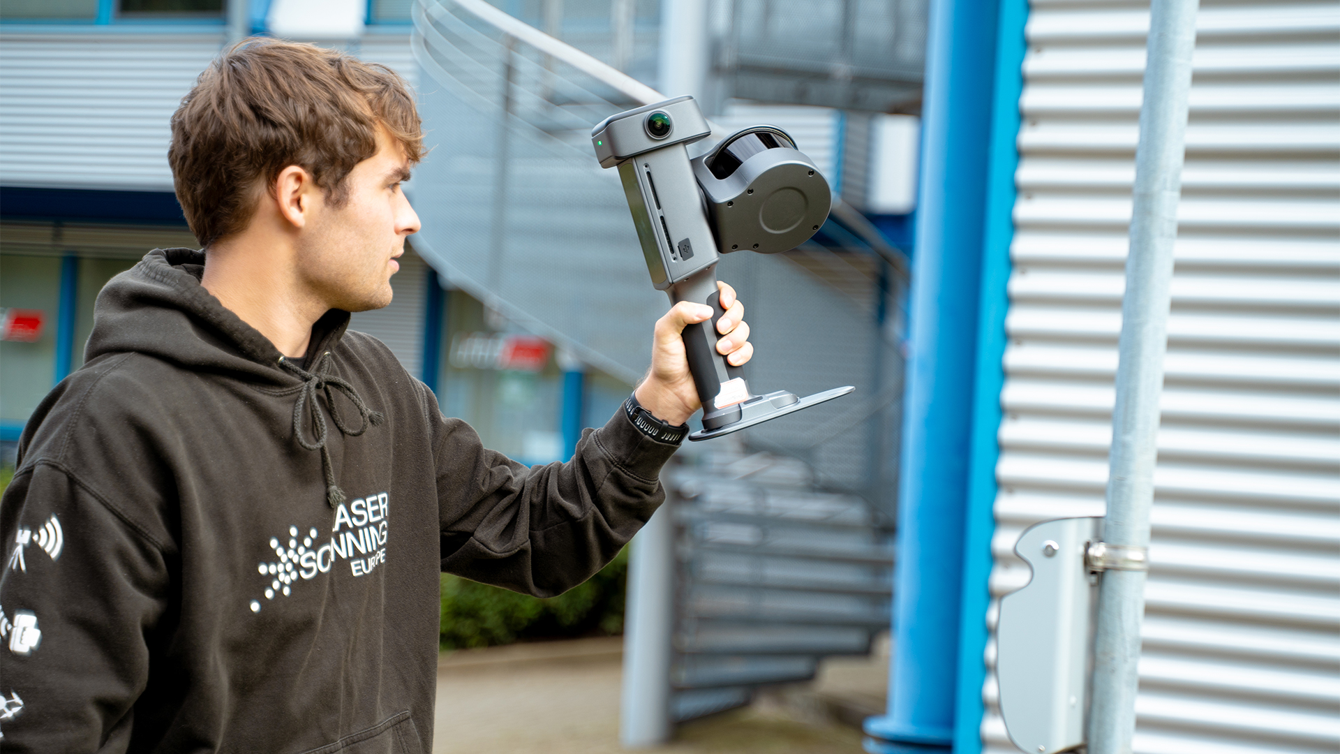
The XGRIDS Lixel L3 captures buildings, facilities, and outdoor areas as a detailed 3D point cloud. XGRIDS specifies a relative accuracy of 5 mm for the post-processed data. This describes how precisely spatial distances are represented within the point cloud. The value was determined in a 500 m² test environment at a sigma level and therefore does not apply universally to every scan.
A colored point cloud is generated even while scanning is in progress, with a specified relative real-time accuracy of 1 cm. Real-time loop closure and alignment optimizations help reduce drift and layering. For applications with high accuracy requirements, the results should be verified using control measurements.
TitleAbsolute Accuracy & Georeferencing
Absolute accuracy, on the other hand, describes how well the point cloud is positioned within a higher-level coordinate system. XGRIDS specifies an RMSE of 2 cm after processing and 2.5 cm RMSE in real time. The integrated RTK supports georeferencing, provided that GNSS reception and suitable correction data are available. This allows the scan data to be merged with other georeferenced project information.
Indoors or in shaded areas, the RTK signal may be limited. In such cases, a carefully planned scan route and, if necessary, control points can help with positioning. The actual accuracy achieved always depends on the measurement conditions.
TitleColor accuracy that makes analysis easier
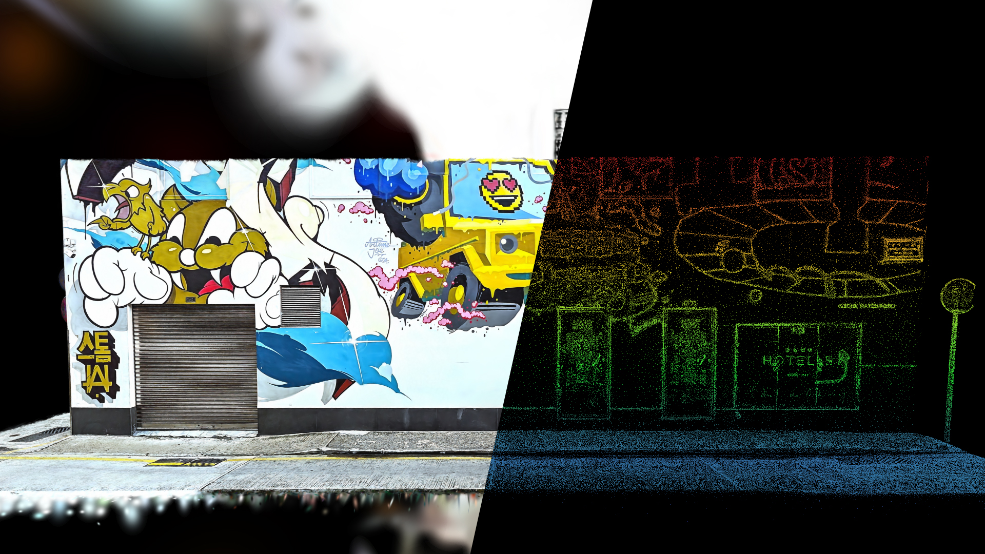
For image capture, the Lixel L3 uses three 50-megapixel cameras, each with 1/1.3-inch sensors. The 4K HDR imaging technology helps preserve details in both bright and dark areas of the image. This makes materials, signage, cables, and other features more easily recognizable in the color point cloud. The image data is also used to create textured meshes and photorealistic 3DGS scenes.
For selected objects or areas, the point cloud can be refined locally without densifying the entire dataset in the same way. This is particularly helpful when, for example, pipes, railings, or nameplates need to be examined more closely. How well individual surfaces are rendered continues to depend on visibility, lighting, material, and shooting distance.
TitleThree results from a single image
The true-color point cloud forms the geometric basis for measurements, as-built drawings, and scan-to-BIM processes.
A mesh describes surfaces as a continuous geometric structure and is suitable for modeling, visualization, and other 3D applications.
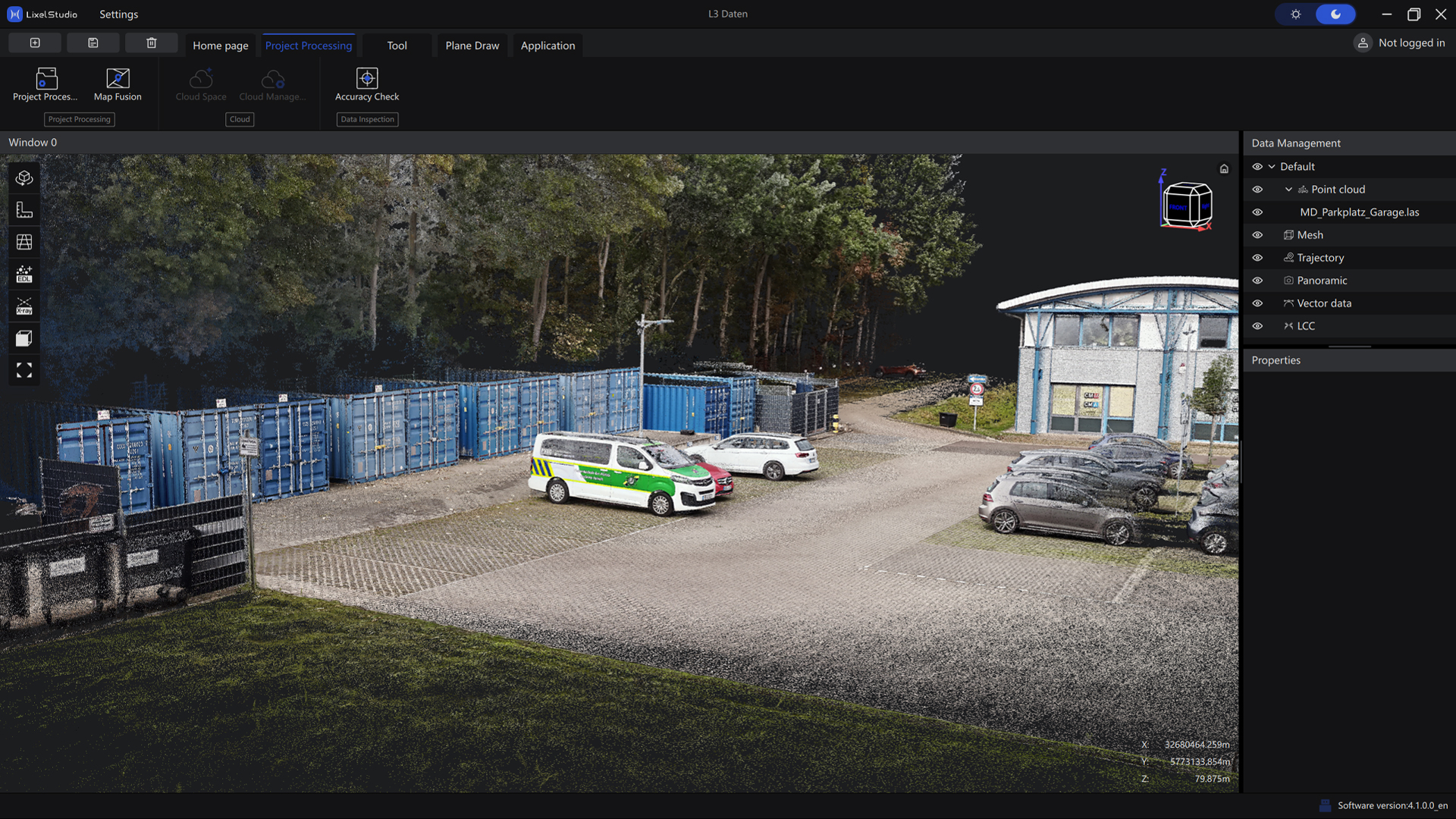
A 3D Gaussian splatting model provides a particularly vivid representation of the captured environment and can be used for digital tours, presentations, or virtual productions. All three outputs are based on the same captured project but are processed and exported using the appropriate XGRIDS tools depending on the target format. This allows surveying, planning, and communication to build on a common data foundation. The most appropriate output depends on whether the focus is on measurable geometry, editable surfaces, or a spatial effect that is as realistic as possible. For a complete project, these formats can also be used in combination.

TitleA mount for a wide range of applications
The XGRIDS Lixel L3 captures rooms, buildings, and facilities as three-dimensional as-built data during a mobile survey. Its combination of precise point clouds and color image data makes the results usable for both technical and visual tasks. Experts can derive measurements from the point cloud, prepare cross-sections, and build as-built models. With Mesh and 3DGS, project participants also receive easy-to-understand views of the surveyed environment. Collaborative data collection is particularly useful when a site is later analyzed by multiple teams. The specific survey plan depends on the area size, accessibility, desired level of detail, and accuracy requirements.
Surveying, Construction Surveying & Scan-to-BIM
During as-built surveys, the Lixel L3 documents rooms, facades, and structural connections as a continuous point cloud. Floor plans, elevations, sections, and as-built models can be derived from this data. The color-coded representation makes it easier to identify building components and technical installations, for example during renovations and retrofits. For CAD and scan-to-BIM workflows, the data should be properly referenced and verified using control dimensions.
Infrastructure, Industry, and Facility Management
Bridges, traffic areas, and technical facilities can be spatially documented during an inspection. In the color-coded point cloud, pipes, railings, and other fixtures are visible in the context of their surroundings. Relevant areas can be zoomed in on locally for a more detailed analysis. Real-time filters for moving objects and loop closure support the capture of larger or more complex areas.
Cultural Heritage, Architecture, and Digital Twins
For historic buildings and monuments, the Lixel L3 captures both geometry and appearance in a single scan. The point cloud is used for as-built documentation, while a textured mesh represents architectural structures and surfaces. With 3DGS (3D Gaussian Splatting), teams, clients, and visitors can explore a location photorealistically from a distance. Faces and license plates can be automatically blurred during post-processing; the results should be reviewed before publication.
Film Production, Visualization & Simulation
For location scouting, you can use the Lixel L3 to digitally capture real-world filming locations and explore them as photorealistic 3DGS scenes. This allows you to assess perspectives, paths, and spatial details even before an on-site visit. The scenes can be integrated into appropriate Unreal Engine workflows for previsualization and virtual production. Point clouds and meshes are also available for geometric editing, digital twins, and other applications.
TitleHow does the XGRIDS Lixel L3 work?
For location scouting, you can use the Lixel L3 to digitally capture real-world filming locations and explore them as photorealistic 3DGS scenes. This allows you to assess perspectives, paths, and spatial details even before an on-site visit. The scenes can be integrated into appropriate Unreal Engine workflows for previsualization and virtual production. Point clouds and meshes are also available for geometric editing, digital twins, and other applications.
TitleLiDAR & SLAM: Capturing Geometry During a Site Survey
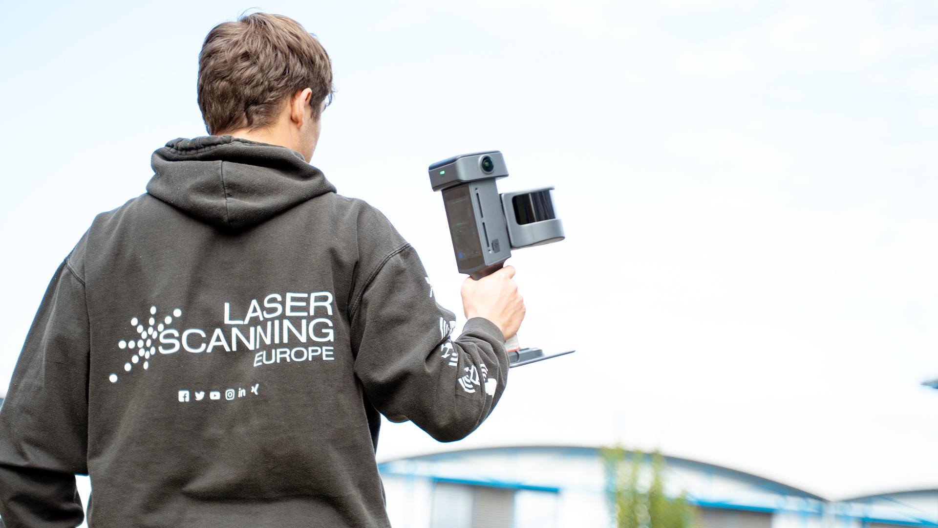
The LiDAR on the XGRIDS Lixel L3 measures distances based on emitted and returning laser pulses. The 16-channel version captures up to 320,000 points per second, while the 32-channel version captures up to 640,000 points per second; the specified measurement range is 0.7 to 120 meters.
SLAM and IMU combine measurements taken during movement to create a spatial map. When re-traversing areas that have already been mapped, real-time loop closure can optimize the trajectory and reduce drift. A well-planned scan route and sufficient overlap between scans remain essential for reliable results.
TitleCameras, HDR, and True-Color Point Cloud
Two panoramic cameras and a forward-facing RGB camera capture image data in parallel with the LiDAR. XGRIDS specifies that each of the three cameras has a 50-megapixel, 1/1.3-inch sensor and an output resolution of 4096 × 3072 pixels. HDR helps preserve details in both bright and dark areas of the image.
The images are linked to the geometry, making it easier to identify components and materials in the true-color point cloud. This same image data is later used to texture meshes and create photorealistic 3DGS scenes.
TitleRTK, Real-Time Processing & On-Site Monitoring
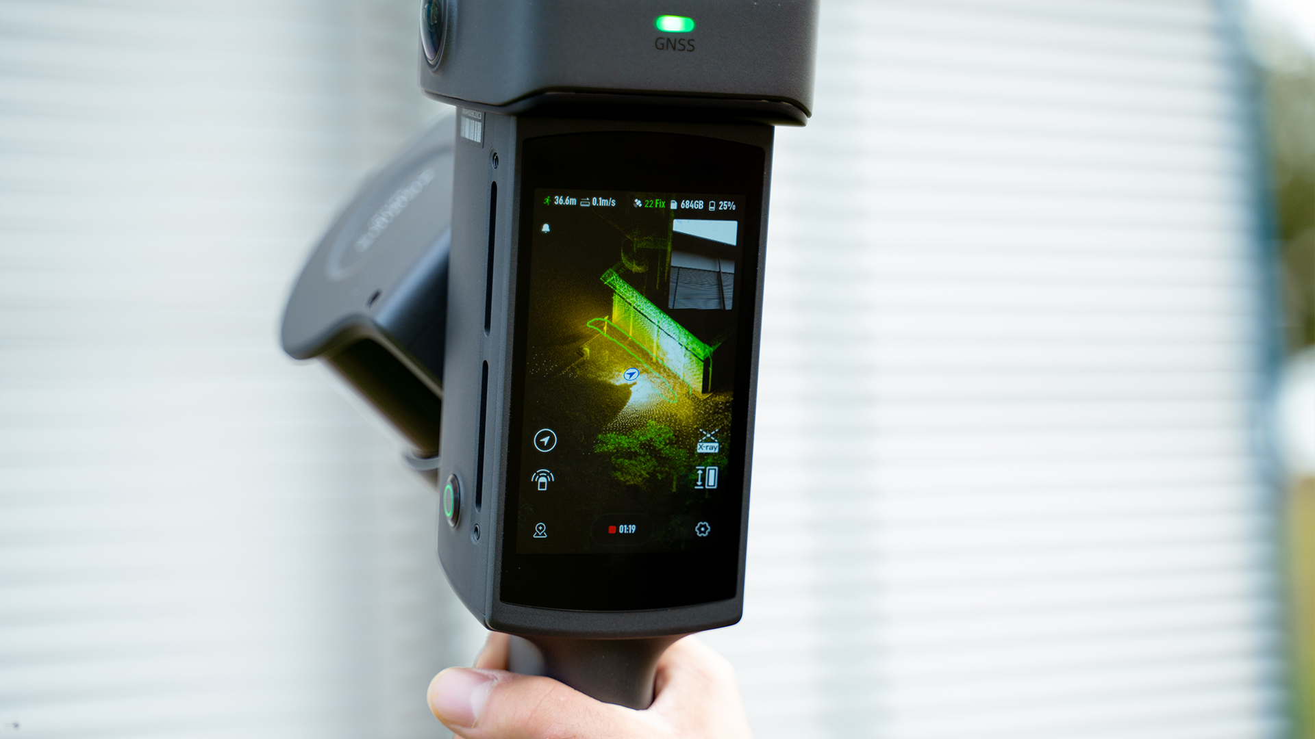
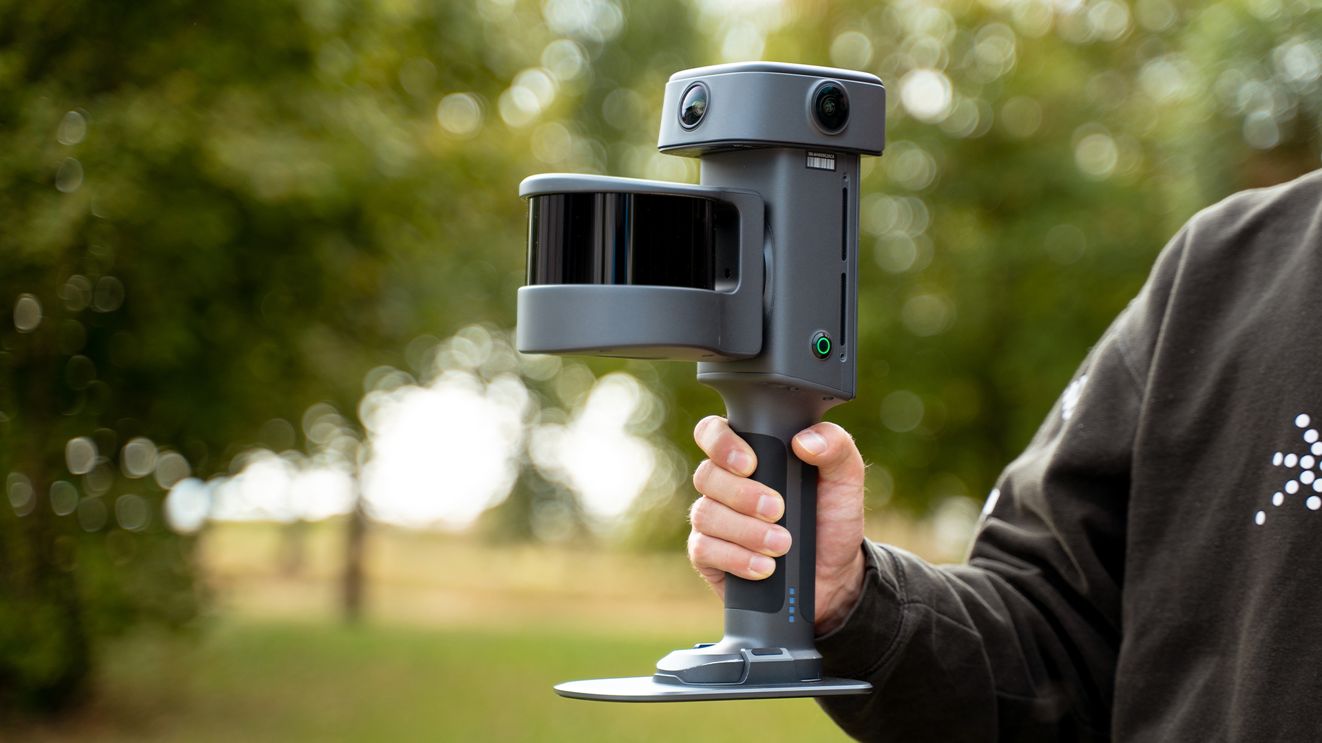
With adequate GNSS reception and available correction data, the integrated RTK ties the survey to absolute coordinates. During scanning, loop closure, leveling optimization, and AI-assisted filtering support the generation of a usable real-time point cloud. XGRIDS specifies a relative accuracy of 1 cm and an absolute accuracy of 2.5 cm RMSE under the specified conditions. The 4.3-inch display allows you to monitor the point cloud, scan progress, and captured areas without a connected smartphone. A target tip on the handle is available for control points; if GNSS reception is limited, referencing should be planned appropriately for the project.
TitlePost-processing & Export for the Rest of the Workflow
In LixelStudio, scans are processed for measurements, point cloud editing, and technical exports. Depending on the project, multiple scans can be merged using ICP, control points, or overlapping areas. Individual objects can be rendered in greater detail by locally refining the point cloud.
Lixel CyberColor (LCC) creates photorealistic 3DGS scenes from the captured data; meshes are also available as an output format. Supported formats include LAS, E57, and RCP for point clouds; OBJ for meshes; and LCC, LCC2, and PLY for 3DGS.

TitleTechnical Specifications of the XGRIDS Lixel L3
The XGRIDS Lixel L3 is available in a 16-channel LiDAR version and a 32-channel LiDAR version. According to the manufacturer’s documentation, both versions have a maximum specified LiDAR range of 120 meters. They differ primarily in their point measurement rates, which are 320,000 and 640,000 points per second, respectively. The relative accuracy of 5 mm refers to post-processed data under defined test conditions. For a practical comparison, absolute accuracy, real-time performance, operating time, and power requirements should also be considered. The following overview summarizes the technical specifications provided. Accuracy values should be interpreted in conjunction with the notes below the table.
TitleLiDAR, Image Sensors & Accuracy
| Feature | Lixel L3 |
|---|---|
| LiDAR Variants | 16 channels / 120 m; 32 channels / 120 m |
| LiDAR Range | 0.7–120 m |
| Measurement Rate | 320,000 points/s (16 channels); 640,000 points/s (32 channels) |
| LiDAR Fieldof View | approx. 360° × 270° |
| Laser Class and Wavelength | Class 1; 905 nm |
| Cameras | 2 panoramic cameras and 1 forward-facing RGB camera; 3 × 50 MP |
| CMOS Sensor Format | 1/1.3 inch |
| Image Output | 4096 × 3072 pixels; DCG HDR |
| Post-Processed Relative Accuracy | 5 mm (1σ; 500 m² test environment) |
| Post-Processed Point Cloud Thickness | ≤ 5 mm |
| Absolute Accuracy - Horizontal / Vertical | 2 cm RMSE each |
| Repeatibility | 2 cm |
| Real-Time Relative Accuracy | 1 cm |
| Real-Time Absolute Accuracy - Horizontal / Vertical | 2.5 cm RMSE each |
| Leveling with / without RTK Fusion | 0.005° / 0.02° |
The 5 mm figure describes the relative accuracy after post-processing, measured in a special 500 m² test environment at a Sigma level. The absolute accuracy of 2 cm and the real-time accuracy of 2.5 cm are specified as RMSE values and should be distinguished from this. The point cloud density of no more than 5 mm, in turn, describes another characteristic of the reconstructed data. The values mentioned depend on the defined GNSS and test conditions; results may vary in actual use. Object surfaces, visibility conditions, the scan route, and the selected processing methods also influence data quality. For projects with binding tolerances, control points and suitable reference points should be planned before data collection begins. This ensures that the manufacturer’s specifications and the actual verified project accuracy remain clearly traceable.
TitleDevice, Display, and Operation
| Feature | Lixel L3 |
|---|---|
| Dimensions | 206 × 107 × 329 mm |
| Weight | approx. 2.5 kg including battery |
| Internal Storage | 1 TB UFS |
| Data Interface | USB 3.1 Gen 2 |
| Integrated RTK | Yes; compatible with standard RTK survey poles |
| GNSS Module - Specified Positioning Accuracy | Horizontal: 0.8 cm + 1 ppm; Vertical: 1.5 cm + 1 ppm |
| Display | 4.3-inch TFT; 480 × 800 pixels; up to 1,000 nits |
| Battery Votage / Capacity | 14,4 V / 3.350 mAh |
| Specified Total Operating Time | 100 minutes |
| Power Consumption | < 30 W |
| Operating Temperature | −20 °C to +50 °C |
| IP Rating | IP54 |
| Housing | Aluminum alloy |
| Wi-Fi | 802.11 a/b/g/n/ac/ax |
| Bluetooth | 2.1+EDR / 3.0+HS / 4.2 / 5.0 / 5.2 |
The built-in display allows you to monitor the point cloud, trajectory, and scan coverage directly on the device. With a specified brightness of up to 1,000 nits, it is designed for outdoor use. The battery life of 100 minutes is a manufacturer’s specification and may vary depending on usage and operating conditions. The stated weight of approximately 2.5 kg refers to the device including the battery. An optional carrying system can distribute the weight across the shoulder and upper body during longer scanning sessions. A target tip on the lower handle is provided for capturing control points. When working at height or with reference points, the scanner can be connected directly to a compatible standard surveying pole.
TitleProcessing, Output Formats, and Accessories
| Feature | Lixel L3 |
|---|---|
| Real-Time Functions | Colorized point cloud, loop closure, moving objects and noise filtering, leveling optimization |
| On-Device Display | Model preview and measurement |
| Point Cloud Refinement | Local enhancement of selected areas |
| Multi-Scan Merging | ICP, control points, overlap-based alignment |
| Privacy Protection | Automatic detection and anonymization of face and license plates |
| Point Cloud Formats | .las, .rcp, .e57, .ply, .ilas |
| Image Format | .jpg |
| Mesh Format | .osgb, .obj |
| 3DGS Formate | .lcc2, .lcc, .ply |
| Additional Formats | 3D Tiles (.3tz), .usd |
| Standard Accessories | Base mount, charging hub, carrying case with backpack system |
| Optional Acessories | Carrying system |
The point cloud formats LAS, E57, RCP, and PLY are particularly relevant for further technical processing. OBJ and OSGB cover the mesh outputs listed in the overview. For 3D Gaussian Splatting, formats such as LCC, LCC2, and PLY are available. The export options directly available may vary depending on the software, license, and selected processing path. LixelStudio also provides so-called “Creator Data,” such as perspective images and COLMAP datasets, for custom workflows. LCC can make original image data and intermediate data from the 3DGS reconstruction accessible. Planned accessories, such as drone, vehicle, or robot mounts, are not part of the currently available equipment described here.
Better advice for users
If you’re interested in our offer or would like to learn more about the XGRIDS Lixel L3, give us a call today to schedule a free, no-obligation consultation. We’ll answer all your questions. As an XGRIDS Gold reseller and user ourselves, we’re well-positioned to support you even after your purchase.