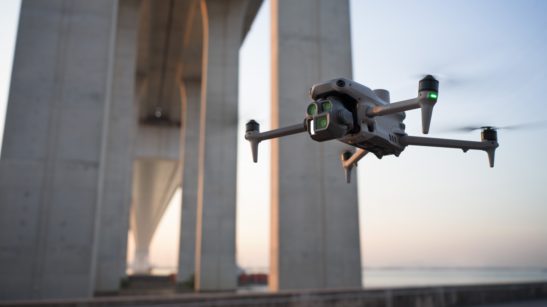
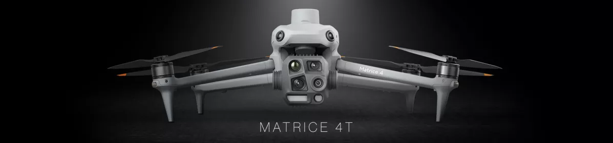
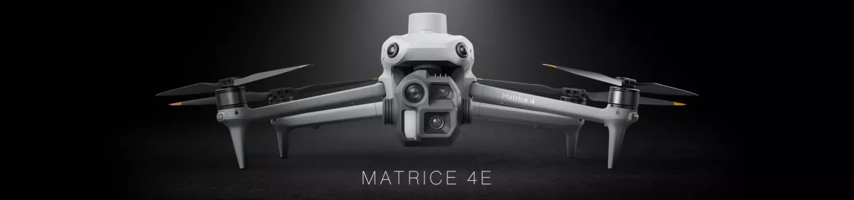
DJI Matrice 4 Series

TitleDJI Matrice 4 - Multi-sensor UAV with AI detection and outstanding low-light performance
With the new DJI Matrice 4 series, DJI is once again setting new standards in industrial UAV technology. The two models, Matrice 4E and Matrice 4T, offer powerful features that have been specially developed for professional applications. Thanks to state-of-the-art sensor technology, long flight times, and robust construction, they are ideal for demanding tasks in the fields of surveying, inspection, security, and rescue operations.
TitleNext-level UAV technology for professional use
With the DJI Matrice 4 series, DJI is taking industrial UAV technology to a new level. This compact and intelligent enterprise-class UAV has been specially developed for professional applications and offers advanced sensor technology, improved safety features, and versatile application options.
Thanks to intelligent detection and measurement systems, improved obstacle detection, and a robust design, flight operations are safer and more reliable than ever before. In addition, the accessories for the Matrice 4 series have been further optimized to ensure maximum efficiency and flexibility.
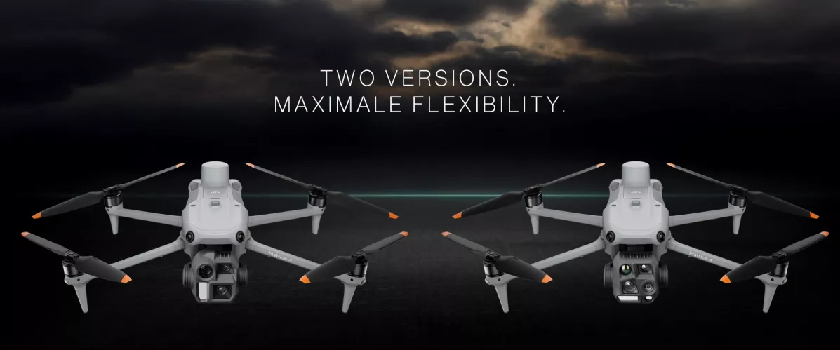
The DJI Matrice 4 series offers state-of-the-art drone technology for professional applications. The two models, Matrice 4E and Matrice 4T, provide powerful solutions for a variety of applications.
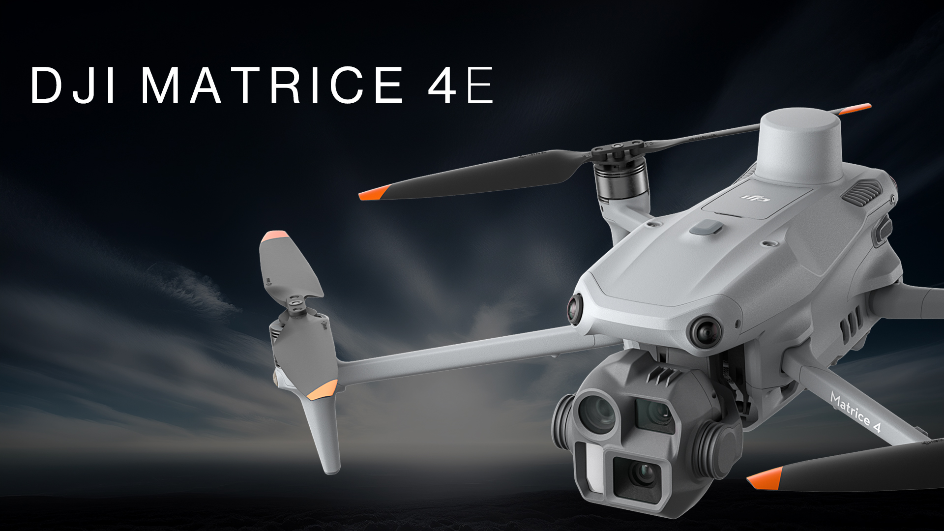
- Matrice 4E was developed specifically for surveying and mapping and offers high-precision GNSS technology and powerful camera systems for geospatial applications.
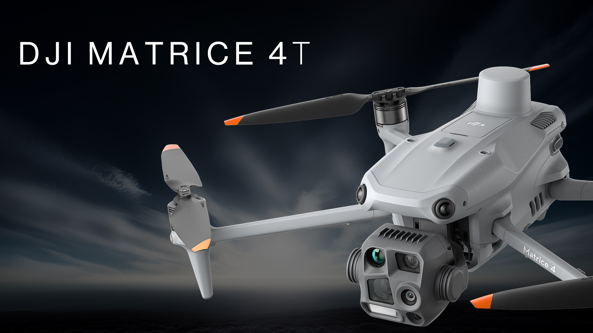
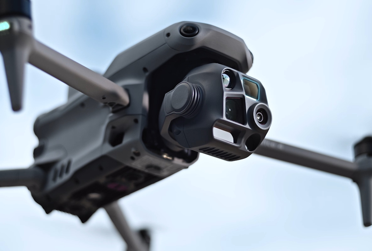
- Matrice 4T is the perfect choice for inspection, security, and rescue missions. It is equipped with a multi-sensor payload that includes a zoom camera, a thermal imaging camera, and a laser rangefinder, among other features.
Both models offer robust construction, advanced safety features, and intuitive controls for maximum efficiency in use.
TitleMatrice 4E & Matrice 4T in comparison
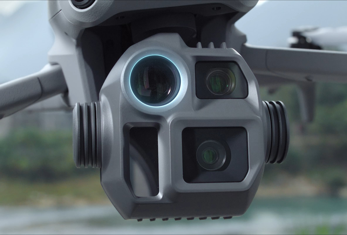
Wide-angle camera
1/1.3" CMOS, 48 MP effective pixels, f/1.7, equivalent focal length: 24mm
Medium telephoto camera
1/1.3" CMOS, 48 MP effective pixels, f/2.8, equivalent focal length: 70mm
Telephoto camera
1/1.5" CMOS, 48 MP effective pixels, f/2.8, equivalent focal length: 168mm
Laser rangefinder
Measuring range: 1800m (1 Hz); measuring range at oblique incidence (ratio 1:5): 600m (1 Hz)
Blind zone: 1m ; range accuracy (m): ± (0.2 + 0.0015 × D)
Infrared thermal imaging camera
Resolution 640 × 512, f/1.0, equivalent focal length: 53mm, uncooled VOx microbolometer, supports high-resolution mode
NIR auxiliary lighting
Field of view: 6°, illumination distance: 100m
Wide-angle camera
4/3 CMOS, 20 MP effective pixels, f/2.8-f/11, equivalent format: 24mm, mechanical shutter
Medium telephoto camera
1/1.3″ CMOS, 48 MP effective pixels, f/2.8, equivalent format: 70mm
Telephoto camera
1/1.5″ CMOS, 48 MP effective pixels, f/2.8, equivalent format: 168mm
Laser rangefinder
Measuring range: 1800m (1 Hz); measuring range at oblique incidence (ratio 1:5): 600m (1 Hz)
Blind zone: 1m; range accuracy (m): ± (0.2 + 0.0015 × D)
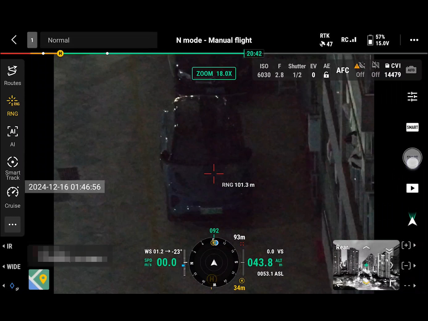
TitleNight Mode
The Matrice 4 series has been equipped with a powerful upgrade for night mode. The new full-color night vision camera now offers three different modes and two levels of optimized noise reduction for even clearer images. Thanks to the integrated IR cut filter and NIR auxiliary lighting, it can handle even the most challenging lighting conditions and ensures that objects remain reliably detected and visible during search and rescue operations.
TitleSmart photos in low light conditions
The Matrice 4 series cameras feature a larger aperture and intelligent low-light capabilities that significantly optimize image quality.
This greatly improves performance in dim lighting conditions and at night, enabling accurate and clear imaging even in challenging conditions.
TitleOmnidirectional wide-angle detection in low light conditions
The Matrice 4 series is equipped with six high-resolution wide-angle vision sensors that have been specially optimized for use in low light conditions. These not only improve visual positioning in poor lighting conditions, but also significantly enhance obstacle detection.
This enables the UAV to automatically avoid obstacles, intelligently adjust its route, and return safely, even in low-light urban environments.
TitleThermal imaging sensor
The Matrice 4T features a high-resolution infrared mode with an image resolution of up to 1280 × 1024. Thanks to its ultra-high level of detail, even the smallest temperature differences can be reliably detected.
Each device undergoes precise temperature accuracy calibration and is equipped with an integrated temperature sensor that enables real-time temperature measurements.
TitleNIR supplementary lighting
The Matrice 4T is equipped with innovative NIR lighting technology that provides illumination up to 100 meters.
This makes objects clearly visible even in dark environments, making it ideal for applications such as wildlife conservation.
TitleImpressive features
Fast 0.5-second interval shooting
The Matrice 4E's wide-angle camera enables fast interval shooting at 0.5-second intervals in both orthophoto and oblique image modes. This allows high-resolution aerial images to be captured efficiently from different perspectives.
In addition, the drone can reach a mapping flight speed of up to 21 meters per second, which significantly increases productivity.
TitleMulti-directional recording - multiplied efficiency
5-directional oblique capture
The Matrice 4 series features an innovative 5-axis oblique camera mount. The gimbal intelligently adjusts its orientation and captures images from different angles depending on the capture area.
Compared to previous models, this allows for multiple shots in a single flight and significantly increases the efficiency of oblique photography with compact drones.
3-axis ortho-surveying
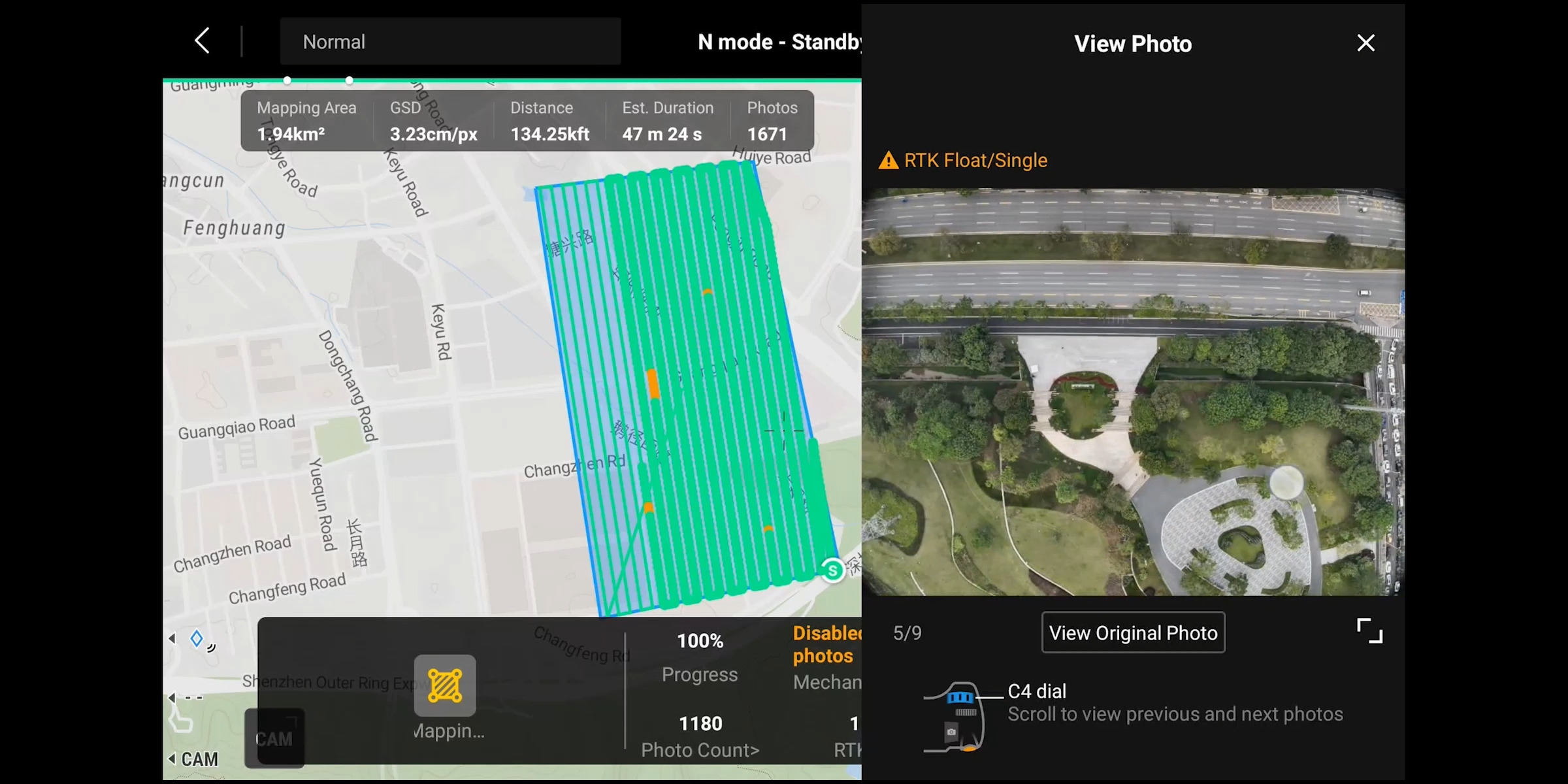
DJI Matrice 4E supports 3-axis ortho capture and enables simultaneous lateral capture, reducing lateral overlap. An area of 2.8 square kilometers can be mapped in a single flight. An additional flight route for altitude optimization is not required to ensure high altitude accuracy.
In conjunction with the advanced features of DJI Terra, reconstruction speed is further optimized without compromising quality.
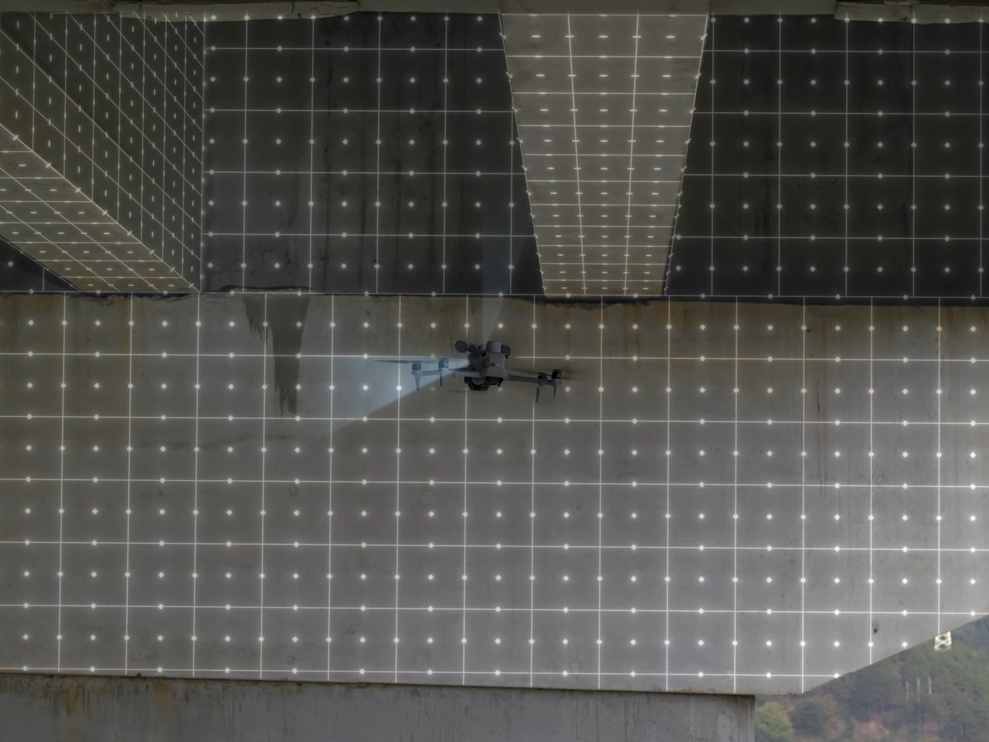
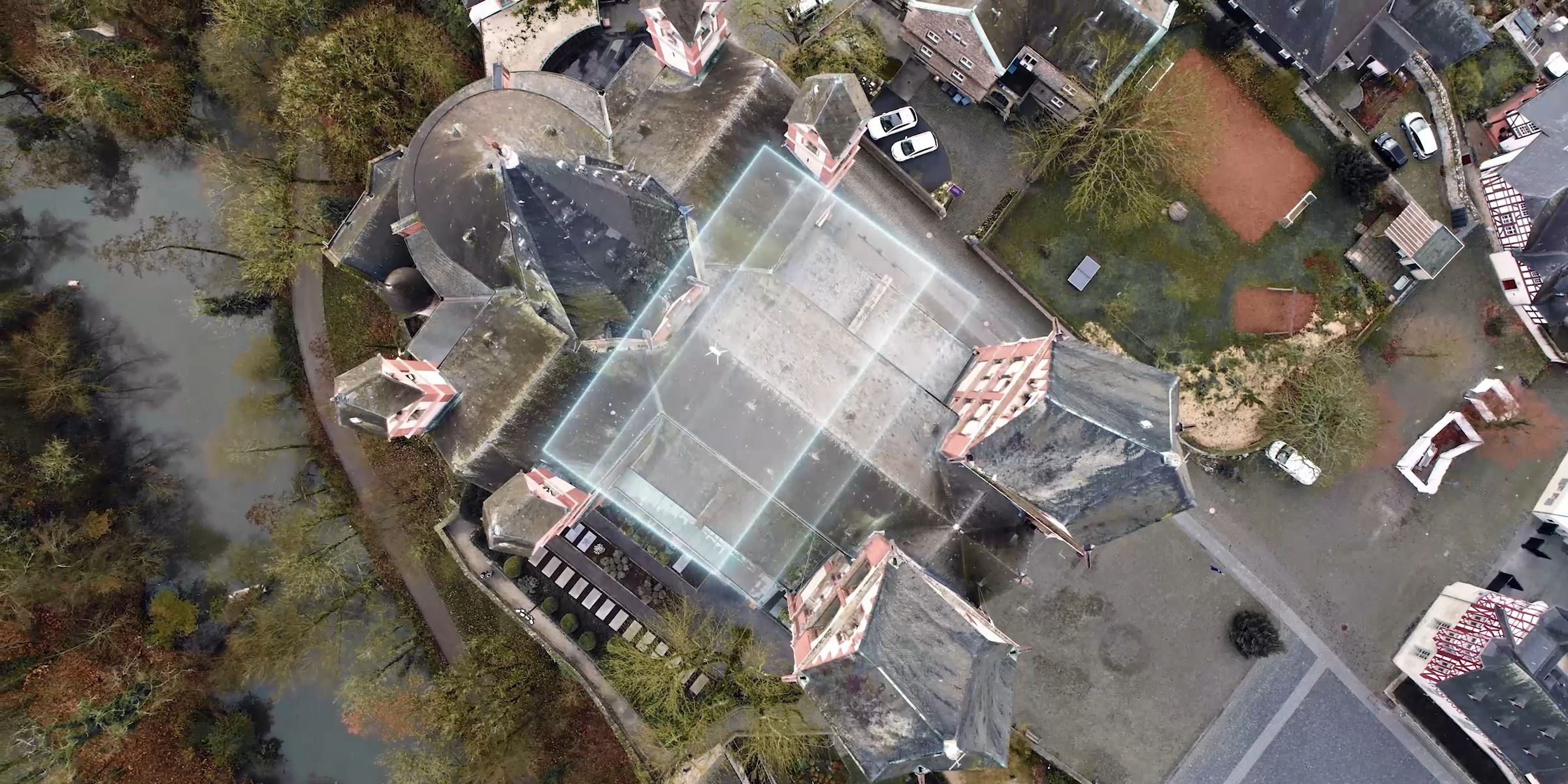
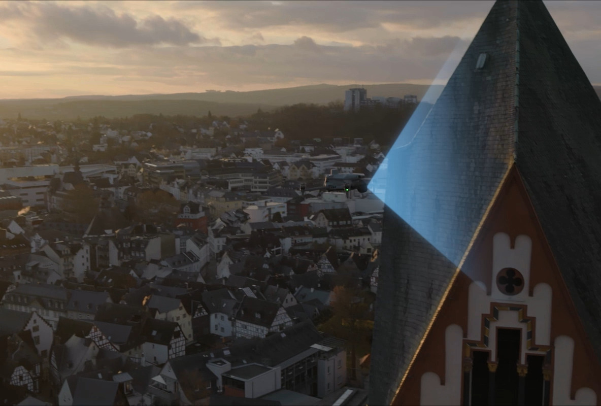
TitleIntelligent 3D capture & precision modeling
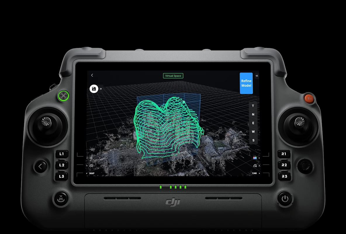
DJI Matrice 4E features intelligent 3D sensing that allows you to create a rough model directly on the remote controller. Based on this model, precise mapping routes close to the surface of a structure can be quickly generated to perform detailed measurements and modeling of complex structures.
It also offers the ability to display virtual flight routes and waypoint photos, allowing you to conveniently assess the coverage area and flight safety of specific routes.
TitleAutomatically generated report on the surveying process
After completing a mission, DJI Pilot 2 automatically generates a survey quality report. This report contains detailed information such as photo points, RTK status, and photo parameters.
If any anomalies are detected, additional photos can be taken on site to avoid repeat missions.
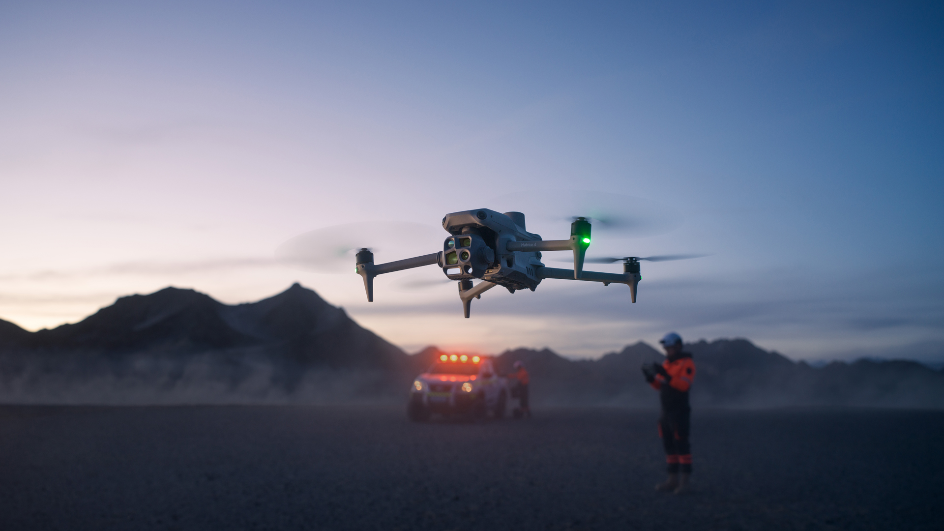
TitleSafe flight & worry-free operation
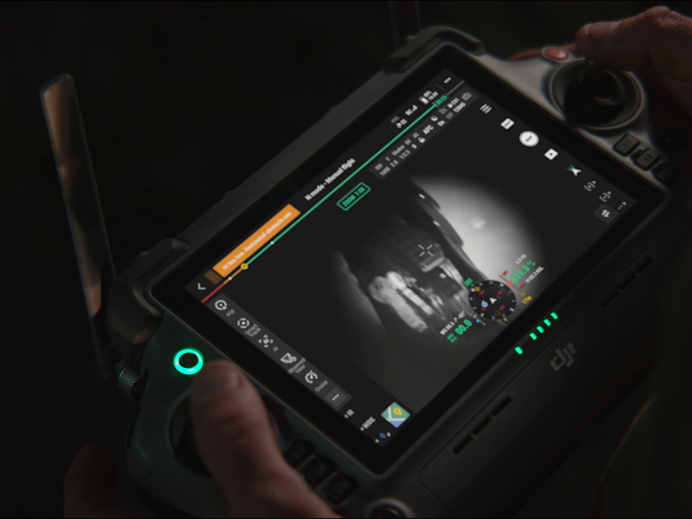
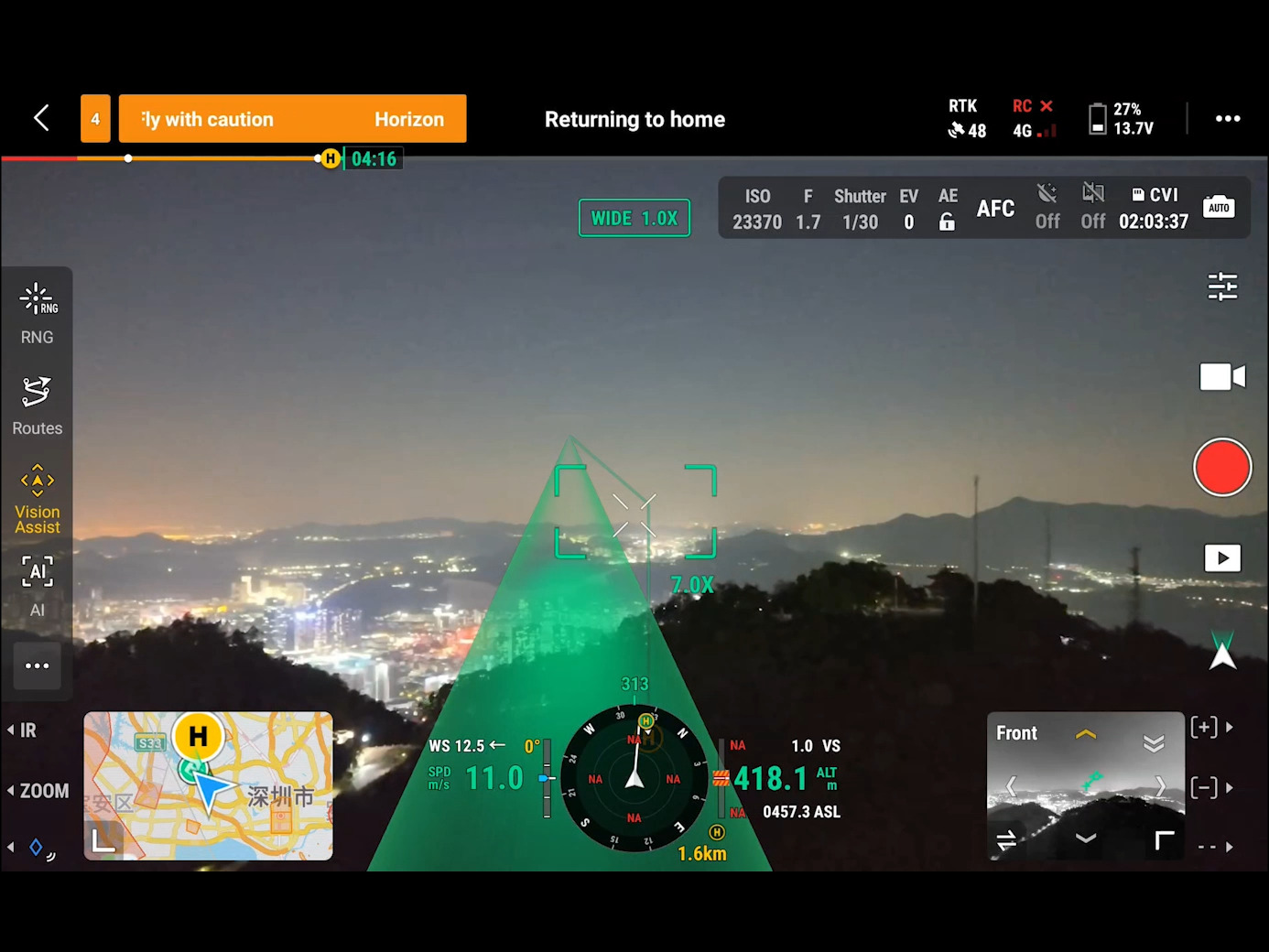
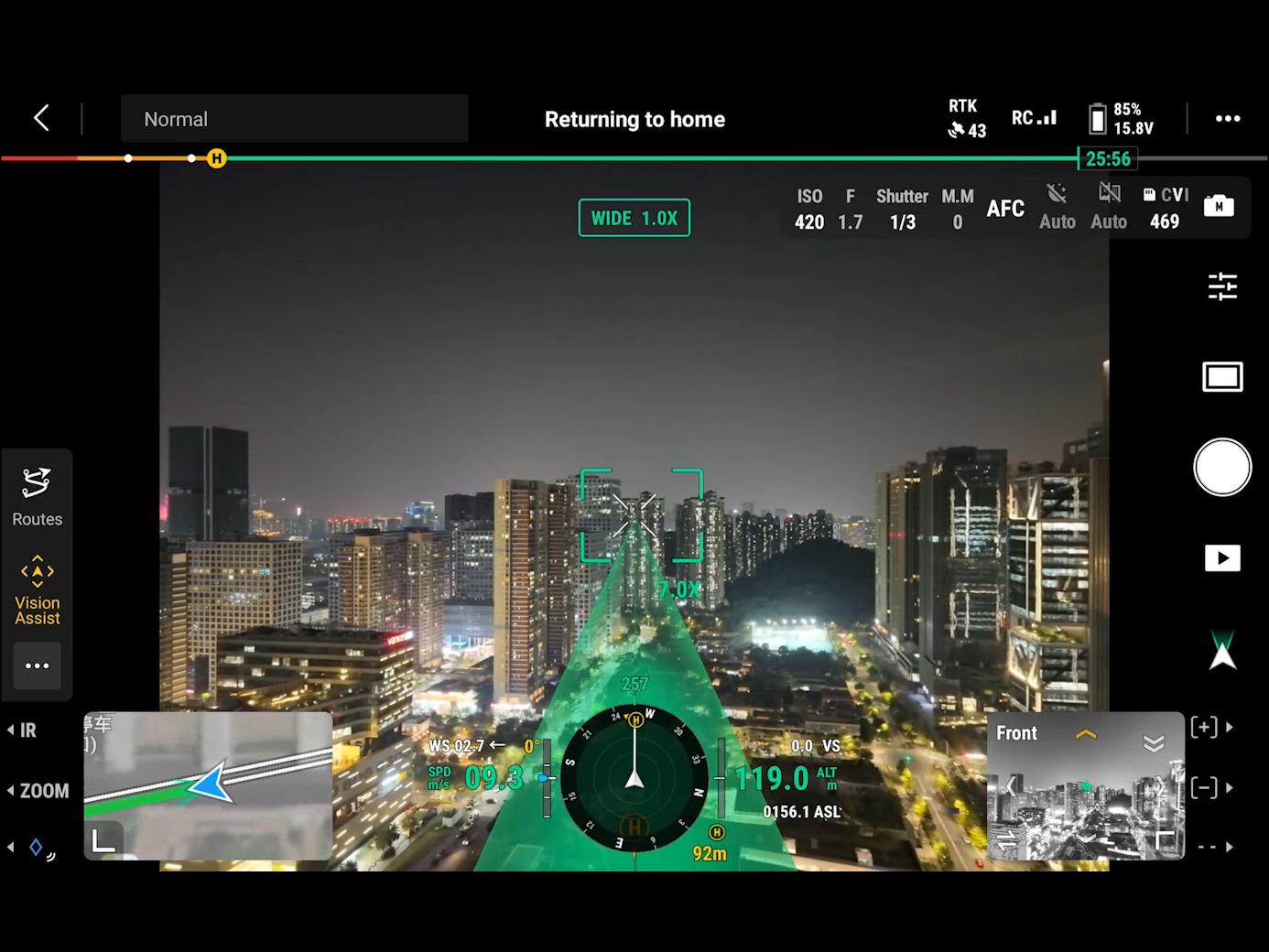
The Matrice 4 series is equipped with an integrated DJI RTK module that supports the extended L5 frequency band and provides a precise GNSS+Vision Fusion positioning and navigation system. Visual positioning allows the return point to be dynamically updated, enabling a quick takeoff in just 15 seconds. Even in the absence of a GNSS signal, the drone can reliably complete the return process, effectively circumventing signal disruptions and interference that are common in urban areas.
TitleIntelligent control & unhindered flight
Once the DJI RC Plus 2 Enterprise remote controller is connected to the internet, it can load terrain elevation maps and pre-store detailed maps. This enables automatic route planning for obstacle avoidance, allowing even challenging scenarios such as night flights or operations in mountainous terrain to be carried out safely.
In addition, the UAV is equipped with a 5-axis Vision Assist vision system and downward vision, which provides comprehensive environmental awareness for added protection.
TitleNew standards in video transmission
The O4 Enterprise video transmission system redefines the industry standard for challenging environments. The powerful 8-antenna system of the Matrice 4 series and the high-gain antenna of the remote controller achieve a range of up to 25 kilometers. In addition, an increased download bandwidth of 20 MB/s – more than twice that of the Mavic 3 Enterprise series – ensures more stable and accurate image transmission during route uploads and material downloads.
The Matrice 4 series also supports the optional DJI Cellular Dongle 2. Combining 4G transmission with the drone's antenna systems further optimizes signal stability.

TitleHigh-end drone technology for versatile applications
The DJI Matrice 4 series sets new standards in precision, efficiency, and safety. Whether in public safety, power line inspection, geoinformation, infrastructure monitoring, or the energy industry, this powerful drone offers intelligent features and high-precision data collection for a wide range of applications.
Thanks to state-of-the-art sensor technology, advanced AI technology, and robust construction, it is the ideal solution for complex and challenging missions.
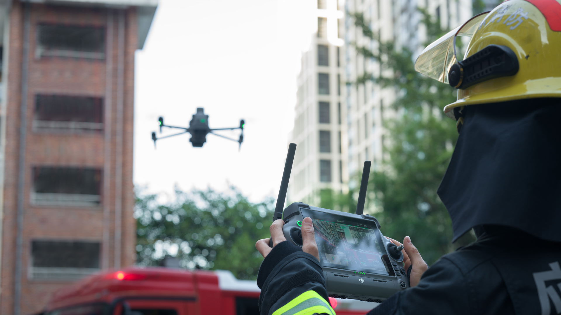
TitlePublic safety
DJI Matrice 4 offers unparalleled support for public safety operations. With its powerful sensor system, the UAV provides an immediate overview of the situation, enabling emergency responders to quickly gain a comprehensive overview in urgent situations. The ability to coordinate across teams allows different teams to synchronize with each other in real time and optimize live mission monitoring.
This reduces risks by eliminating uncertainties, allowing emergency responders to act safely and confidently. Especially in the areas of firefighting, law enforcement, and emergency medical services, the Matrice 4 helps make decisions faster, increase the safety of emergency responders, and improve mission efficiency.
TitlePower grids & power plants
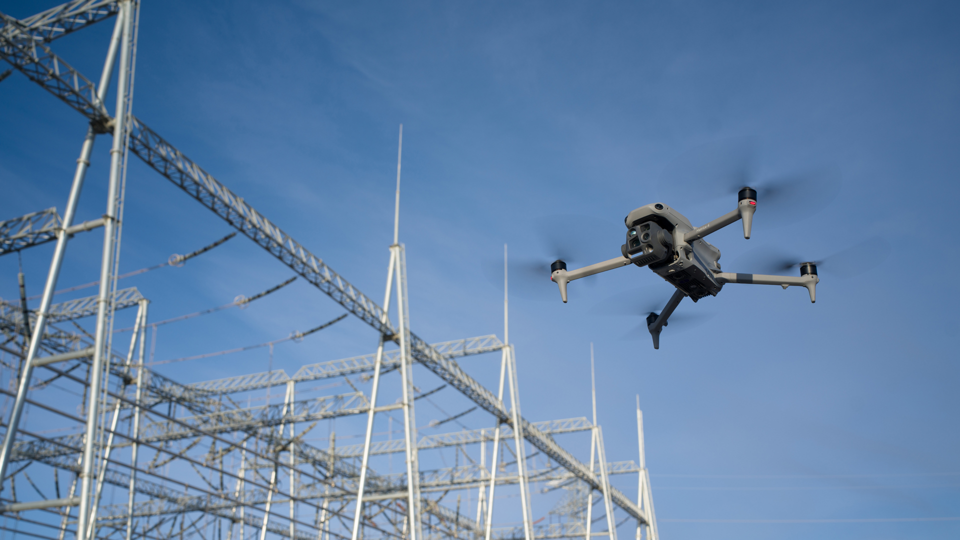
DJI Matrice 4 offers an efficient and cost-effective solution for use in the inspection and management of power grids and power plants. With precise aerial imagery captured during automated drone flights, potential hazards can be quickly identified and immediate action taken. This enables more economical operations by allowing critical inspections to be carried out without interrupting operations.
The use of intelligent UAV solutions minimizes maintenance costs, as the UAV enables high-precision inspections while the facilities remain in operation. In addition, the use of UAVs ensures greater safety for workers by allowing UAVs to inspect dangerous building structures without exposing people to direct risks.
Whether in construction planning and design, construction management, power grid management, or power generation management, Matrice 4 is the ideal solution for increasing efficiency, minimizing risks, and optimizing plant maintenance.
TitleGeografic information
DJI Matrice 4 offers a powerful solution for efficient geographic information capture. By integrating UAV and software technologies, it increases data collection efficiency while optimizing data processing. Automating data collection and analysis can significantly reduce equipment and laboratory costs.
Thanks to its ability to collect aerial imagery, Matrice 4 can produce standardized results such as digital surface models, digital terrain models, and accurate 3D models that meet industry standards.
Applications range from land surveying (with geotagging data and photogrammetry) to urban planning, where both 2D and 3D models are created. The UAV is also ideal for architecture, engineering, and construction, especially for site surveys and construction projects. In raw materials management, Matrice 4 can be used to create accurate maps, models, and telemetry data, enabling optimal planning and resource utilization.
TitleOil & Gas

DJI Matrice 4 provides valuable support to the oil and gas industry by reducing risks and protecting employees from dangerous situations. Using the UAV, potential problems with assets can be quickly identified and resolved without exposing employees to hazardous conditions.
Thanks to its precise aerial imagery and ability to quickly locate irregularities in assets, Matrice 4 provides reliable insights for informed decision-making. Its automated and repeatable workflow ensures high accuracy and efficiency in analysis.
Whether in production and refinery management, pipeline integrity management, or exploration and construction management, Matrice 4 enables comprehensive monitoring, inspection, and analysis that significantly increases both the safety and efficiency of oil and gas operations.
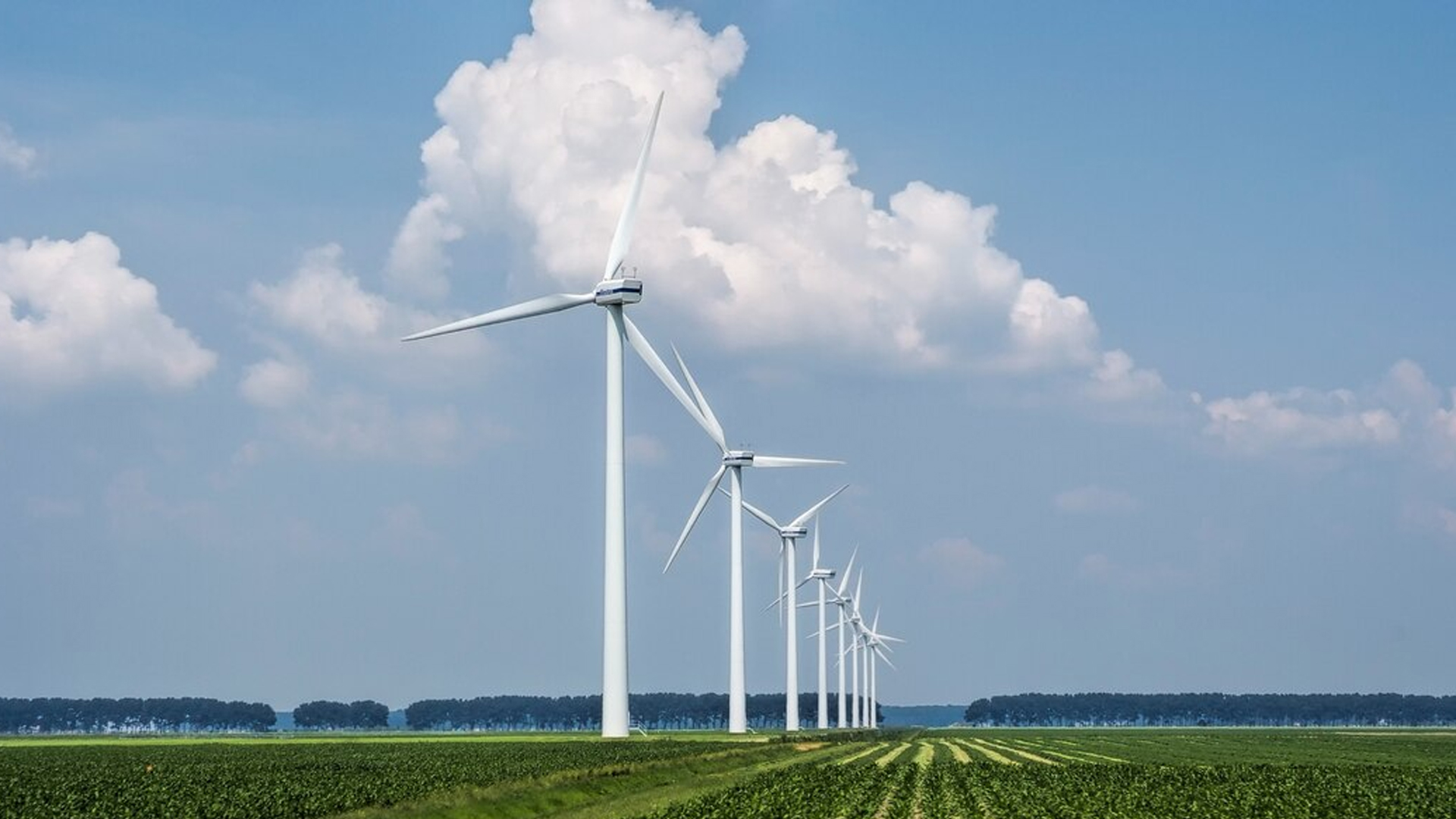
TitleRenewable energies
DJI Matrice 4 offers an effective solution for optimizing operations in the renewable energy sector. With precise aerial imagery during automated UAV flights, it enables more economical management of facilities by quickly identifying potential hazards. This technology not only supports precise monitoring, but also ensures continuous efficiency improvements for facilities.
Matrice 4 is particularly helpful in construction planning and design, construction management, power management, and power generation management. In addition, it is also ideal for special operations where precise inspections and data collection are necessary to ensure the long-term efficiency and safety of renewable energy sources.
Worker safety is also increased by using drones to inspect dangerous tall structures. This allows problems to be identified quickly without exposing people to direct danger.
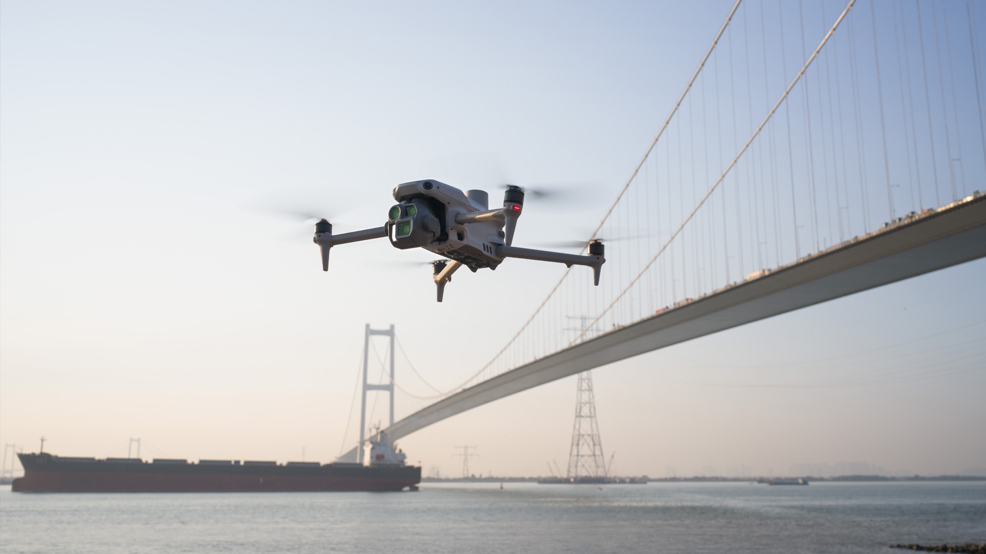
TitleRoad & bridge construction
In road and bridge construction, Matrice 4 enables detailed inspection of infrastructure to quickly identify potential damage. Automated drone flights perform critical inspections while operations continue, reducing maintenance costs and avoiding downtime.
This technology helps increase worker safety by efficiently monitoring hazardous areas.
TitleSeafaring
For maritime applications, Matrice 4 offers a reliable solution for monitoring coastlines, port areas, and shipping routes. It enables early detection of hazards and assists in analyzing environmental damage without the need for direct intervention. In addition, it provides valuable data for improving route planning and port logistics.
TitleWater conservation
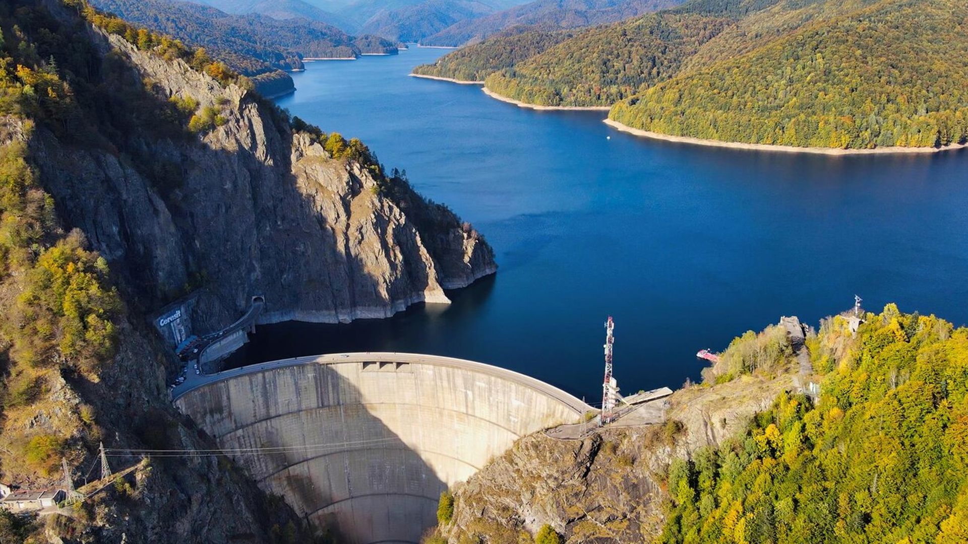
In the field of water protection, drones are used to inspect dams, reservoirs, and river systems.
They enable precise monitoring of water resources and help with the early identification of erosion or other hazards that could compromise safety.

TitlePowerful UAV technology for demanding applications
The DJI Matrice 4 series sets new standards in drone technology and offers advanced features for a wide range of professional applications. Whether for inspections, mapping, security surveillance, or operations in challenging environments, Matrice 4 combines precision, efficiency, and intelligent automation. With a robust design, state-of-the-art sensor technology, and powerful camera systems, it is specially designed for professional use and offers a reliable solution for complex tasks.
TitleBasic functions of the DJI Matrice 4
Matrice 4 stands out thanks to its intelligent flight modes, advanced image processing, and powerful O4 Enterprise video transmission, which enables a range of up to 25km. Thanks to multi-directional oblique photography and 3-directional ortho capture, the UAV is ideal for aerial mapping and high-precision surveying. In addition, the integrated RTK module and GNSS+Vision Fusion system ensure accurate positioning, even in environments with poor satellite coverage.
Matrice 4 supports intelligent 3D capture, enabling the creation of detailed models of buildings and terrain structures. Automated route planning and obstacle avoidance ensure a high level of safety and efficiency during flight operations.
TitleMatrice 4T – The powerful solution for demanding applications
DJI Matrice 4T is specially designed for security, inspection, and rescue operations. It is equipped with a high-resolution zoom camera, a wide-angle camera, a thermal imaging camera, and a laser rangefinder (LIDAR). This combination enables precise day and night imaging, which is particularly advantageous in public safety, disaster control, and industrial inspections.
Matrice 4T's thermal imaging camera can detect temperature differences, which is crucial for firefighting, search and rescue, and inspections of power lines and solar installations. The laser rangefinder also enables precise distance measurement in real time, facilitating navigation in complex environments.
TitleMatrice 4E – Efficient mapping & surveying
DJI Matrice 4E is primarily designed for surveying and mapping tasks. It supports 3-directional ortho capture, which enables lateral data capture during aerial mapping, thereby reducing overlap. This allows large areas of up to 2.8 square kilometers to be captured in a single flight.
Another highlight is intelligent 3D capture, which allows you to quickly create precise mapping routes for buildings. This makes the Matrice 4E the ideal choice for urban planning, infrastructure monitoring, land surveying, and geodata analysis. In addition, the captured data can be processed directly with DJI Terra, allowing you to create DSM, DOM, and high-resolution 3D models.
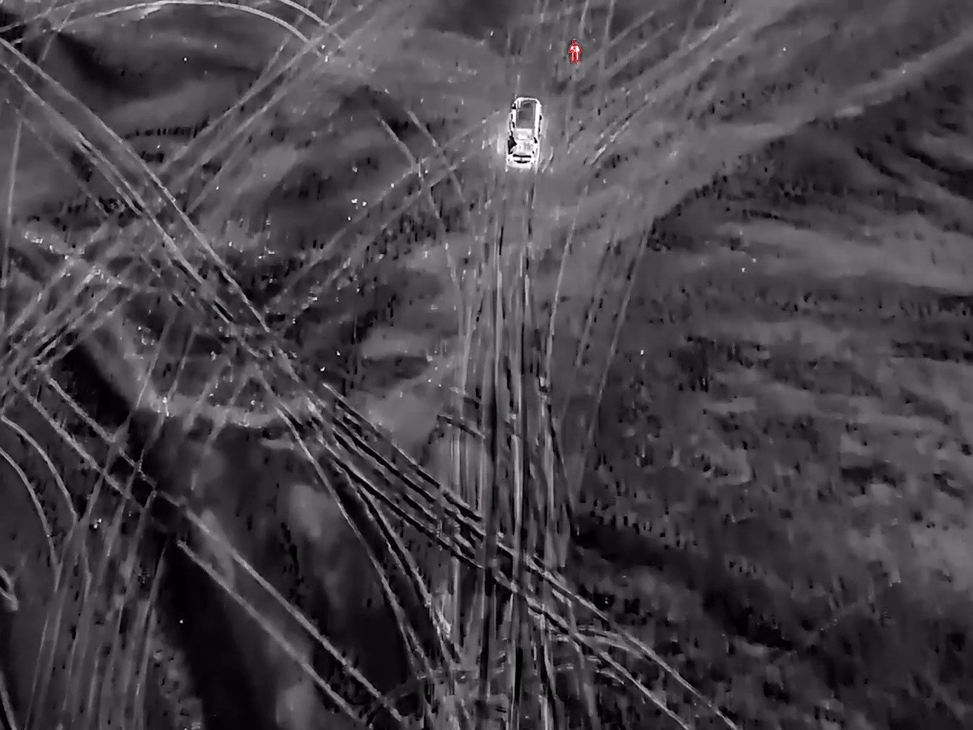
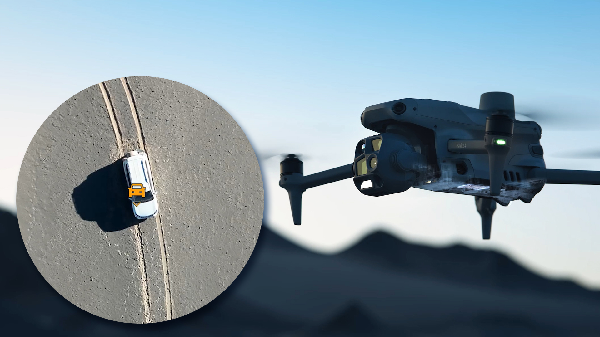
TitleIntelligent operations
The integrated AI model enables the detection of vehicles, ships, and people during search and rescue operations as well as during routine flights. It can also be flexibly converted to other models, expanding its range of applications.
In addition, the system supports high-resolution raster imaging and offers powerful tracking functions for precise monitoring and tracking.
TitleLaser rangefinder for precise measurements
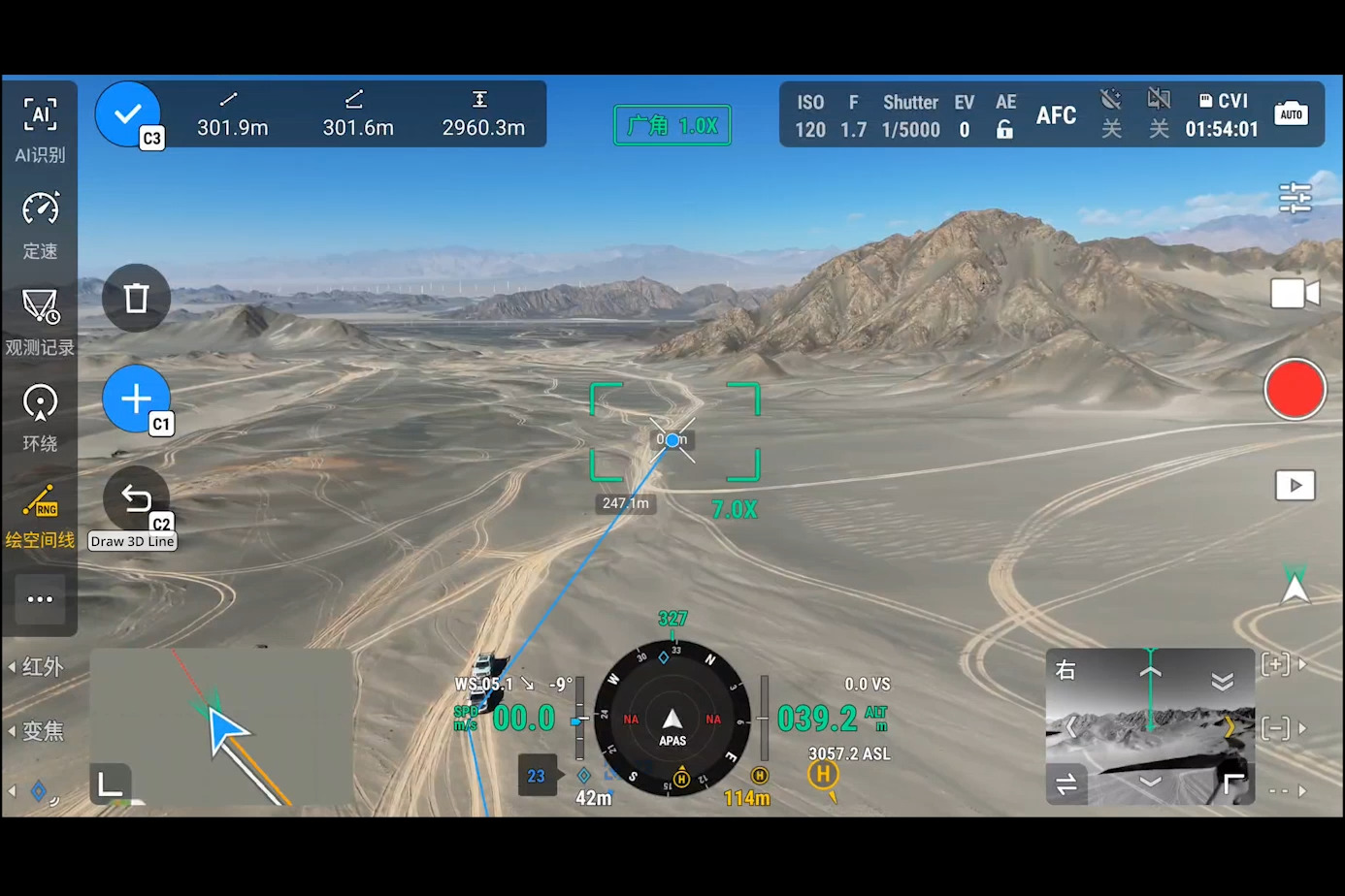
The laser rangefinder enables precise real-time measurements and simplifies tasks such as marking target points, drawing lines, or calculating areas. This is particularly useful for inspection purposes or for quickly assessing the spread of a wildfire.
In addition, captured data can be shared with relevant teams via the DJI Pilot QR code or FlightHub 2 to optimize collaboration and increase workflow efficiency.
TitleImproved medium telephoto lens
The Matrice 4 series features a medium telephoto lens that expands its capabilities for inspection tasks at medium ranges.
When inspecting power lines or bridges, it can accurately detect bolts and cracks from a distance of 10 meters and clearly capture readings from equipment in substations.
TitleSuper-resolution telecamera
The Matrice 4 series telecamera offers significantly improved image sharpness and a high resolution of 48MP, allowing even signs up to 250 meters away to be captured with razor-sharp clarity.
In addition, the Matrice 4T is equipped with an IR cut filter, enabling continuous 24/7 operation.
TitleElectronic defogging
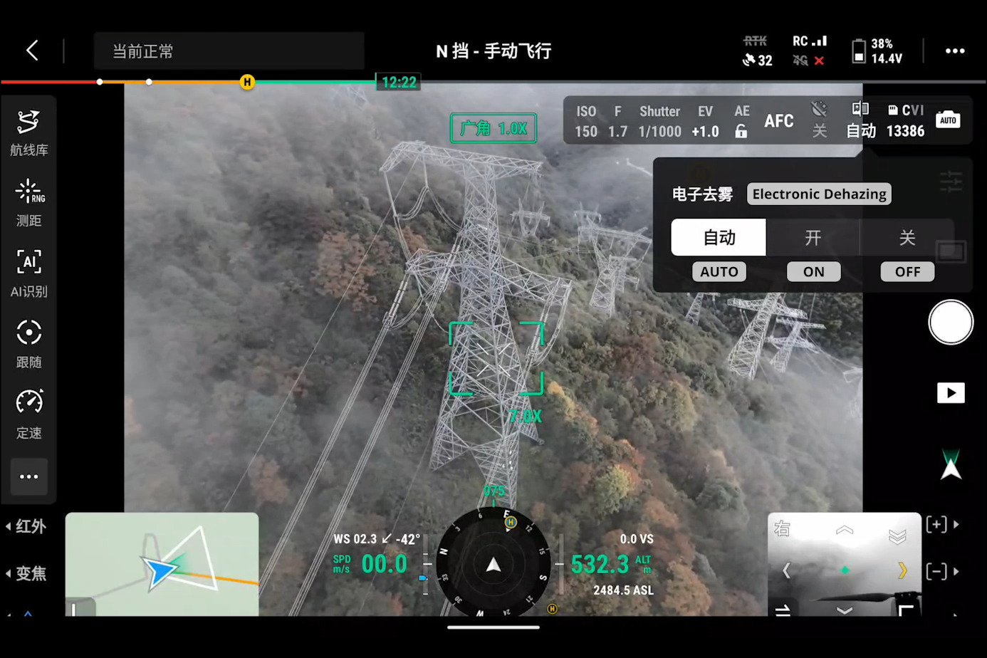
In smog, high humidity, or similar visibility-impairing conditions, the electronic defogging feature of the Matrix 4 series optimizes image sharpness with three adjustable modes (low, medium, high). This allows the drone to respond flexibly to different operating conditions and requirements.
TitleConclusion: DJI Matrice 4
The DJI Matrice 4 series sets new standards in professional drone technology, combining powerful sensors, intelligent flight modes, and high-precision data collection in a robust and versatile system. With an advanced telecamera, AI-powered object recognition, electronic defogging, and a precise laser rangefinder, it offers unmatched capabilities across a wide range of industries – from public safety and infrastructure inspection to mapping and geodata collection.
Thanks to powerful image processing, flexible payload options, and intelligent software solutions such as DJI Pilot 2 and FlightHub 2, the Matrice 4 series ensures optimized collaboration and maximum efficiency. Its long range, weather resistance, and 24/7 operability make it the ultimate tool for demanding missions—anywhere, anytime.

TitleTechnical specifications of Matrice 4
Below is a detailed overview of the specifications for the DJI Matrice 4E and DJI Matrice 4T.
Both models offer powerful features for professional applications, but differ in their specific areas of use and technical characteristics. Learn more about the technical details and find out which drone best suits your needs.
| Aircraft | |
|---|---|
| Takeoff weight (with propellers) | 1219g |
| Takeoff weight (with low-noise propellers) | 1229g |
| Maximum takeoff weight | Standard propeller: 1420g Low-noise propeller: 1430g |
| Dimensions | Folded (L × W × H): 260.6 × 113.7 × 138.4mm Unfolded (L × W × H): 307.0 × 387.5 × 149.5mm |
| Max. payload | 200g |
| Propeller size | 10,8 inch |
| Diagonal wheelbase | 438,8mm |
| Max. climbing speed | 10m/s |
| Max. climbing speed with accessories | 6m/s |
| Max. sinking speed | 8m/s |
| Max. descent speed with accessories | 6m/s |
| Max. horizontal speed (at sea level, in calm conditions) | 21m/s 21m/s flying forward, 18 m/s flying backward, 19 m/s flying sideways |
| Max. cruising altitude | 6000m |
| Max. operating altitude with payload | 4000m |
| Max. flight time (in calm conditions) | 49 min (standard propeller) 46 min (low-noise propellers) |
| Max. hovering time (in calm conditions) | 42 min (standard propeller) 39 min (low-noise propellers) |
| Max. flight distance (without wind) | 35km (standardpropeller) 32km (low-noise propellers) |
| Max. wind resistance | 12m/s |
| Max. nickle angle | 35° |
| Operating temperature | -10 °C to 40 °C |
| GNSS | GPS + Galileo + BeiDou + GLONASS* * GLONASS is only supported when the RTK module is enabled. |
| Floating accuracy (calm or windy conditions) | ±0.1m (with visual positioning); ±0.5m (with GNSS); ±0.1m (with RTK) |
| RTK GNSS accuracy | RTK Fix: 1cm + 1ppm (horizontal), 1.5cm + 1ppm (vertical) |
| Internal memory | N/A |
| Connections | E-Port interface × 1: Supports official accessories and third-party PSDK devices (hot swapping is not supported) E-Port Lite interface × 1: Supports USB connection to DJI tuning software and some third-party PSDK devices. |
| Propeller type | 1157F (standard propeller) 1154F (low-noise propeller) |
| Signal light | Integrated into the aircraft |
| Camera | |
|---|---|
| Image sensor | DJI Matrice 4T Wide angle: 1/1.3" CMOS, effective pixels: 48MP Medium telephoto camera: 1/1.3" CMOS, effective pixels: 48MP Telephoto: 1/1.5" CMOS, effective pixels: 48MP DJI Matrice 4E 4/3" CMOS, effective pixels: 20MP Medium telephoto camera: 1/1.3" CMOS, effective pixels: 48MP Telephoto: 1/1.5" CMOS, effective pixels: 48MP |
| Lens | DJI Matrice 4T Telephoto camera |
| ISO | Normal mode: ISO 100 to ISO 25600
DJI Matrice 4E |
| Shutter speed | DJI Matrice 4T 2 to 1/8000 s DJI Matrice 4E Wide angle: Electronic shutter: 2 to 1/8000 s Mechanical shutter: 2 to 1/2000 s Medium telephoto: 2 to 1/8000 s Telephoto: 2 to 1/8000 s |
| Max. photo resolution | DJI Matrice 4T Wide angle: 8064 × 6048 Medium telephoto: 8064 × 6048 Telephoto: 8192 × 6144 DJI Matrice 4E Wide angle: 5280 × 3956 Medium telephoto: 8064 × 6048 Telephoto: 8192 × 6144 |
| Minimum photo interval | DJI Matrice 4T: 0,7 s DJI Matrice 4E: 0,5 s |
| Photo modes | DJI Matrice 4T Medium telephoto camera: Telephoto: Medium telephoto camera: Telephoto: |
| Video codec and resolution | Video encoding format: H.264/H.265 Encoding strategy: CBR, VBR Resolution: 4K: 3840 × 2160 at 30 fps Full HD: 1920 × 1080 at 30 fps |
| Maximum video bit rate | H.264: 60 Mbps H.265: 40 Mbps |
| Supported file systems | exFAT |
| Photo format | DJI Matrice 4T: JPEG DJI Matrice 4E Wide angle: JPEG/DNG (RAW) Medium telephoto camera: JPEG Telephoto: JPEG |
| Video format | MP4 (MPEG-4 AVC/H.264) |
| Digital zoom | Telephoto: 16× (112 × hybrid zoom) |
| NIR-Additional lighting | |
|---|---|
| Infrared illumination | DJI Matrice 4T: Field of view: 5,7°±0,3° |
| Laser module | |
|---|---|
| Laser distance measurement | Measuring range: 1800m (1 Hz) For targets with 20% reflectivity* Angled incidence range (1:5 angled distance): 600m (1 Hz) Blind zone: 3-1m Distance measurement accuracy: 1-3m: System error < 0.3m, random error < 0.1 meters for 1σ Other distances: ±(0.2+0.0015D) (D represents the measurement distance in meters) |
| Infrared thermal imaging camera (Matrice 4T model only) | |
|---|---|
| Thermal imaging sensor | DJI Matrice 4T: ungekühltes Vanadiumoxid (VOx) |
| Resolution | DJI Matrice 4T: 640 × 512 |
| Pixel pitch | DJI Matrice 4T: 12 μm |
| Frame rate | DJI Matrice 4T: 30 Hz |
| Lens | DJI Matrice 4T Diagonal field of view: 45°±0.3° DJI Matrice 4T Equivalent focal length: 53 mm DJI Matrice 4T Aperture: f/1.0 DJI Matrice 4T Focus: 5 m to ∞ |
| Sensitivity | DJI Matrice 4T: ≤ 50 mk at F1,0 |
| Temperature measurement method | DJI Matrice 4T: Spot meter, area measurement |
| Temperature measurement range | DJI Matrice 4T: High gain: -20°C to 150°C Low gain: 0°C to 550°C |
| Pallet | DJI Matrice 4T: White hot/Black hot/Tint/Iron red/Hot iron/Arctic/Medical/Fulgurite/Rainbow 1/Rainbow 2 |
| Photo format | DJI Matrice 4T: JPEG (8 Bit), R-JPEG (16 Bit) |
| Video resolution | DJI Matrice 4T: 1280 × 1024 at 30 fps (super resolution enabled, night mode disabled) Other conditions: 640 × 512 at 30 fps |
| Video bitrate | DJI Matrice 4T: 6,5 Mbps (H.264 640 × 512 at 30 fps) 5 Mbps (H.265 640 × 512 at 30 fps) 12 Mbps (H.264 1280 × 1024 at 30 fps) 8 Mbps (H.265 1280 × 1024 at 30 fps) |
| Video format | DJI Matrice 4T: MP4 |
| Photo modes | DJI Matrice 4T: Single: 1280 × 1024/640 × 512 Interval: 1280 × 1024/640 × 512 JPEG: 0.7/1/2/3/5/7/10/15/20/30/60 s |
| Photo resolution | DJI Matrice 4T: Infrared: 1280 × 1024 (super resolution enabled) 640 × 512 (super resolution disabled) |
| Digital zoom | DJI Matrice 4T: 28x |
| Infrared wavelength | DJI Matrice 4T: 8 μm to 14 μm |
| Infrared temperature measurement accuracy | DJI Matrice 4T: High gain: ±2 °C or ±2%, whichever is greater DJI Matrice 4T: Low gain: ±5 °C or ±3%, whichever is greater |
| Video transmission | |
|---|---|
| Video transmission system | O4 Enterprise |
| Quality of the live view | Remote control: 1080p/30fps |
| Operating frequency | 2,400 to 2,4835 GHz 2,400 to 2,4835 GHz 5,725 to 5,850 GHz 5,150 to 5,250 GHz (CE) |
| Radiated power (EIRP) | 2,4 GHz: ≤ 33 dBm (FCC), ≤ 20 dBm (CE/SRRC/MIC) 5,8 GHz: < 33 dBm (FCC), < 30 dB (SRRC), < 14 dBm (CE) 5,15 to 5,25: < 23 dBm (FCC/CE) |
| Maximum transmission distance (unobstructed, free from interference) | 25km (FCC) 12km (CE) 12km (SRRC) 12km (MIC) |
| Maximum transmission range (with interference) | Strong interference - City centers (approx. 1.5 to 5km) Moderate interference - Suburban areas (approx. 5 to 15km) Micro interference: Suburbs/outskirts (approx. 15 to 25km) |
| Maximum download speed | 20 MB/s |
| Latency (depending on environmental conditions and mobile device) | 130 ms |
| Antenna | 8 antennas, 2T4R |
| Miscellaneous | Mobile phone dongle compartment |
| Memory cards | |
|---|---|
| Supported SD cards | U3/Class10/V30 or higher is required, or use a memory card from the recommended list. |
| Recommended microSD cards | Lexar 1066x 64 GB U3 A2 V30 microSDXC Lexar 1066x 128 GB U3 A2 V30 microSDXC Lexar 1066x 256 GB U3 A2 V30 microSDXC Lexar 1066x 512 GB U3 A2 V30 microSDXC Kingston Canvas GO! Plus 64 GB U3 A2 V30 microSDXC Kingston Canvas GO! Plus 128 GB U3 A2 V30 microSDXC Kingston Canvas GO! Plus 256 GB U3 A2 V30 microSDXC Kingston Canvas GO! Plus 512 GB U3 A2 V30 microSDXC |
| Intelligent Flight Battery | |
|---|---|
| Capacity | 6741mAh |
| Standard voltage | 14.76V |
| Max. charging voltage | 17.0V |
| Cell type | Li-Ion 4S |
| Energy | 99.5Wh |
| Weight | 401g |
| Temperature during charging | 5 °C to 40 °C |
| Unloading rate | 4C |
| Max. charging capacity | 1.8C |
| Supports charging at low temperatures | Not supported |
| Number of cycles | 200 |
Better advice as a user
If you are interested in our offer or would like to learn more about the DJI Matrice drones, then call us today and arrange a free and non-binding consultation appointment for you. We will answer all your questions. As a dealer and at the same time a user, we are well positioned to assist you even after the purchase.