Map Fusion in Lixel Cyber Color

TitleWhat is Map Fusion?
With Map Fusion in Lixel Cyber Color Studio, you can automatically merge multiple scans. This allows you to create one large scan from several individual scans.
Let's say you want to capture a large area in very high quality, but you can't operate the scanner for that long. In that case, you can divide your area into several individual scans and then have them calculated in Lixel Cyber Color (LCC) using the ‘Map Fusion’ function.
Important note:
- You can calculate up to 10 scans with a maximum capture time of 200 minutes.
- Always use the same scanner for Map Fusion scans.
- The ‘Map Fusion’ function is available in the LCC Studio Premium version.
TitleWhich devices (scanners) can be used with Map Fusion?
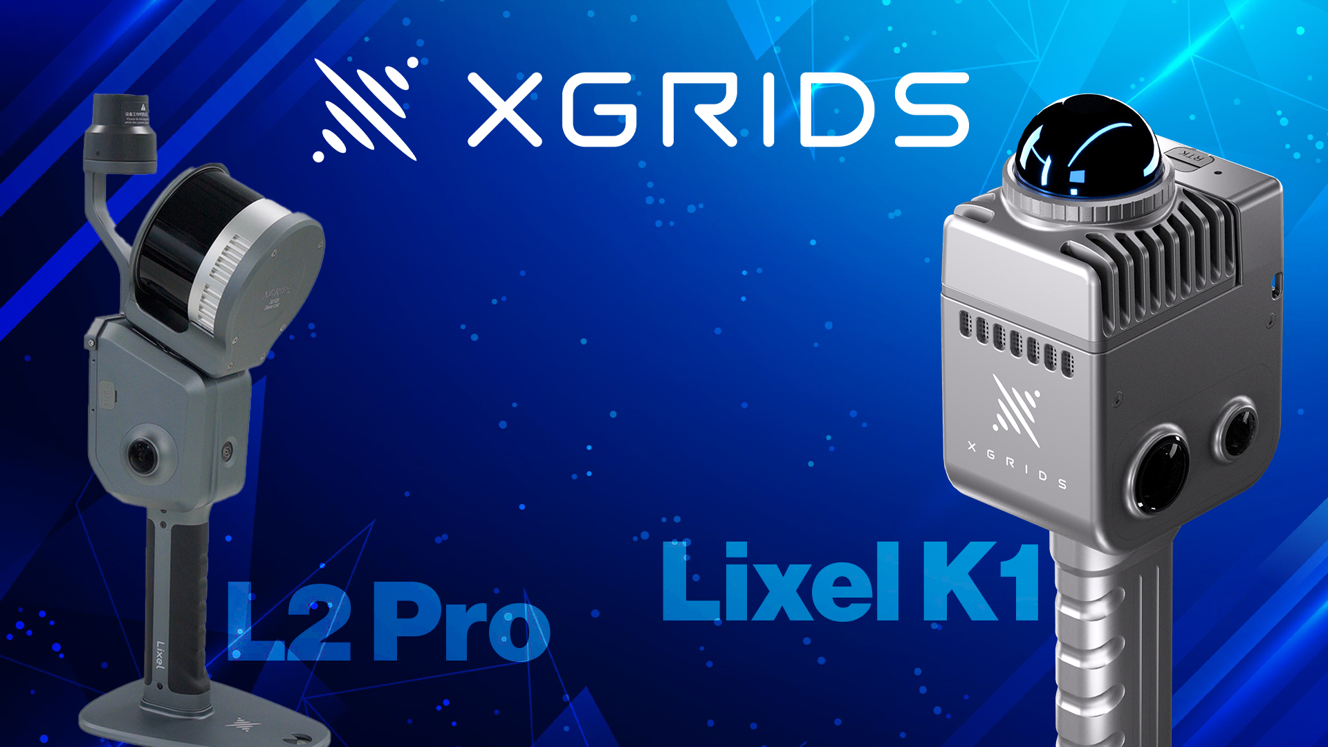
The ‘Map Fusion’ function can be implemented with both the Lixel Kity K1 and the Lixel L2 Pro scanner from XGRIDS. Since both scanners allow Lixel Cyber Color calculation and also have GCP (Ground Control Point) and RTK (Real Time Kinematic) functions, multiple scans can be easily calculated together in an LCC scene.
If you are using older models, such as the Lixel L2 or Lixel L1 with the Insta360 ONE RS, you must manually load the video sequence from the 360° camera into the import.
TitleWhat is the workflow for scanning?
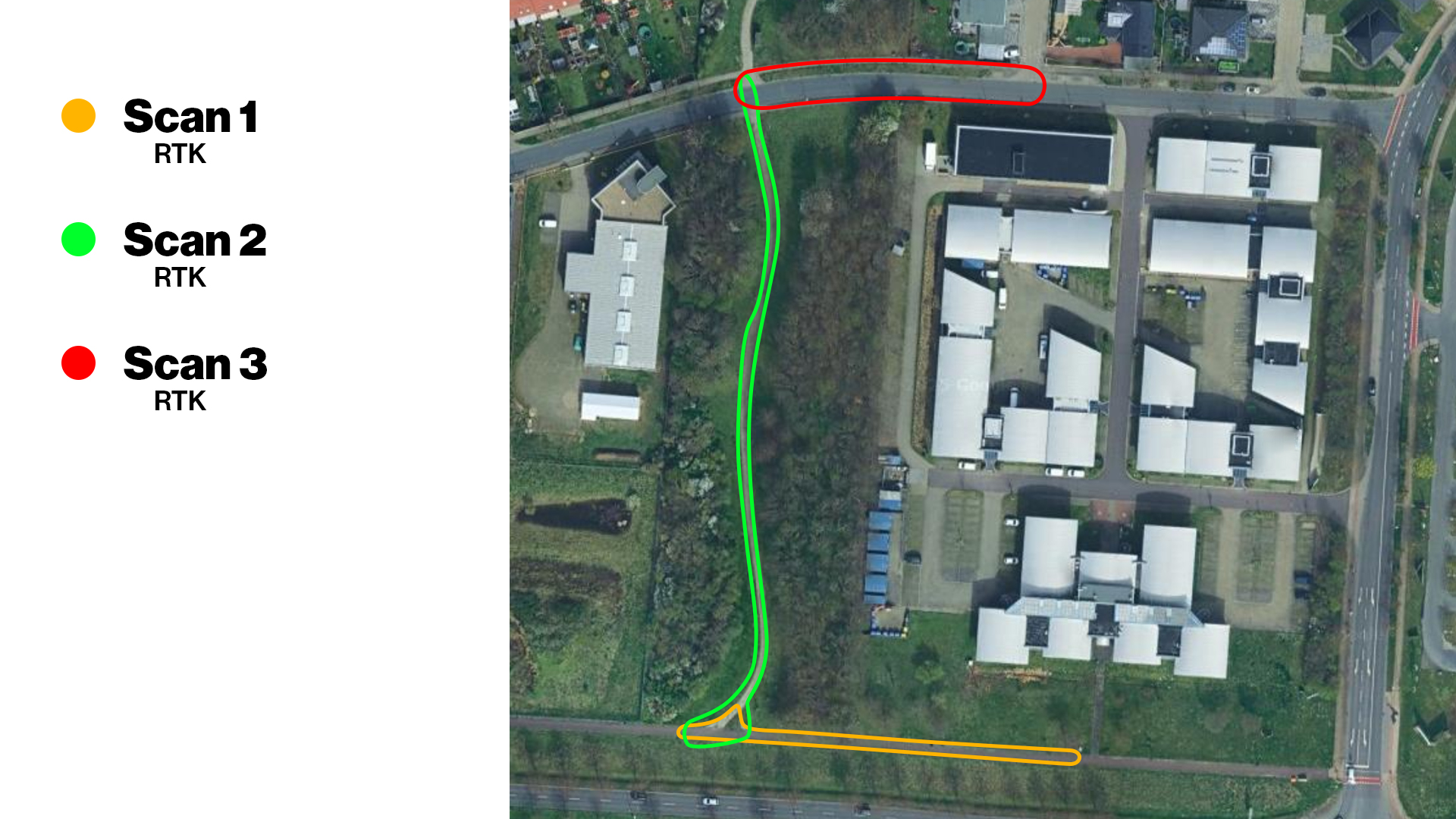
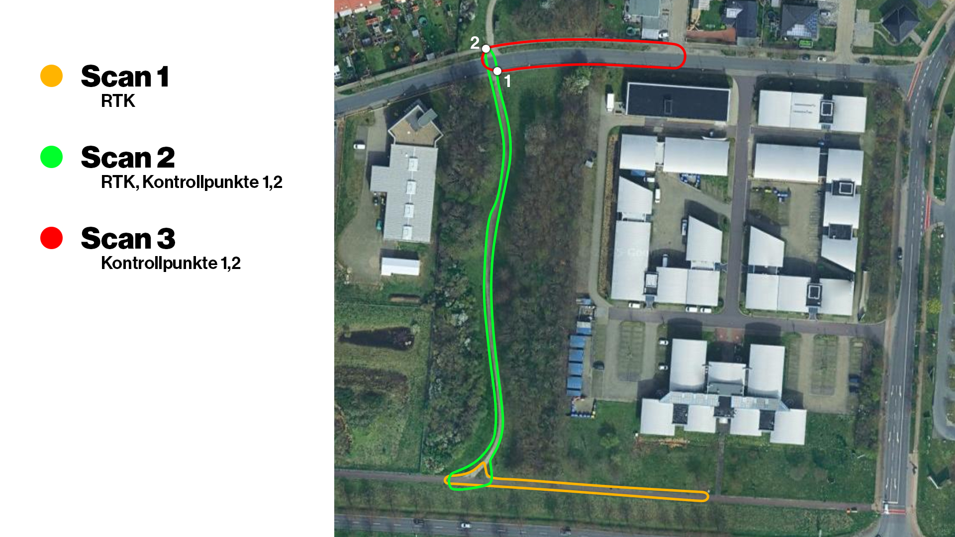
Example 1: RTK
In the first example, all three scans were captured with the RTK module and have an overlap path of approximately 15m. However, this method only works in areas where good signals can be received. We therefore do not recommend it for indoor use or in forests.
Important note:
- RTK signal must be available at all times
- Overlap of approx. 15m
- Fastest of the 4 methods (examples)
Example 2: Control points
In the second example, we use control points. Each control point has a unique ID (number) that we must enter during the scan at the control point. For example, if we create the first scan with control points 1 and 2, the second scan must also have the same control points with the same labels.
Important note:
- Each control point has an ID (number)
- Overlap of approx. 15m
- RTK is not required
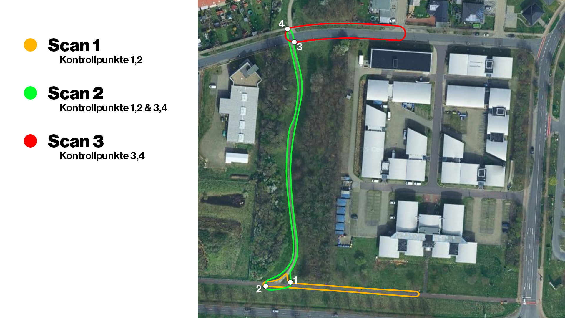
Example 3: RTK & control points
In the third example, we use the RTK module and the control points. We will again use the three scans as an example. The first scan uses the RTK module and control points 1 and 2, while the second scan uses the same control points as the first scan, i.e. 1 and 2. For the third scan, we create control points 3 and 4. In the third scan, we then capture control points 3 and 4, which we created in the second scan.
Important note:
- Each control point has an ID (number)
- Overlap of approx. 15m
- RTK data usable in the scan where it was used
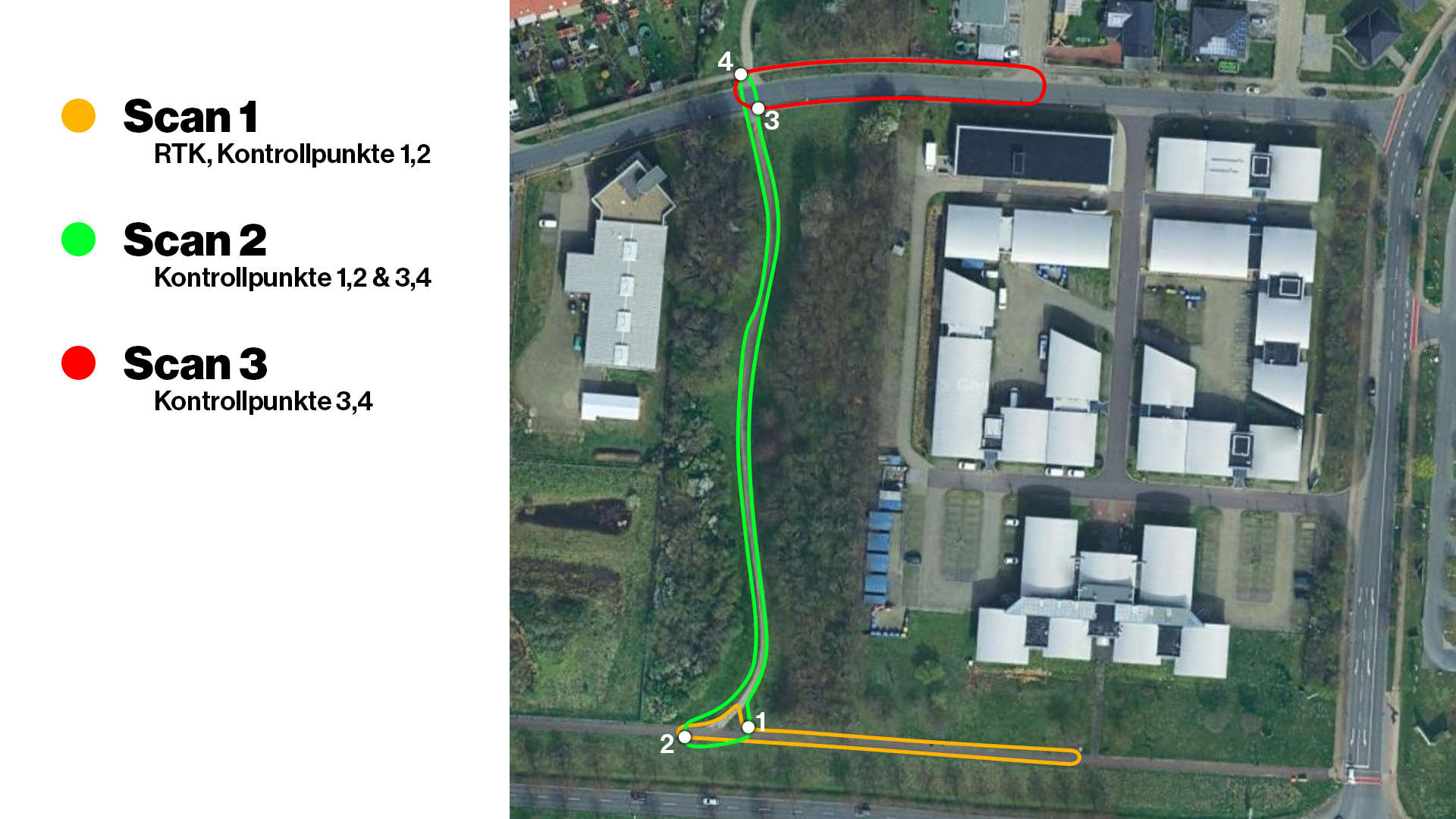
Example 4: RTK & control points
In the fourth example, we also use the RTK module and the control points. We again have our three scans, whereby the first two scans are combined using RTK data. In the second scan, however, we need the two control points 1 and 2. The same control points must also be added in the third scan. This means that scans 2 and 3 are then combined with the control points.
Important note:
- Each control point has an ID (number)
- Overlap of approx. 15m
- RTK data usable in the scan where it was used
TitleDuration of scan calculation in LCC Studio (hardware specifications)
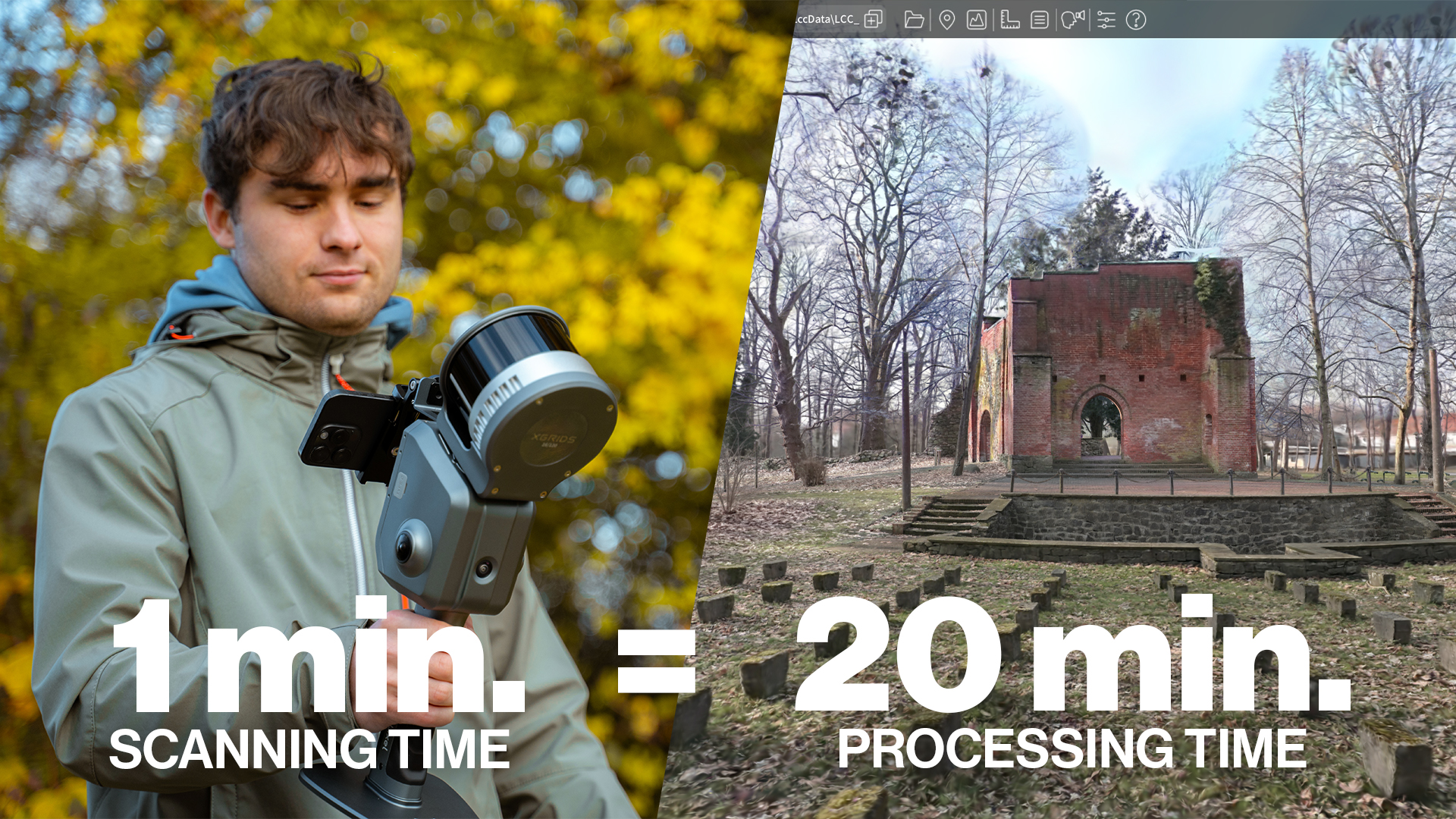
Since the calculation of Gaussian splats requires a high degree of computing power, the calculation takes a corresponding amount of time. Roughly speaking, approximately 1 minute of scan time corresponds to approximately 20 minutes of post-processing. If the maximum 200 minutes of scan time are used up, processing can take almost 2 days – with good hardware.
We recommend using a powerful computer for the calculation, as a large amount of data has to be processed. This is especially the case if you use the full 10 scans with a maximum capturing time of 200 minutes.
Recommended hardware:
- Processor: AMD Ryzen 9 9950X with 16 cores or higher
- RAM: 128GB or higher
- Graphics card: NVIDIA RTX 4090 or the RTX 50 series
TitleAnalysis of the results
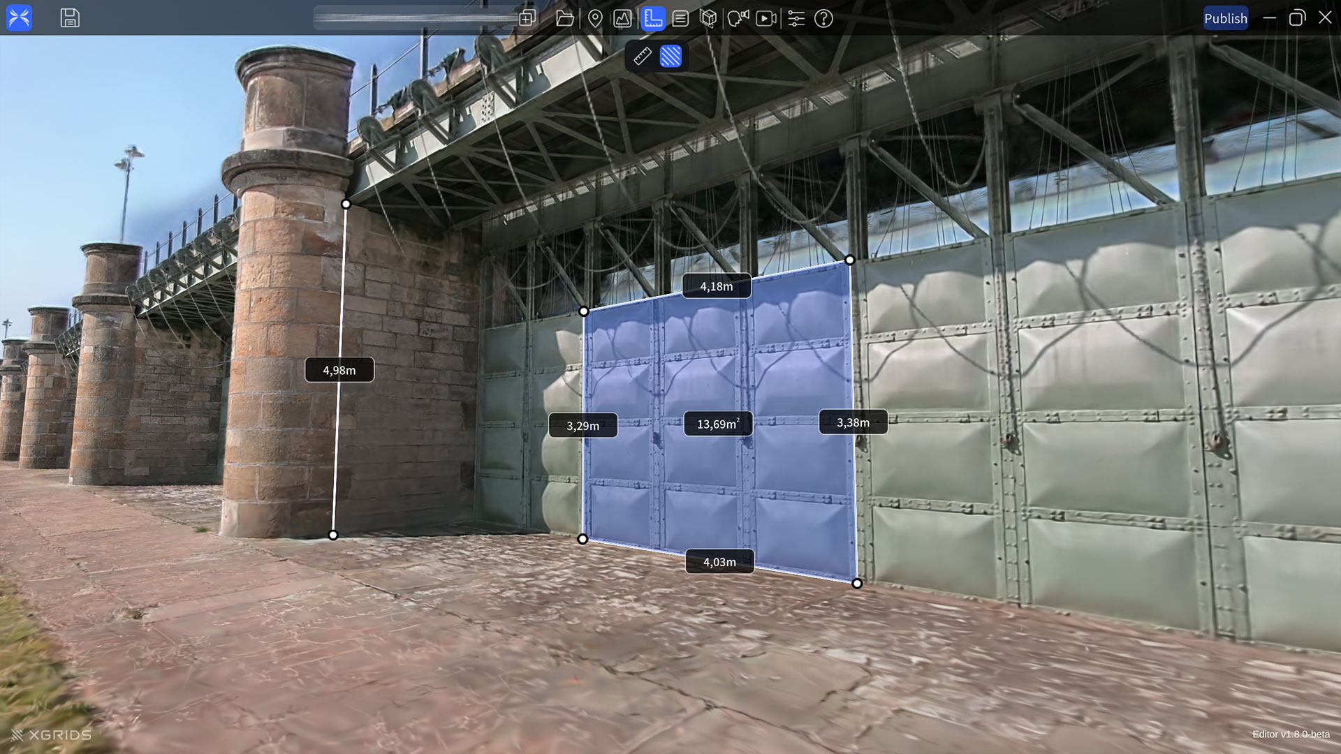
Now you have many options and functions available for further processing. Once the model has been calculated, you can double-click on the model to open the LCC scene in the LCC Editor. The following functions are available there:
- Clipping Tools
- Measuring Tools
- Notes
TitleOptions for further processing
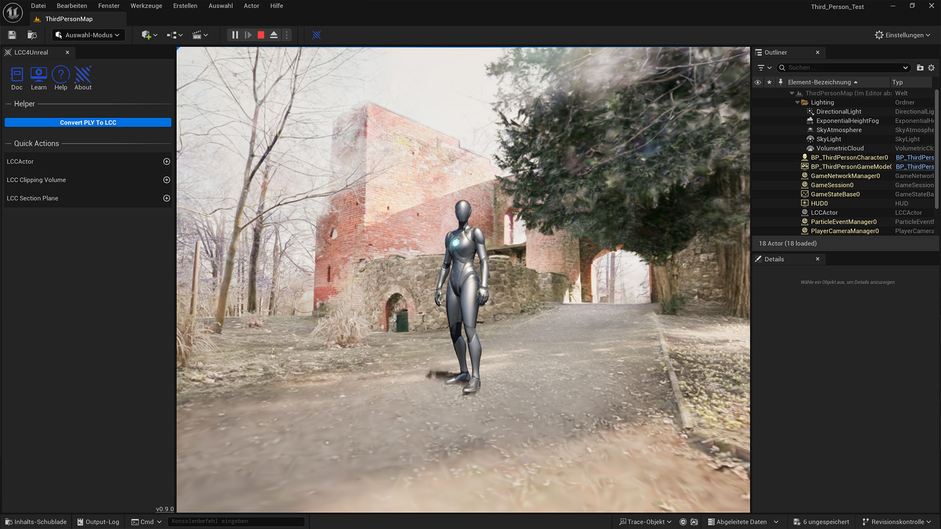
XGRIDS then provides you with a variety of options for further processing your LCC model. You can upload the model to the XGRIDS Cloud to show it to your customers. Or export the model as a *.ply file and make it available as the standard format for Gaussian Splats.
Furthermore, XGRIDS also offers a range of SDK connections, such as for Unreal Engine or Unity, where creative professionals can also make good use of the LCC models.
TitleConclusion
The ‘Map Fusion’ function offers a great way to combine multiple scans and display them as a single LCC model. Furthermore, no post-processing is necessary; simply select the scans in LCC and start processing.
The ‘Map Fusion’ function is a truly effective and useful tool for a wide range of applications.