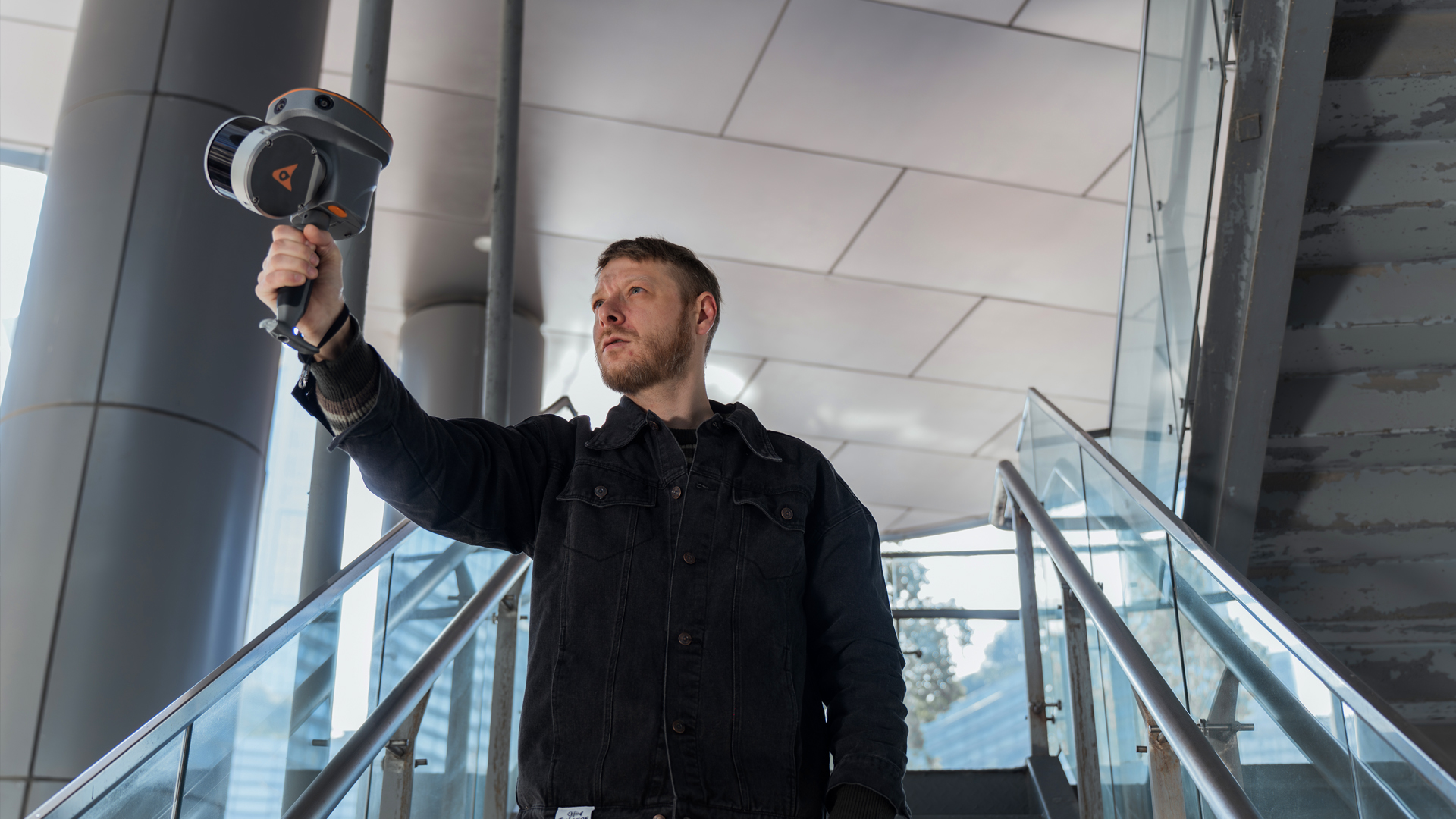
RS10 & RS30 – Innovative All-in-One scanners

TitleIntegrated GNSS, SLAM and laser technology in a compact system
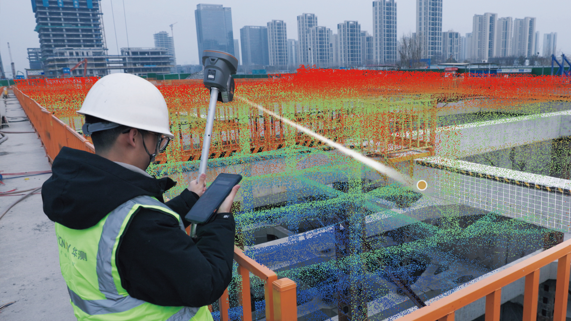
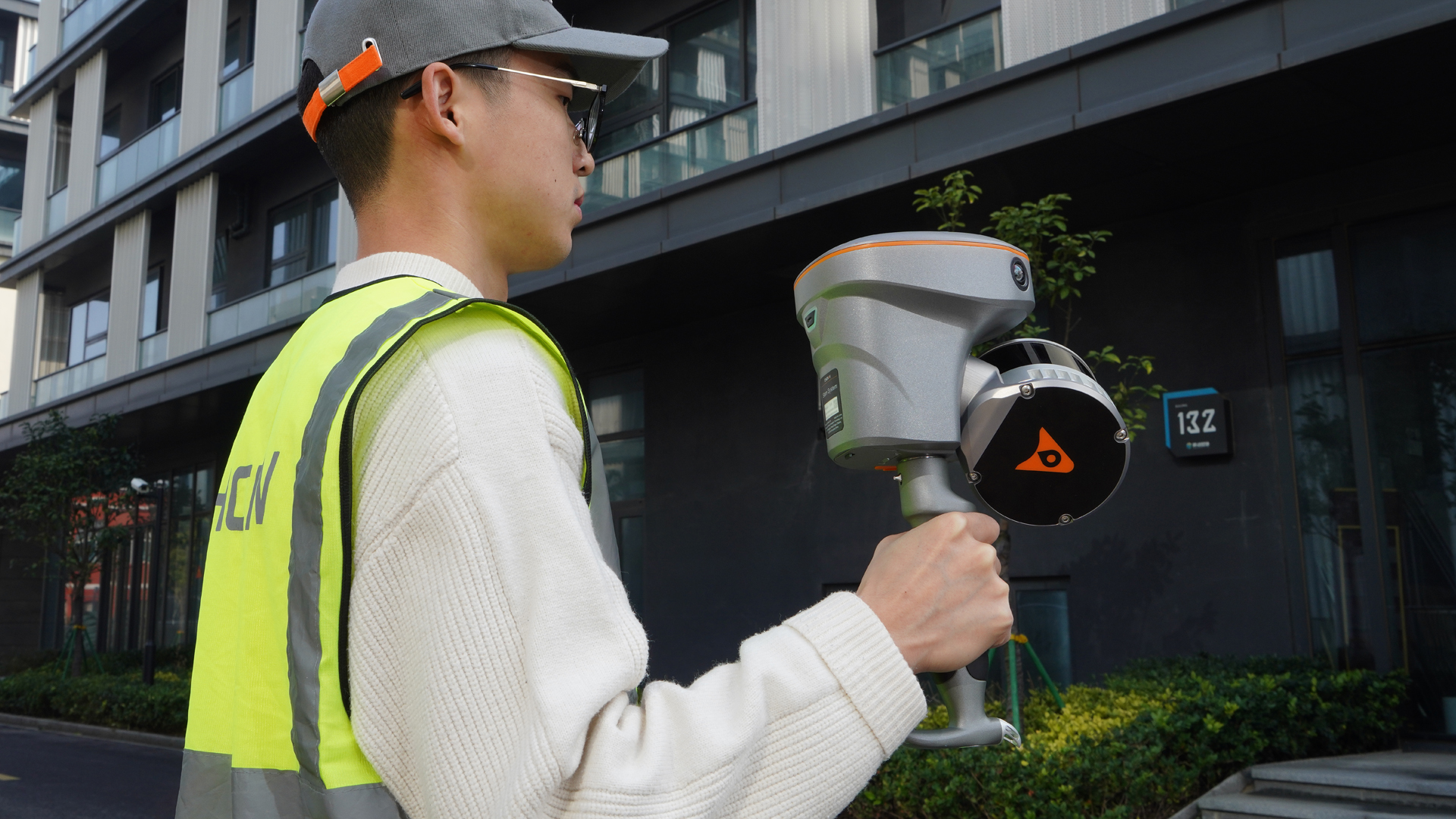
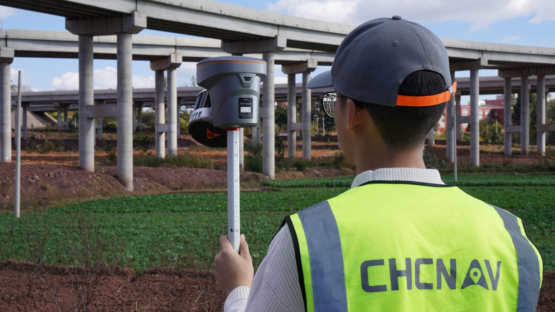
The RS10 and RS30 combine GNSS RTK, laser scanning and visual SLAM technologies in a compact platform, setting new standards in geospatial surveying. They were developed to make 3D scanning and surveying tasks more efficient and accurate, both indoors and outdoors.
Whether in civil engineering, BIM, agriculture and forestry, or for inspections and volume calculations, these scanners deliver reliable results even in environments with weak or no GNSS signal. Combining classic RTK surveying with innovative 3D reality capture, the scanners significantly increase the flexibility, efficiency and data quality of your projects.
TitleRTK and SLAM fusion
The RS10 and RS30 scanners combine CHCNAV's latest developments in GNSS and sensor technology. With a 4th generation air dielectric GNSS antenna, they achieve RTK positioning accuracy of less than 3 cm – even in demanding operating environments. The combination of a high-precision LiDAR system and three integrated HD cameras fuses RTK, laser and visual SLAM data. The result: absolute measurement accuracy of up to 5 cm. Whether for detailed architectural surveys or large-scale infrastructure projects, the RS series provides professionals with reliable, accurate and comprehensive data sets.
TitleEfficient, loop-free workflow
Thanks to the intelligent combination of GNSS and SLAM technologies, the classic loop closure that is often required with conventional handheld scanners is no longer necessary. Loop-free data acquisition optimises the workflow in the field and saves valuable time. Users benefit from smooth, fast and productive project execution – from recording to evaluation.
TitleSFIX technology
With innovative SFix technology, the RS10 and RS30 scanners can also handle areas with weak or no GNSS signal. In RTK rover mode, precise point coordinates are calculated in such situations using LiDAR and visual SLAM data. This allows accuracies of up to 5 cm to be achieved within a minute – even without satellite reception. This opens up completely new possibilities for surveying indoors, in tunnels or in densely built-up urban areas.
TitleReal-time SLAM

A powerful integrated processor enables real-time SLAM (Simultaneous Localisation and Mapping) functionality directly in the device. This creates georeferenced point clouds during recording – without any subsequent data processing. Users see their results immediately and can add to the scan areas as needed. With an area coverage of up to 13,000m² in real time, the RS10 and RS30 are ideal for precise, fast surveying – even for complex projects with tight deadlines.
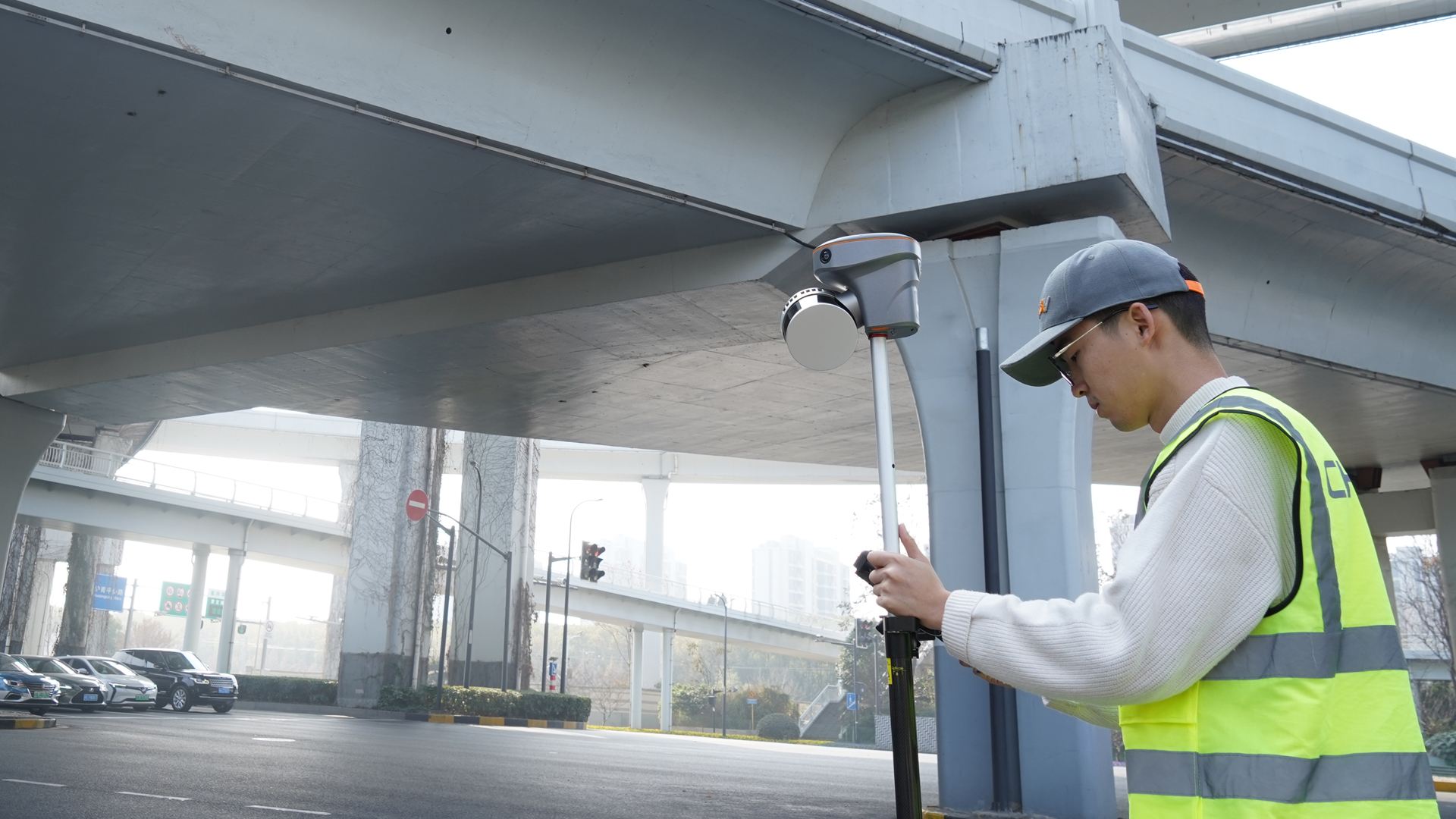
TitleClose-range outdoor and indoor mapping
Switching between indoor and outdoor areas is possible without additional georeferencing. Both scanners use the same coordinate system, ensuring consistently accurate and consistent data capture. The SmartGo or LandStar™ software allows you to select the desired coordinate system directly on site – for a seamless workflow from the building façade to the interior.
TitleVI LiDAR technology
The innovative Vi-LiDAR technology combines GNSS rover functions with precise laser scanning for contactless measurements. With just one click on the desired point in the image scene in the LandStar™ software, the 3D coordinates are calculated in real time – based on the intersection of the RTK origin line and the LiDAR point cloud. The result: pinpoint measurements with an accuracy of up to 5cm within a range of 15m.

TitlePrecise applications for every industry
The RS10 and RS30 scanners from CHCNAV offer versatile solutions for a wide range of applications where precise, efficient and georeferenced 3D data capture is essential.
Combining RTK, SLAM and LiDAR technology, they deliver accurate point clouds in real time – both indoors and outdoors.
Whether for construction, architecture, engineering surveying, facility management, urban planning or digital inventory, the RS series enables precise and time-saving data acquisition for a wide range of professional applications.
Topographical mapping
Create precise topographic maps quickly, efficiently and in great detail with the RS10 and RS30. The combined RTK and SLAM technology allows large areas of terrain to be surveyed without loop closure. Even complex terrain features are mapped with millimetre accuracy – ideal for construction planning, terrain analysis and inventory documentation.
Construction and engineering surveying
RS scanners deliver high-resolution point clouds for all phases of the construction project – from inventory and construction progress monitoring to quality control. With real-time data and precise georeferencing, you can immediately identify deviations and manage your construction and engineering projects more efficiently.
Architecture and Facility Management
For architects and facility managers, the RS10 and RS30 are powerful tools for digital inventory management. Interior and exterior areas can be captured in a continuous coordinate system, enabling the creation of precise floor plans, 3D models and digital twins of buildings – ideal for renovation planning or space management.
Urban planning and smart cities
RS scanners allow you to capture urban environments with a high level of detail and speed. The 3D point clouds generated form the basis for traffic analyses, infrastructure planning or the development of digital city models. This results in realistic data sets for smart city projects and urban development processes.
Industry and plant surveying
Whether production facilities, factory premises or technical infrastructure – the RS10 and RS30 enable precise 3D capture of complex industrial environments. This allows maintenance work, conversions and safety analyses to be planned and documented efficiently without disrupting ongoing operations.
Agricultural and forestry applications
Capture large areas in no time at all – from fields to forest areas. The scanners provide reliable data for crop planning, terrain profiling and resource management. The precise 3D representation allows vegetation heights, volumes and changes to be analysed accurately.
TitleHow the RS10 and RS30 scanners work
The RS10 and RS30 from CHCNAV redefine mobile 3D data capture. Combining high-precision LiDAR technology, RTK positioning and visual SLAM fusion, they capture point clouds in real time with high accuracy.
An integrated IMU (inertial measurement unit) also precisely records every movement and, together with intelligent SFix and Vi-LiDAR technology, ensures seamless, georeferenced results – even in GNSS-critical environments.
TitleReal-time recording in one step
The RS10/RS30 scanners enable the immediate capture of georeferenced point clouds directly on site – without time-consuming post-processing. Thanks to the combination of RTK-GNSS, LiDAR sensor technology and visual SLAM technology, a clear, robust database is created as soon as the scan starts.
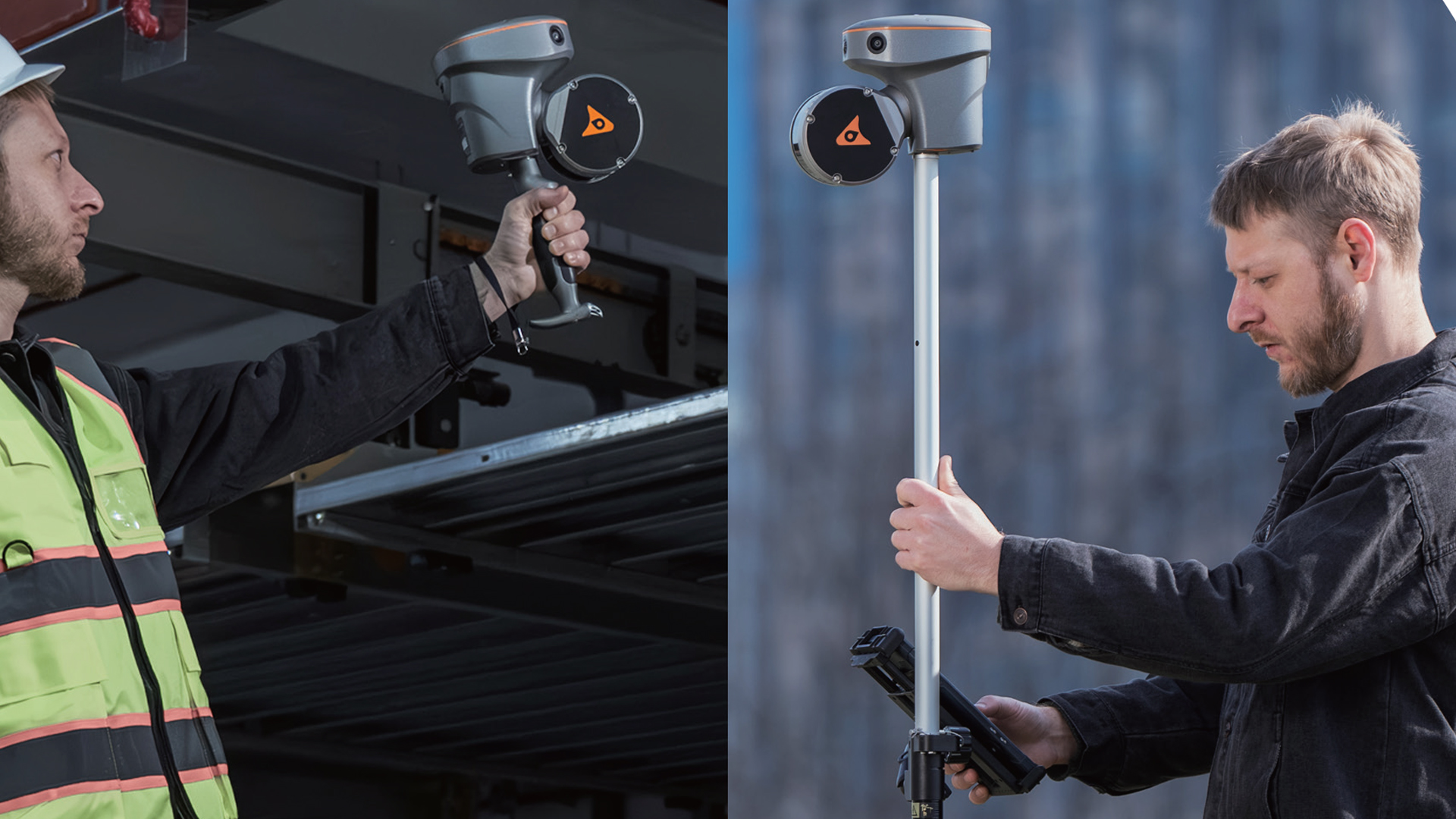
TitleDual working mode – flexible use

Whether in GNSS rover mode or as a purely SLAM-based solution, the scanners support both modes of operation. Outdoors, RTK positioning takes over geodetic position determination, while indoors or in areas with weak GNSS signals, the SLAM system takes over seamlessly. This creates a consistent solution for both outdoor and indoor use.
TitleIntelligent sensor fusion – for precision in every detail
Several components work together in the system: a high-precision LiDAR sensor with 16 (or 32 in the RS30) channels, three HD cameras and an IMU (inertial measurement unit) capture the environment, movement and position. SLAM algorithms and RTK data fusion enable measurements with an absolute accuracy of up to 5cm.
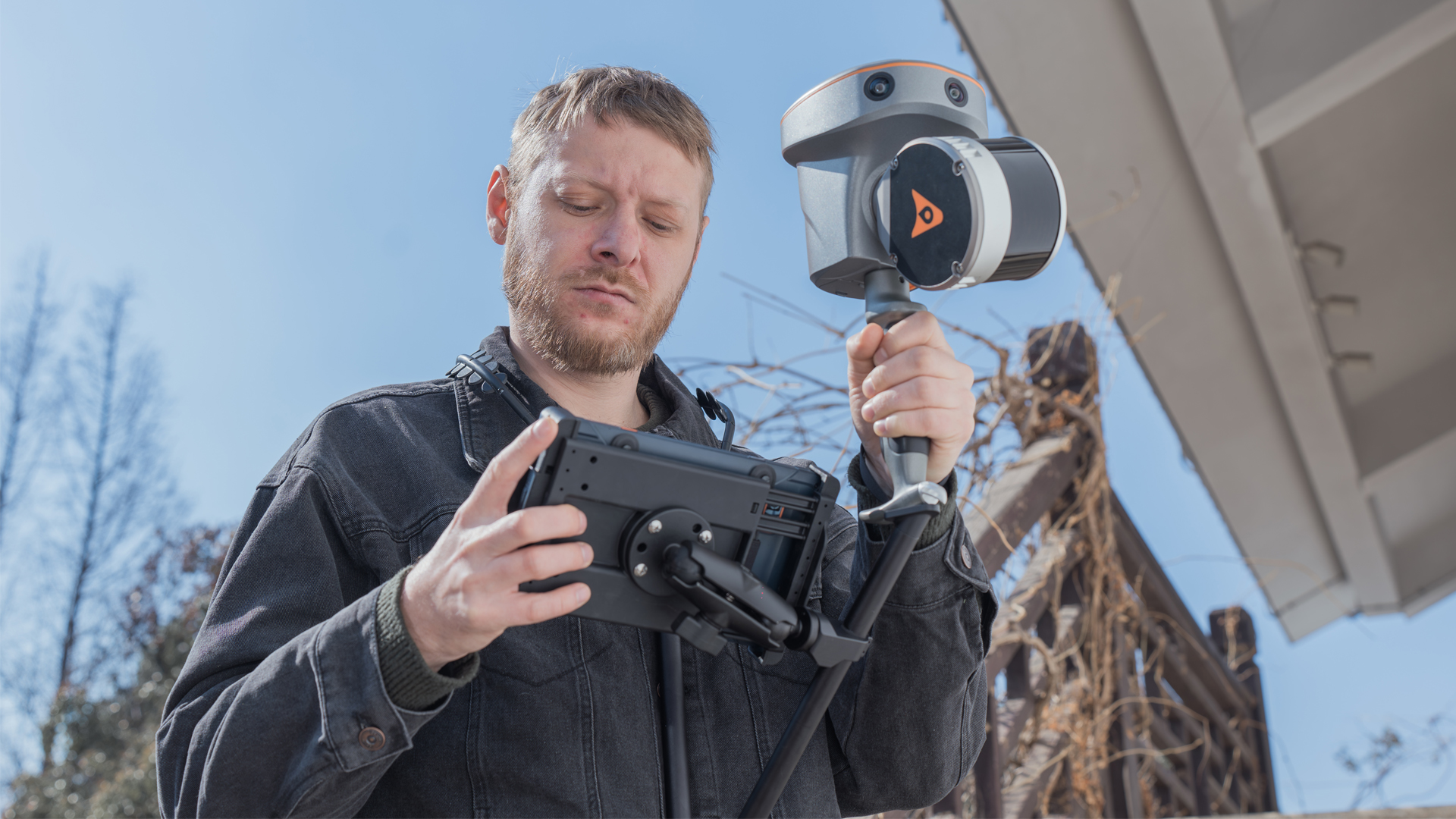
TitleSoftware – from recording to evaluation
- SmartGo (tablet/handheld device) and LandStar™ (field software) control data acquisition, allow selection of the coordinate system, live monitoring and immediate control of point clouds.
- The CoPre desktop tool is used for post-processing: trajectory processing, point cloud correction, image georeferencing and DOM/3D models.
- CoProcess provides a powerful platform for large point cloud datasets – CAD integration, feature extraction and rapid evaluation.

TitleSeamlessly from outdoor to indoor areas
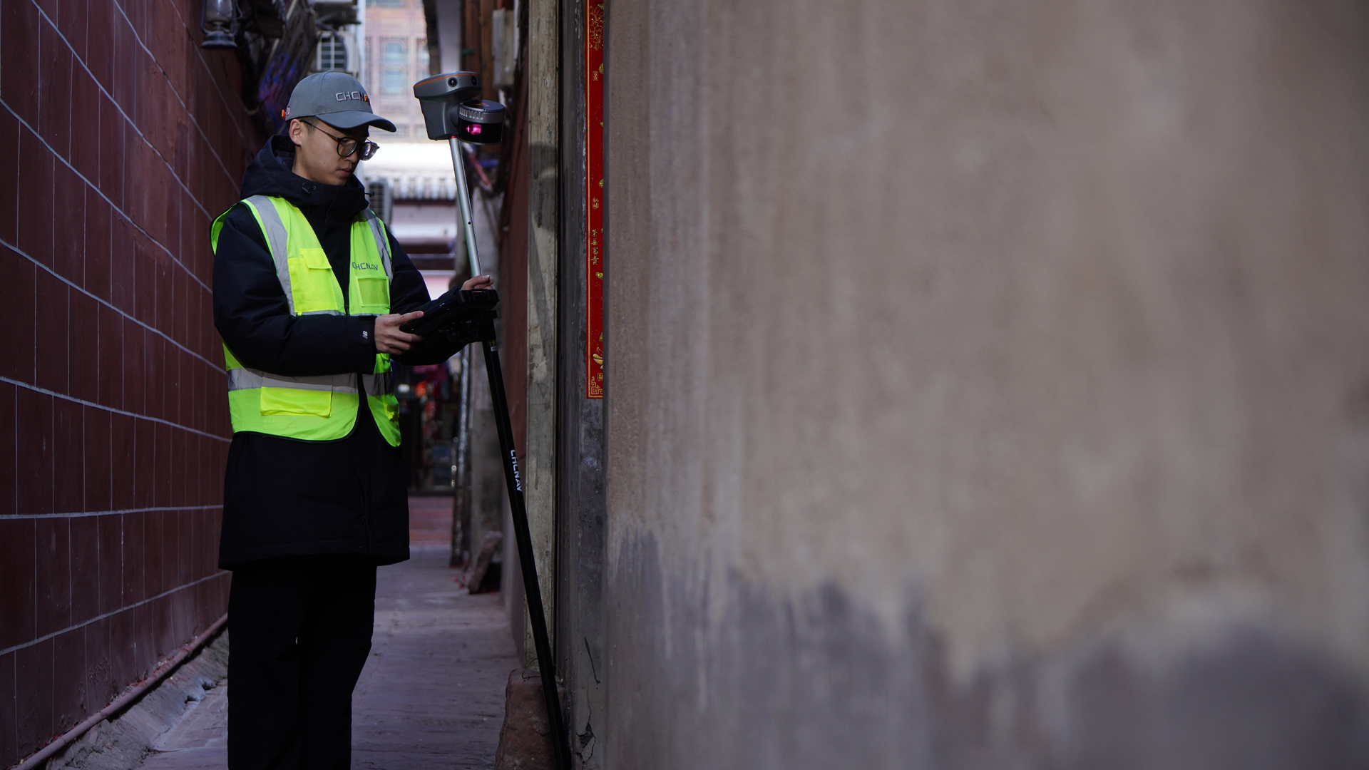
When switching from outdoor areas to indoor spaces, the coordinate system remains consistent: the scanners capture data in the same reference system, regardless of whether a satellite signal is available or not. This reduces effort, avoids additional georeferencing steps and significantly speeds up the workflow.

TitleSpecifications
The RS10 and RS30 handheld scanners from CHCNAV combine high-precision RTK and SLAM technologies for accurate 3D data capture with an accuracy of up to 5 cm.
The RS10 works with a 16-channel LiDAR, while the RS30 offers even higher scan density and speed with 32 channels.
Thanks to integrated GNSS, visual SLAM and powerful real-time processing, both systems deliver reliable results indoors and outdoors.
These technical specifications make the RS series the ideal solution for professional surveying, mapping and 3D documentation in demanding environments.
Scanner-Eigenschaften
| Product | RS10 | RS30 |
|---|---|---|
| Absolute accuracy | H: < 5cm RMS | |
| Relative accuracy | <1cm | |
| Power supply mode | Lithium battery, supports hot-swapping and portable charger | |
| Working time from a single battery | 1 Stunde | |
| Data storage | 512 GB | |
| Field of view (FOV) | 360° × 270° | |
| Weight | 1.9 kg (including RTK and battery) | 1.7 kg (including RTK and battery) |
| Loop-free data acquisition | Yes | |
| Real-time accuracy assessment | Yes | |
IMU
| Product | RS10 | RS30 |
|---|---|
| IMU update rate | 200 Hz |
| Auto initialization | Yes |
| Attitude accuracy after post-processingg | 0.005° RMS pitch/roll, |
| Position accuracy after post-processing | 0.010 m RMS horizontal, |
Electrical
| Product | RS10 | RS30 |
|---|---|---|
| Input voltage | 9 - 20V DC | |
| Power consumption | <30W | |
| Battery capacity | 24.48 Wh | |
Laser scanner
| Product | RS10 | RS30 |
|---|---|---|
| Laser class | Class 1 (Eye safe) | |
| Range | 0,05 to 120m | 0.5 to 300m |
| Channel | 16 | 32 |
| Point cloud thickness | 2cm | 1cm |
| Range capability | 80m at 10 % reflectivity | 80m at 10 % |
| FOV (Horizontal) | 360° | |
| Horizontal angle resolution | 0.18° (10 Hz) | |
| FOV (Vertical) | 30° (-15° to +15°) | 40.3°(–20.8° ~ +19.5°) |
| Max. effective measurement rate | Single Return: 320 000 pts/sec Dual Return: 640 000 pts/sec | Single Return: 640 000 pts/sec Dual Return: 1280 000 pts/sec Triple Return: 1920 000 pts/sec |
| Selectable scan speed | 10 Hz | |
| Max. Number of return pulses | 2 | 3 |
| Wavelength | 905nm | |
GNSS-Performance
| Product | RS10 | RS30 |
|---|---|
| Channels | 1408 channels with iStar2.0 |
| GPS | L1C/A, L2C, L2P(Y), L5 |
| GLONASS | L1, L2, L3 |
| Galileo | E1, E5a, E5b, E6 |
| BeiDou | B1I, B2I, B3I, B1C, B2a, B2b |
| QZSS | L1C/A, L1C, L2C, L5, L6 |
| NavIC/IRNSS | L5 |
| PPP | B2b-PPP |
| SBAS | EGNOS (L1, L5) |
GNSS Accuracies
| Product | RS10 | RS30 |
|---|---|
| Real time kinematic (RTK) | H: 8 mm + 1 ppm RMS |
| Post-processing kinematic )PPK) | H: 3 mm + 1 ppm RMS |
| PPP | H: 10cm |
| High-precision static | H: 2.5 mm + 0.1 ppm RMS |
| Static and Rapid static | H: 2.5 mm + 0.5 ppm RMS |
| Code differential | H: 0.4 m RMS |
| Visual-assisted positioning | Yes |
Cameras
| Product | RS10 | RS30 |
|---|---|
| Number of cameras | 3 |
| Resolution | 15 MP (5 MP*3) |
| Sensor size | 2592 (H) × 1944 (V) |
| Pixel size | 2.0 μm |
| FOV | 210° × 170° |
Environments
| Product | RS10 | RS30 |
|---|---|
| Operating temperature | -20°C to +50°C |
| Storage temperature | -20°C to +60°C |
| Ingress protection | IP64 (according to IEC 60529) |
| Humidity (operating) | 80%, non-condensing |
Equipped software
| Software | Fields of application |
|---|---|
| SmartGo software | Data acquisition control, real-time point cloud display,etc |
| CoPre intelligent processing software | POS process, Adjust & Refine, Generate point cloud, modeling, etc |
| CoProcess efficient feature extraction software | Building feature extraction, road feature extraction, volume calculation, etc |
| LandStar Field Survey APP | Topographic survey, Point stakeout, Line stakeout, Elevation check, Facade survey |
Better advice as a user
If you are interested in our offer or would like to learn more about the CHCNAV RS scanners, then call us today and arrange a free and non-binding consultation appointment for you. We will answer all your questions. As a dealer and at the same time a user, we are well positioned to assist you even after the purchase.